West Virginia's 2nd congressional district
| West Virginia's 2nd congressional district | |
|---|---|
|
West Virginia's 2nd congressional district - since January 3, 2013. | |
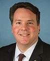
| Current Representative | Alex Mooney (R) |
| Distribution |
|
| Population (2010) | 648,186 |
| Median income | 33,198 |
| Ethnicity |
|
| Occupation | |
| Cook PVI | R+11[1] |
.tif.png)
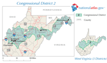
West Virginia's 2nd congressional district stretches from the Ohio River border with Ohio to the Potomac River border with Maryland and the border with Virginia. It includes the capital city of Charleston and the rapidly growing residential communities of West Virginia's Eastern Panhandle and Potomac Highlands regions connected by a narrow strip of nearly unpopulated counties. It has been accurately described as 20 miles wide and 300 miles long.
The district is currently represented by Alex Mooney, a Republican.
West Virginia had four Congressional seats from 1973 to 1993. Previously, much of the western portion of the current 2nd District had been in the 3rd District, based in Charleston. The eastern portion of the district had been in the 2nd District, which had been anchored in Martinsburg and Morgantown for all but a few years since statehood. For all but two years from 1949 to 1993, it was held by the Democratic Staggers family--Harley O. Staggers from 1949 to 1981 and Harley "Buckey" Staggers, Jr. from 1983 to 1993. When West Virginia lost a seat following the 1990 Census, the state legislature divided Staggers's district among the remaining three districts. Much of Staggers's old territory was merged with the 3rd District, represented by five-term Democrat Bob Wise and renumbered the 2nd. However, Staggers's home in Mineral County wound up in the 1st District, where he was routed in the Democratic primary by Alan Mollohan. Wise represented the new district until 2000, when he ran for and won West Virginia's governorship. Following the 2010 Census, Mason County was transferred to the 3rd District, which changed the character of the district only slightly. This change took effect for the 2012 election.[2]
The district is very expensive to campaign in, because six counties on the district's eastern fringe are in the very expensive Washington, D.C. television market. The two main parts, Charleston and the Eastern Panhandle, have very little in common and very little interaction.
The district is slightly more conservative and prosperous than the rest of the state. It also shares West Virginia's tendency to give congressmen long tenures in Washington. The 2000 election that resulted in Capito's victory marked the first open-seat race in the district since 1945. The old 2nd District had only five congressmen from 1933 until its elimination in 1993.
George W. Bush carried the district twice in 2000 with 54% of the vote and in 2004 with 57% of the vote. John McCain also won the district in 2008 with 54.63% of the vote while Barack Obama received 43.77%.
History
The Second District as originally formed in 1863 included Taylor, Marion, Monongalia, Preston, Tucker, Barbour, Upshur, Webster, Pocahontas, Randolph, Pendleton, Hardy, Hampshire, Berkeley, and Morgan counties (Jefferson county's status in the state was still in dispute, and Grant and Mineral counties were still part of other counties, but the modern territory of all was also included). The district was unchanged for 1882. In 1902, the district was changed to Monongalia, Preston, Tucker, Taylor, Barbour, Tucker, Randolph, Pendleton, Grant, Hardy, Mineral, Hampshire, Morgan, Berkeley, and Jefferson counties. The district was unchanged for 1916. Taylor was removed for 1934. The district was again unchanged for 1954. In 1962 Upshur, Webster, Pocahontas, and Greenbrier counties were added. In 1972, Lewis, Monroe, Summers, and Fayette were added. In 1982, Barbour was added.
1992 first saw the district as currently constituted, consisting of Berkeley, Braxton, Calhoun, Clay, Glimer, Hampshire, Hardy, Jackson, Jefferson, Kanawha, Lewis, Mason, Morgan, Nicholas, Pendleton, Putnam, Randolph, Roane, Upshur, and Wirt counties. In 2002, Gilmer and Nicholas were removed and for the election cycle beginning in 2012, Mason was removed.[3]
List of representatives
| Representative | Party | Dates | District home | Note |
|---|---|---|---|---|
| District created | December 7, 1863 | |||
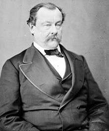
 William G. Brown, Sr. William G. Brown, Sr. |
Unconditional Unionist | December 7, 1863 - March 4, 1865 | ||
 George R. Latham George R. Latham |
Unconditional Unionist | March 4, 1865 - March 4, 1867 | ||
 Bethuel Kitchen Bethuel Kitchen |
Republican | March 4, 1867 - March 4, 1869 | ||
 James McGrew James McGrew |
Republican | March 4, 1869 - March 4, 1873 | ||
 John Hagans John Hagans |
Republican | March 4, 1873 - March 4, 1875 | ||
 Charles J. Faulkner Charles J. Faulkner |
Democratic | March 4, 1875 – March 4, 1877 | ||
 Benjamin F. Martin Benjamin F. Martin |
Democratic | March 4, 1877 – March 4, 1881 | ||
 John B. Hoge John B. Hoge |
Democratic | March 4, 1881 – March 4, 1883 | ||
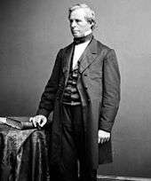
 William L. Wilson William L. Wilson |
Democratic | March 4, 1883 – March 4, 1895 | ||
 Alston G. Dayton Alston G. Dayton |
Republican | March 4, 1895 - March 16, 1905 | Resigned after being appointed as a judge of US District Court for the Northern District of West Virginia | |
| Vacant | March 16, 1905 – June 6, 1905 | |||
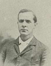
 Thomas B. Davis Thomas B. Davis |
Democratic | June 6, 1905 – March 4, 1907 | ||
 George C. Sturgiss George C. Sturgiss |
Republican | March 4, 1907 - March 4, 1911 | ||
 William G. Brown, Jr. William G. Brown, Jr. |
Democratic | March 4, 1911 – March 9, 1916 | Died | |
| Vacant | March 9, 1916 – May 9, 1916 | |||
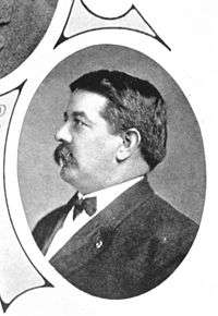 George M. Bowers George M. Bowers |
Republican | May 9, 1916 - March 4, 1923 | ||
| Robert E. L. Allen |
Democratic | March 4, 1923 – March 9, 1925 | ||
| Frank L. Bowman |
Republican | March 4, 1925 - March 4, 1933 | ||
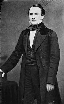
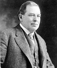
 Jennings Randolph Jennings Randolph |
Democratic | March 4, 1933 – January 3, 1947 | ||
| Melvin C. Snyder |
Republican | March 4, 1947 - March 4, 1949 | Defeated in general election | |
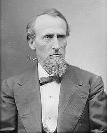
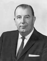
 Harley O. Staggers Harley O. Staggers |
Democratic | January 3, 1949 - January 3, 1981 | Retired | |
 Cleve Benedict Cleve Benedict |
Republican | January 3, 1981 - January 3, 1983 | Ran for U.S. Senate seat | |
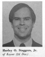 Harley O. Staggers, Jr. Harley O. Staggers, Jr. |
Democratic | January 3, 1983 - January 3, 1993 | Ran for the 1st district following redistricting, lost primary to Alan Mollohan | |
 Bob Wise Bob Wise |
Democratic | January 3, 1993 - January 3, 2001 | Redistricted from the 3rd district | |
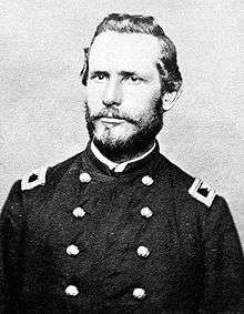
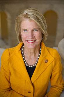 Shelley M. Capito Shelley M. Capito |
Republican | January 3, 2001 – January 3, 2015 | elected to the US Senate | |
 Alex Mooney Alex Mooney |
Republican | January 3, 2015 – | ||
Historical district boundaries
See also
References
- ↑ "Partisan Voting Index Districts of the 113th Congress: 2014" (PDF). The Cook Political Report. 2013. Retrieved 2013-11-14.
- ↑ http://www.legis.state.wv.us/legisdocs/2011/1x/maps/senate/Enr%20SB1008%20Map.pdf
- ↑ West Virginia Blue Book (pp 535, 2012 edition)
- Martis, Kenneth C. (1989). The Historical Atlas of Political Parties in the United States Congress. New York: Macmillan Publishing Company.
- Martis, Kenneth C. (1982). The Historical Atlas of United States Congressional Districts. New York: Macmillan Publishing Company.
- Congressional Biographical Directory of the United States 1774–present
Coordinates: 38°50′20″N 80°10′26″W / 38.83889°N 80.17389°W