Williamsville, Missouri
| Williamsville, Missouri | |
|---|---|
| City | |
 Location of Williamsville, Missouri | |
| Coordinates: 36°58′22″N 90°32′53″W / 36.97278°N 90.54806°WCoordinates: 36°58′22″N 90°32′53″W / 36.97278°N 90.54806°W | |
| Country | United States |
| State | Missouri |
| County | Wayne |
| Area[1] | |
| • Total | 0.32 sq mi (0.83 km2) |
| • Land | 0.32 sq mi (0.83 km2) |
| • Water | 0 sq mi (0 km2) |
| Elevation | 410 ft (125 m) |
| Population (2010)[2] | |
| • Total | 342 |
| • Estimate (2012[3]) | 339 |
| • Density | 1,068.8/sq mi (412.7/km2) |
| Time zone | Central (CST) (UTC-6) |
| • Summer (DST) | CDT (UTC-5) |
| ZIP code | 63967 |
| Area code(s) | 573 |
| FIPS code | 29-80026[4] |
| GNIS feature ID | 0752918[5] |
Williamsville is a city in Wayne County, Missouri, United States, along the Black River. The population was 342 at the 2010 census.
History
Williamsville was founded in 1822. It was named for its founder, Asa E. Williams.[6]
Williamsville once centered around lumber mills and iron works. It was situated along the St. Louis, Iron Mountain and Southern Railway.[7]
Geography
Williamsville is located at 36°58′22″N 90°32′53″W / 36.97278°N 90.54806°W (36.972909, -90.548164).[8]
According to the United States Census Bureau, the city has a total area of 0.32 square miles (0.83 km2), all of it land.[1]
Demographics
| Historical population | |||
|---|---|---|---|
| Census | Pop. | %± | |
| 1880 | 184 | — | |
| 1890 | 435 | 136.4% | |
| 1900 | 215 | −50.6% | |
| 1910 | 477 | 121.9% | |
| 1920 | 448 | −6.1% | |
| 1930 | 428 | −4.5% | |
| 1940 | 511 | 19.4% | |
| 1950 | 492 | −3.7% | |
| 1960 | 412 | −16.3% | |
| 1970 | 398 | −3.4% | |
| 1980 | 418 | 5.0% | |
| 1990 | 391 | −6.5% | |
| 2000 | 379 | −3.1% | |
| 2010 | 342 | −9.8% | |
| Est. 2015 | 347 | [9] | 1.5% |
2010 census
As of the census[2] of 2010, there were 342 people, 148 households, and 98 families residing in the city. The population density was 1,068.8 inhabitants per square mile (412.7/km2). There were 188 housing units at an average density of 587.5 per square mile (226.8/km2). The racial makeup of the city was 98.2% White, 0.3% African American, 0.3% Native American, and 1.2% from two or more races. Hispanic or Latino of any race were 0.9% of the population.
There were 148 households of which 28.4% had children under the age of 18 living with them, 44.6% were married couples living together, 13.5% had a female householder with no husband present, 8.1% had a male householder with no wife present, and 33.8% were non-families. 29.7% of all households were made up of individuals and 15.5% had someone living alone who was 65 years of age or older. The average household size was 2.31 and the average family size was 2.80.
The median age in the city was 44.5 years. 19.6% of residents were under the age of 18; 7.9% were between the ages of 18 and 24; 23.1% were from 25 to 44; 29.2% were from 45 to 64; and 20.2% were 65 years of age or older. The gender makeup of the city was 50.6% male and 49.4% female.
2000 census
As of the census[4] of 2000, there were 379 people, 161 households, and 108 families residing in the city. The population density was 1,228.1 people per square mile (472.0/km²). There were 190 housing units at an average density of 615.7 per square mile (236.6/km²). The racial makeup of the city was 99.74% White and 0.26% Native American. Hispanic or Latino of any race were 0.26% of the population.
There were 161 households out of which 28.6% had children under the age of 18 living with them, 54.7% were married couples living together, 10.6% had a female householder with no husband present, and 32.9% were non-families. 30.4% of all households were made up of individuals and 19.9% had someone living alone who was 65 years of age or older. The average household size was 2.35 and the average family size was 2.87.
In the city the population was spread out with 24.8% under the age of 18, 7.1% from 18 to 24, 24.8% from 25 to 44, 20.3% from 45 to 64, and 23.0% who were 65 years of age or older. The median age was 39 years. For every 100 females there were 93.4 males. For every 100 females age 18 and over, there were 87.5 males.
The median income for a household in the city was $21,111, and the median income for a family was $28,125. Males had a median income of $21,667 versus $20,288 for females. The per capita income for the city was $14,844. About 19.5% of families and 25.0% of the population were below the poverty line, including 38.1% of those under age 18 and 17.4% of those age 65 or over.
References
- 1 2 "US Gazetteer files 2010". United States Census Bureau. Retrieved 2012-07-08.
- 1 2 "American FactFinder". United States Census Bureau. Retrieved 2012-07-08.
- ↑ "Population Estimates". United States Census Bureau. Retrieved 2013-05-30.
- 1 2 "American FactFinder". United States Census Bureau. Retrieved 2008-01-31.
- ↑ "US Board on Geographic Names". United States Geological Survey. 2007-10-25. Retrieved 2008-01-31.
- ↑ Eaton, David Wolfe (1918). How Missouri Counties, Towns and Streams Were Named. The State Historical Society of Missouri. p. 371.
- ↑ History of Southeast Missouri: A Narrative Account of Its Historical Progress, Its People and Its Principal Interests, Volume 1. Lewis Publishing Company. 1912. p. 393.
- ↑ "US Gazetteer files: 2010, 2000, and 1990". United States Census Bureau. 2011-02-12. Retrieved 2011-04-23.
- ↑ "Annual Estimates of the Resident Population for Incorporated Places: April 1, 2010 to July 1, 2015". Retrieved July 2, 2016.
- ↑ "Census of Population and Housing". Census.gov. Retrieved June 4, 2015.
Municipalities and communities of Wayne County, Missouri, United States | ||
|---|---|---|
| Cities | 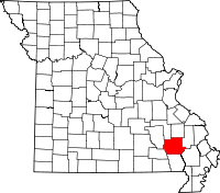 | |
| Village | ||
| Townships |
| |
| Unincorporated communities | ||