Withcott
| Withcott Queensland | |
|---|---|
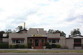 Withcott Hotel | |
 Withcott | |
| Coordinates | 27°33′0″S 152°01′0″E / 27.55000°S 152.01667°ECoordinates: 27°33′0″S 152°01′0″E / 27.55000°S 152.01667°E |
| Population | 1,000 (2006 census)[1] |
| Postcode(s) | 4352 |
| Location | |
| LGA(s) | Lockyer Valley Region |
| State electorate(s) | Lockyer |
| Federal Division(s) | Wright |
Withcott is a town in the Lockyer Valley region of Queensland, Australia. The town is located on the Warrego Highway, 116 kilometres (72 mi) west of the state capital, Brisbane and 10 kilometres (6.2 mi) east of the regional centre of Toowoomba. At the 2006 census, Withcott had a population of 1,000.[1]
During the 2010–2011 Queensland floods, Withcott suffered extensive damage when a flash flood hit the town on 10 January 2011.[2]
References
- 1 2 Australian Bureau of Statistics (25 October 2007). "Withcott (L) (Urban Centre/Locality)". 2006 Census QuickStats. Retrieved 11 January 2011.
- ↑ Johnson, Callum (10 January 2010). "Withcott evacuated". Toowoomba Chronicle. Retrieved 11 January 2011.
This article is issued from Wikipedia - version of the 7/19/2016. The text is available under the Creative Commons Attribution/Share Alike but additional terms may apply for the media files.