Xinying District
| Xinying 新營區 | |
|---|---|
| District | |
| Xinying District | |
|
| |
 Location in Tainan City | |
| Country | Taiwan |
| City | Tainan |
| Incorporated | 1981 |
| District | 2010 |
| Area | |
| • Total | 38.5386 km2 (14.8798 sq mi) |
| Population (January 2016) | |
| • Total | 78,185 |
| • Density | 2,031/km2 (5,260/sq mi) |
| Website | http://www.sych.gov.tw/ |

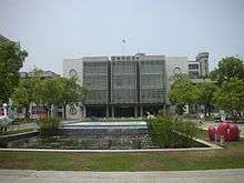
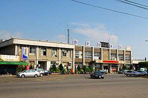
Xinying District (Chinese: 新營區; Hanyu Pinyin: Xīnyíng Qū; Tongyong Pinyin: Sinyíng Cyu; Wade–Giles: Hsin1-ying2 ch'ü1; Pe̍h-ōe-jī: Sin-iâⁿ-khu) or Sinying District is a district and the location of second administration center of the city government of Tainan City in Taiwan. Sugar production was the most important industry in Xinying.
History
On 7 January 1946, Tainan County was established and Xinying Township was made its county capital. On 25 December 1981, Xinying was upgraded to a county-controlled city. After 25 December 2010, Tainan City merged with Tainan County to form a single special municipality, subsequently Xinying City became Xinying District and became the capital of Tainan City along with Anping District.
Geography
Located in the northern portion of Tainan, Xinying has a tropical monsoon climate and is known for its many snacks and traditions.
Administrative divisions
Zhongzheng Village, Minquan Village, Sanxian Village, Haoping Village, Yanping Village, Yongsheng Village, Dahong Village, Wanggong Village, Xintung Village, Zhongying Village, Tuku lage, Xingan Village, Nanxing Village, Xingye Village, Minsheng Village, Xinbei Village, Xinnan Village, Minrong Village, Beiliao Village, Huzeng Village, Tainan Village, Taibei Village, Nanzhi Village, Jiafang Village, Jiubu Village, Jiaodai Village, Tiexian Village, Wuxing Village and Guye Village.
Government institutions
Education
Senior High Schools
- Xinying Senior High School (國立新營高級中學)
- Xinying Industrial Professional School (國立新營高級工業職業學校)
- Tainan City Nan'guang Private Senior High School (臺南市私立南光高級中學)
- Tainan City Xingguo Private Senior High School (臺南市私立興國高級中學)
- Tainan City Yude Private Industrial Professional School (臺南市私立育德工業家事職業學校)
Junior High Schools
- Tainan City Xindong Junior High School (臺南市立新東國民中學)
- Tainan City Taizi Junior High School (Taizi Palace) (臺南市立太子國民中學【太子宮】)
- Tainan City Nanxin Junior High School (臺南市立南新國民中學)
Primary Schools
- Tainan City Xinying District Primary School (臺南市新營區新營國民小學)
- Tainan City Xinying District Tuku Primary School (臺南市新營區土庫國民小學)
- Tainan City Xinying District Gongcheng Primary School (臺南市新營區公誠國民小學)
- Tainan City Xinying District Nanzi Primary School (臺南市新營區南梓國民小學)
- Tainan City Xinying District Xinsheng Primary School (臺南市新營區新生國民小學)
- Tainan City Xinying District Xintai Primary School (臺南市新營區新泰國民小學)
- Tainan City Xinying District Xinjin Primary School (臺南市新營區新進國民小學)
- Tainan City Xinying District Xinqiao Primary School (Tiexian Bridge) (臺南市新營區新橋國民小學【鐵線橋】)
- Tainan City Xinying District Xinxing Primary School (臺南市新營區新興國民小學)
- Tainan City Xinying District Xinmin Primary School (臺南市新營區新民國民小學)
Tourist attractions
Transportation
Xinying is served by National Highway No. 1 (國道一號) and the TRA Western Line (臺鐵西部幹線) Xinying Station. It is also served by Provincial Highway No. 1.
See also
| Wikimedia Commons has media related to Xinying District, Tainan. |
References
External links
- [http://www.sych.gov.tw/ Sinying District Office, Tainan City] (English)
Coordinates: 23°18′30″N 120°18′50″E / 23.30833°N 120.31389°E


.svg.png)