Zalana
| Zalana | |
|---|---|
|
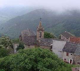
The church of the Annunciation, before restoration, in A Belfasca | |
 Zalana | |
|
Location within Corsica region 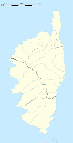 Zalana | |
| Coordinates: 42°15′41″N 9°22′34″E / 42.2614°N 9.3761°ECoordinates: 42°15′41″N 9°22′34″E / 42.2614°N 9.3761°E | |
| Country | France |
| Region | Corsica |
| Department | Haute-Corse |
| Arrondissement | Corte |
| Canton | Moïta-Verde |
| Government | |
| • Mayor (2008–2014) | Laurent Marchetti |
| Area1 | 13.2 km2 (5.1 sq mi) |
| Population (2008)2 | 149 |
| • Density | 11/km2 (29/sq mi) |
| Time zone | CET (UTC+1) |
| • Summer (DST) | CEST (UTC+2) |
| INSEE/Postal code | 2B356 / 20272 |
| Elevation |
193–847 m (633–2,779 ft) (avg. 600 m or 2,000 ft) |
|
1 French Land Register data, which excludes lakes, ponds, glaciers > 1 km² (0.386 sq mi or 247 acres) and river estuaries. 2 Population without double counting: residents of multiple communes (e.g., students and military personnel) only counted once. | |
Zalana is a commune in the Haute-Corse department of France on the island of Corsica.
Geography
Zalana is in the Castagniccia region of Corsica in the Moïta-Verde canton. The village is located on the east coast of the island 22 km from the sea by road. The connecting road ends in the village. It is situated on the mountainside at an altitude of 675m and has a view over the sea. Located in the south of the Castagniccia region, it is a quiet, rural village away from the busy coastal cities and their tourists. Many pleasant walks begin in the village, including one that takes you to a typical Genoese bridge.
Population
| Historical population | ||
|---|---|---|
| Year | Pop. | ±% |
| 1962 | 210 | — |
| 1968 | 243 | +15.7% |
| 1975 | 210 | −13.6% |
| 1982 | 164 | −21.9% |
| 1990 | 172 | +4.9% |
| 1999 | 128 | −25.6% |
| 2008 | 149 | +16.4% |
See also
References
| Wikimedia Commons has media related to Zalana. |
This article is issued from Wikipedia - version of the 7/16/2016. The text is available under the Creative Commons Attribution/Share Alike but additional terms may apply for the media files.