Campi, Haute-Corse
| Campi Campi | |
|---|---|
|
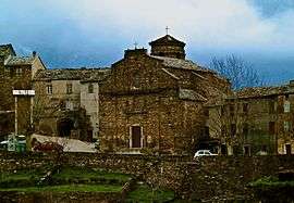
Chapel of San Cervone | |
 Campi | |
|
Location within Corsica region 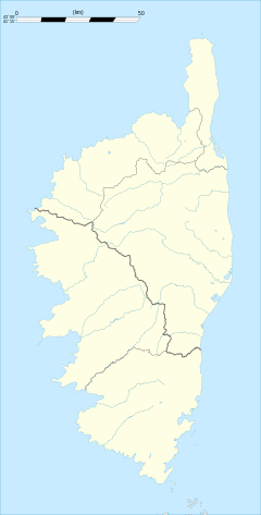 Campi | |
| Coordinates: 42°16′09″N 9°25′25″E / 42.2692°N 9.4236°ECoordinates: 42°16′09″N 9°25′25″E / 42.2692°N 9.4236°E | |
| Country | France |
| Region | Corsica |
| Department | Haute-Corse |
| Arrondissement | Corte |
| Canton | Moïta-Verde |
| Government | |
| • Mayor (2008–2014) | Roche Emmanuel Alessandri |
| Area1 | 5 km2 (2 sq mi) |
| Population (2008)2 | 23 |
| • Density | 4.6/km2 (12/sq mi) |
| Time zone | CET (UTC+1) |
| • Summer (DST) | CEST (UTC+2) |
| INSEE/Postal code | 2B053 / 20270 |
| Elevation |
199–1,093 m (653–3,586 ft) (avg. 554 m or 1,818 ft) |
|
1 French Land Register data, which excludes lakes, ponds, glaciers > 1 km² (0.386 sq mi or 247 acres) and river estuaries. 2 Population without double counting: residents of multiple communes (e.g., students and military personnel) only counted once. | |
Campi is a commune in the Haute-Corse department of France on the island of Corsica.
Administration
Campi is part of the canton of Moïta-Verde, together with 13 other communes: Aléria, Moïta, Ampriani, Canale-di-Verde, Chiatra, Linguizzetta, Matra, Pianello, Pietra-di-Verde, Tallone, Tox, Zalana and Zuani.[1]
Geography
Campi is 2 kilometres (1.2 mi) to the southeast of Moïta. Its territory reaches the summit of Campana at 1,093 metres (3,586 ft). The village has beautiful old houses.
Population
| Historical population | ||
|---|---|---|
| Year | Pop. | ±% |
| 1962 | 76 | — |
| 1968 | 78 | +2.6% |
| 1975 | 42 | −46.2% |
| 1982 | 40 | −4.8% |
| 1990 | 32 | −20.0% |
| 1999 | 28 | −12.5% |
| 2008 | 23 | −17.9% |
See also
References
- ↑ "France, le trésor des régions: Département: Haut-Corse" (in French). Retrieved 2008-05-06..
| Wikimedia Commons has media related to Campi (Haute-Corse). |
This article is issued from Wikipedia - version of the 11/19/2014. The text is available under the Creative Commons Attribution/Share Alike but additional terms may apply for the media files.