Ōdai, Mie
| Ōdai 大台町 | ||
|---|---|---|
| Town | ||
|
Ōdai town hall | ||
| ||
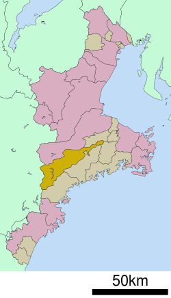 Location of Ōdai in Mie Prefecture | ||
 Ōdai
| ||
| Coordinates: 34°24′N 136°24′E / 34.400°N 136.400°ECoordinates: 34°24′N 136°24′E / 34.400°N 136.400°E | ||
| Country | Japan | |
| Region | Kansai | |
| Prefecture | Mie Prefecture | |
| District | Taki | |
| Area | ||
| • Total | 362.94 km2 (140.13 sq mi) | |
| Population (September 2012) | ||
| • Total | 10,132 | |
| • Density | 27.9/km2 (72/sq mi) | |
| Time zone | Japan Standard Time (UTC+9) | |
| Phone number | 0598-82-3781 | |
| Address | 750 Sahara, Ōdai-chō, Taki-gun, Mie-ken 519-2404 | |
| Website |
www | |


Ōdai (大台町 Ōdai-chō) is a town located in Mie Prefecture, Japan. As of September 2012, the town had an estimated population of 10,132 and a population density of 27.9 persons per km². The total area was 257.01 km². [1]
Geography
Ōdai is located in southeastern Kii Peninsula in central Mie Prefecture. An inland municipality, Ōdai extends almost the width of Mie Prefecture from east to west, but is narrow north to south.
Neighboring municipalities
- Mie Prefecture
- Nara Prefecture
History
The town of Ōdai was established on September 30, 1956 by the merger of the towns Kawazoe and Misedani, both in Taki District. On January 1, 2006, the last remaining village in Mie Prefecture, Miyagawa Village, merged with Ōdai.
Economy
Ōdai serves as a commercial center for the surrounding region.
Transportation
Railway
Highway
Local attractions
References
- ↑ "Odai Town website". Odaitown.jp.
External links
![]() Media related to Ōdai, Mie at Wikimedia Commons
Media related to Ōdai, Mie at Wikimedia Commons
- Ōdai official website (Japanese)
| Special city | ||
|---|---|---|
| Cities | ||
| Kuwana District | ||
| Inabe District | ||
| Mie District | ||
| Taki District | ||
| Watarai District | ||
| Kitamuro District | ||
| Minamimuro District | ||