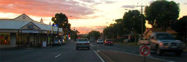
Portrush Road, Adelaide
| National Highway A17 Portrush Road / Lower Portrush Road / Ascot Avenue / Taunton Road / Hampstead Road South Australia | |
|---|---|
 North end South end | |
| Coordinates | |
| General information | |
| Type | Highway |
| Length | 15 km (9.3 mi) |
| Route number(s) |
|
| Major junctions | |
| North end | Gepps Cross / Northfield |
Taunton Road
| |
| South end |
|
| Location(s) | |
| Major settlements |
Hampstead Road Taunton Road Ascot Avenue Lower Portrush Road Portrush Road |
| Highway system | |
|
Highways in Australia National Highway • Freeways in Australia Highways in South Australia | |
| |
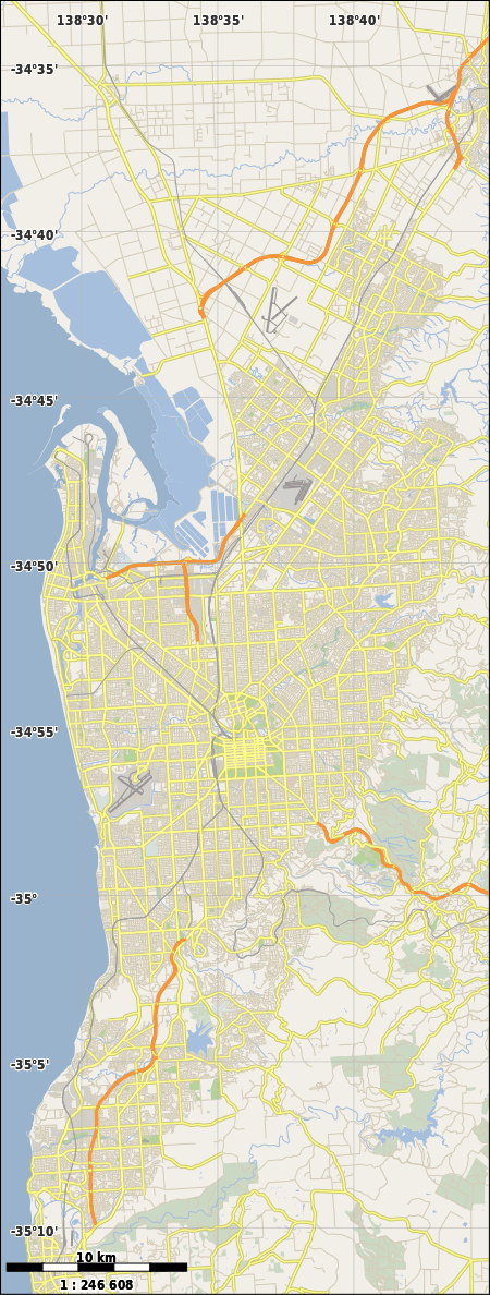
Portrush Road is a major part of National Route A17, a bypass route in Adelaide, the capital of South Australia.[1]
Route description
It runs north-south through the south-eastern and eastern suburbs of Adelaide, at the foot of the Adelaide Hills. The southern end is at the beginning of National Route M1, the South Eastern Freeway (the major route from Melbourne and the south-east of South Australia), which is also the intersection with the south-eastern ends of Cross Road (State Route A3) and Glen Osmond Road (State Route A1).
Portrush Road extends north from there to Payneham Road (State Route A11), crossing the four major arterial routes from the south-eastern and eastern suburbs into the city: Greenhill Road, Kensington Road, The Parade and Magill Road. Portrush road carries approximately 36,000 vehicles per day, including heavy freight trucks.[2] It is an authorised route for trucks up to 26 metres (85 ft) B-double and 25 metres (82 ft) vehicle carrier size.[3]
Had the Metropolitan Adelaide Transport Study of the 1960s progressed, a Hills Freeway would have been constructed to link the South Eastern Freeway to the Port of Adelaide. This would have subsequently removed the freight that utilises Portrush Road (and the A17 Route altogether) today.
A17
At Payneham Road, the A17 turns north-west and changes name to Lower Portrush Road. As it crosses the River Torrens, it changes name to Ascot Avenue. At the intersection with North East Road (State Route A10), it changes name to Taunton Road. At the end of Taunton Road, it turns north again and changes name to Hampstead Road, continuing north and terminating at the intersection with Grand Junction Road, (National Route A16).
The A17 (Portrush Road - Hampstead Road) and the A16 (Grand Junction Road) constitute the major heavy road transport route through suburban Adelaide from Port Adelaide and anywhere north of Adelaide to the South East of South Australia and the adjacent state of Victoria.
History
Portrush Road was named by Nathaniel A. Knox after Portrush in Ireland. Knox owned land near the intersection with Greenhill Road, in the area now occupied by the suburbs of Glenunga and Glenside.[4]
In a 1949 street directory, the southern end of Portrush Road had its current route to Kensington Road. North of Kensington Road, it took the name Kensington Terrace, then Wellington Road north of the Magill Road intersection to Payneham Road. What is now Lower Portrush Road (including the bridge over the River Torrens) did not exist at all. Ascot Avenue was a minor street running off of North East Road which did not exactly line up with Taunton Road on the other side of North East Road. The nearest bridge over the River Torrens was the Felixstow Bridge on Felixstow Road, which is now O.G. Road.[5] Lower Portrush Road and the bridge across the Torrens was opened in November 1970.[6]
Major intersections in National Route A17
See also
![]() Australian Roads portal
Australian Roads portal
References
- ↑ 2003 Adelaide Street Directory, 41st Edition. UBD (A Division of Universal Press Pty Ltd). 2003. ISBN 0-7319-1441-4.
- ↑ "Greenways and bike boulevards". Department of Planning, Transport and Infrastructure, Government of South Australia. 12 March 2015. Norwood-Magill Bicycle Boulevard. Retrieved 3 April 2015.
Portrush Road is a busy freight route carrying an average of 36,000 motor vehicles per day.
- ↑ "RAVnet - Heavy vehicle routing, South Australia". Department of Planning, Transport and Infrastructure, Government of South Australia. Retrieved 3 April 2015.
- ↑ "Portrush Road". The Mail (Adelaide). 17, (844). South Australia. 28 July 1928. p. 14. Retrieved 28 October 2016 – via National Library of Australia.
- ↑ "Gregory's Street Directory of Adelaide and Suburbs" (1949 ed.). Retrieved 10 July 2016 – via Open Street Map Australia.
- ↑ Notes for the Opening of the Portrush Road Bridge at Marden, 13 November 1970, retrieved 10 July 2016
- ↑ "Property Location Browser". Government of South Australia. Retrieved 10 July 2016.
- 1 2 Google (10 July 2016). "Portrush Road, Adelaide" (Map). Google Maps. Google.