Grand Junction Road
| Grand Junction Road South Australia | |
|---|---|
| General information | |
| Type | Road |
| Length | 21 km (13 mi) |
| Route number(s) |
|
| Major junctions | |
| East end |
|
| |
| West end |
|
| Location(s) | |
| Major suburbs | Holden Hill, Northfield, Gepps Cross, Regency Park, Port Adelaide |
| |
Grand Junction Road is the longest east-west thoroughfare in the Adelaide metropolitan area, and is located approximately 9 kilometres north of the city centre.[1] Travelling from the Port Adelaide region, it is mostly a double lane sealed road (becoming a single lane road past Tolley Road intersection at Hope Valley, South Australia) running 21 kilometres to the base of the Adelaide Hills. The western terminus is at the intersection of Old Port Road, 300 metres east of a causeway, which separates the Port River from West Lakes. The 2.4 kilometre section of road that continues west of Old Port Road to Semaphore South is named Bower Road. The eastern terminus of Grand Junction Road is in the suburb of Hope Valley, at the intersection of Hancock Road and Lower North East Road, just before the latter proceeds into the Adelaide Hills, past Anstey Hill Recreation Park and on towards the towns of Houghton and Inglewood.
History
The Grand Junction, located at today's intersection of Grand Junction Road and Churchill Road,[2] is the meeting point of what was once the most accessible route out of Adelaide City to the north (over the Torrens via Port Road). It was the intersection of the North Road, later called the Lower North Road (today's Cavan Road), and the east-west road from Upper Dry Creek to the Port (today's Grand Junction Road from Walkley's Road to Cavan Road). It remained so until January 1843 when migrant labourers completed a new bridge spanning 120 feet over the Torrens River.[3] This enabled travellers to take the more direct route northward on the road from the city to Gawler Town (later called the Great North Road, today Main North Road), and the junction of roads at Gepp's Cross took on a greater significance than the Grand Junction.
In the mid 1850s the track and road from the upper Dry Creek, past the Grand Junction Inn, to the Port, was variously called ‘road to the Port’,[4] ‘Port Road,’[5] or ‘Grand Junction' to (Port) 'Causeway Road’.[6][7] In November 1854 the Legislative Council requested the Central Road Board estimate the cost of a continuous road from the Grand Junction to the "Port-road near Albert Town", rendered necessary by the formation of the Adelaide and Port Railway.[8] The road upgrade was shelved though for two years. In 1856 the Central Road Board resolved to upgrade the poor roadway between the Grand Junction Inn and Albert Town through the Alberton Swamp.[9] The matter was a serious concern for many district councils north of Adelaide and, in a united front, the district councils flooded the Legislative Council with petitions. On 9 May the Legislative Council passed a motion "for £2,500 to be placed on the Estimates, to form the road from the Grand Junction to Alberton."[10] Official reference to ‘Grand Junction Road’ was made by the government in a message (No. 42) received from the Governor-in-Chief which appropriate funds for the road to the Central Road Board in 1856.[11]
Progress on the road was slow and it was not until May 1857 that approval was given to metal (pave) the new road with compacted limestone.[12] The woes of the road dragged on. Tenderers defaulted and further works were ordered, including an additional 1,090 yards of limestone on the swamp that still was not laid by the end of 1858.[13][14][15] The road between the Grand Junction Inn and Alberton across the swamp turned into a money pit for the road board and the community. The saga continued for years. In July 1861 the Central Road Board yet again called for tenders to make 19 chains of the Grand Junction Road over sands at Alberton Swamp.[16] Popular usage of the name "Grand Junction Road" greatly increased after the upgrade was completed in the early 1860s.
Major intersections
There are a number of major intersections along Grand Junction Road, the largest being at Gepps Cross, where Main North Road and Port Wakefield Road meet at a five-way crossing. Main North Road joins from the south and continues on to the north-east, towards Parafield, Elizabeth and Gawler, while Port Wakefield Road begins at this location, travelling due north to the northern Adelaide Plains and 90 kilometres to the town of Port Wakefield. The original Grand Junction at the intersection with Churchill and Cavan Roads was once a five-way intersection used by most northbound travel out of Adelaide.
The road is also officially part of the National Highway system, and therefore attracts a shield and federal funding. The National Highway runs south (from Port Augusta) off the Salisbury Highway/South Road connector intersection, heads east along Grand Junction Road through Gepps Cross (where it meets another National Highway, Main North Road (A20), north-east to Sydney), to the Hampstead Road intersection a few kilometres away where it turns south (to Melbourne). Grand Junction Road continues on without the National shield.
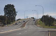
In 2011, construction began on the South Road superway and as a result, changes have been made to Grand Junction road. South Road now goes over this road and connects to the Port River Expressway Highway.
Railway crossings
Due to the configuration of the Adelaide railway system north of the CBD, there are a number of current and former railway crossings over Grand Junction Road. These include:
- The bridge over the Adelaide to Outer Harbor railway line at Alberton
- A level crossing over the Dry Creek-Port Adelaide railway line, at Rosewater
- A dismantled level crossing in the proximity of Glenroy Street and Eastern Parade, at Pennington and Ottoway (On the former Finsbury railway line)
- The bridge over the Adelaide to Gawler and Adelaide-Port Augusta railway at Kilburn and Wingfield
- The Adelaide O-Bahn underpass at Holden Hill (Dedicated Busway)
Educational institutions
Adjoining institutions
A number of schools and other education institutions front on to Grand Junction Road. These include:
- Enfield High School at Enfield
- Gepps Cross Girls School, Gepps Cross
- St. Pauls College, Gilles Plains
- Tauondi College at Port Adelaide, opposite Alberton
- Torrens Valley Christian School at Hope Valley
Non-adjoining institutions
There are also schools which are located within a few streets of Grand Junction Road, in adjacent suburbs:
- Cedar College on Fosters Road, Northgate
- Gepps Cross Special School and Gepps Cross Primary School, both in the suburb of Blair Athol
- Heritage College, Oakden
- Kilburn Primary School, Kilburn
- Mansfield Park Primary School, Mansfield Park
- Modbury High School, Modbury
- Modbury Primary School, Hope Valley
- Northfield Primary School, Northfield
- Pennington Primary School, Pennington
- Mount Carmel College, Rosewater
- Torrens Valley TAFE and Wandana Primary School, both in Gilles Plains
It also passes Yatala Labour Prison, the Adelaide Pre-Release Centre and the Adelaide Women's Prison at Northfield.
Gallery
-
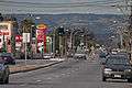
Looking down Grand Junction Road towards the Adelaide Hills from Rosewater.
-
The bridge over the Adelaide to Port Adelaide railway line at Alberton.
-

Location of Grand Junction Road in the Adelaide Metropolitan area.
See also
![]() Australian Roads portal
Australian Roads portal
References
- ↑ 2003 Adelaide Street Directory, 41st Edition. UBD (A Division of Universal Press Pty Ltd). 2003. ISBN 0-7319-1441-4.
- ↑ Fuller, W.C. (1940). "Adelaide - Map 7" (Map). Street Directory of Adelaide and Suburbs with Reference Maps. Keyplan. Retrieved 16 December 2015.
- ↑ "OFFICIAL RETROSPECT FOR 1842.". The Southern Australian. Adelaide, SA. 6 January 1843. p. 2.
NORTH ROAD. On the Northern Road various works have been executed over a distance extending from Adelaide to Gawler Town. At the point where this road passes over the Torrens in the Park Lands, a bridge of 120 feet span has been erected. This road has also been cleared as far as the Little Para.
- ↑ "Land for sale, in the District of Yatala". South Australian Register. Adelaide. 2 February 1855. p. 4. Retrieved 16 December 2015.
LAND for SALE, in the DISTRICT of YATALA, opposite the Grand Junction, having frontage to the Lower North-road and the road to the Port, containing 67 Acres, and likely to become a property of great value, from the fact that as the Gawler Town Railway passes through the property, a Terminus is here intended for the Branch to the Port.
- ↑ "???". South Australian Register. Adelaide. 22 December 1856. p. 4.
- ↑ "CENTRAL ROAD BOARD.". South Australian Register. Adelaide. 22 March 1865. p. 3. Retrieved 16 December 2015.
No. 1152. Road from Grand Junction to Cause-way on Port-road, for forming and metalling about 20 chains of road near the Grand Junction end— No tenders. To be readvertised.
- ↑ "???". South Australian Weekly Chronicle. Adelaide. 27 May 1865. p. 4.
- ↑ "???". South Australian Register. Adelaide. 10 November 1854. p. 3.
- ↑ "???". South Australian Register. Adelaide. 11 April 1856. p. 3.
- ↑ "???". South Australian Register. Adelaide. 23 June 1856. p. 2.
- ↑ "???". South Australian Register. Adelaide. 15 May 1856. p. 3.
- ↑ "???". South Australian Register. Adelaide. 22 May 1857. p. 3.
- ↑ "???". South Australian Register. Adelaide. 23 January 1858. p. 3.
- ↑ "???". South Australian Register. Adelaide. 5 November 1858. p. 3.
- ↑ "???". The South Australian Advertiser. Adelaide. 10 January 1859. p. 3.
- ↑ "???". South Australian Register. Adelaide. 4 July 1861. p. 3.
| ||||
| National Highways | ||||
| M & A routes | ||||
| B & C routes | ||||