Alamo Heights, Texas
| Alamo Heights, Texas | |
|---|---|
| City | |
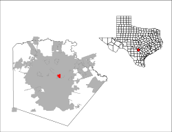 Location of Alamo Heights, Texas | |
| Coordinates: 29°28′58″N 98°28′2″W / 29.48278°N 98.46722°WCoordinates: 29°28′58″N 98°28′2″W / 29.48278°N 98.46722°W | |
| Country |
|
| State |
|
| County | Bexar |
| Government | |
| • Type | Council-Manager |
| • City Council |
Mayor Louis Cooper Bobby Hasslocher Bobby Rosenthal Fred Prassel Lynda Billa Burke John Savage |
| • City Manager | Mark Browne |
| Area | |
| • Total | 1.9 sq mi (4.8 km2) |
| • Land | 1.9 sq mi (4.8 km2) |
| • Water | 0.0 sq mi (0.0 km2) |
| Elevation | 801 ft (244 m) |
| Population (2010)[1] | |
| • Total | 7,031 |
| • Estimate (2013)[1] | 7,547 |
| • Density | 3,818/sq mi (1,474.3/km2) |
| Time zone | Central (CST) (UTC-6) |
| • Summer (DST) | CDT (UTC-5) |
| ZIP code | 78209 |
| Area code(s) | 210, 726 (planned) |
| FIPS code | 48-01600[2] |
| GNIS feature ID | 1329300[3] |
| Website |
www |
Alamo Heights is an incorporated city that is surrounded by the city of San Antonio in Bexar County in the U.S. state of Texas. At the time of the 2010 census, the population of Alamo Heights was 7,031.[4] It is part of the Greater San Antonio metropolitan area. A portion of the University of the Incarnate Word is in Alamo Heights.
Alamo Heights is about 5 miles (8 km) north of downtown San Antonio, the urban core of the seventh largest city in America, and is completely surrounded by the city of San Antonio.[5]
Geography
Alamo Heights is located at 29°28′58″N 98°28′2″W / 29.48278°N 98.46722°W (29.482881, -98.467271).[6] It is bordered by the following neighborhoods: Lincoln Heights to the north, Olmos Park to the west, Brackenridge Park and Fort Sam Houston to the south, and Terrell Hills to the east. All of them are districts within San Antonio except for Terrell Hills and Olmos Park, both independent cities like Alamo Heights. Alamo Heights is about 3 miles (5 km) south of the San Antonio International Airport and 5 miles (8 km) north of downtown San Antonio, both of which are accessible via Broadway and U.S. 281 North.
According to the United States Census Bureau, Alamo Heights has a total area of 1.9 square miles (4.8 km2), all of it land.[4]
Demographics
| Historical population | |||
|---|---|---|---|
| Census | Pop. | %± | |
| 1930 | 3,874 | — | |
| 1940 | 5,700 | 47.1% | |
| 1950 | 8,000 | 40.4% | |
| 1960 | 7,552 | −5.6% | |
| 1970 | 6,933 | −8.2% | |
| 1980 | 6,252 | −9.8% | |
| 1990 | 6,502 | 4.0% | |
| 2000 | 7,319 | 12.6% | |
| 2010 | 7,031 | −3.9% | |
| Est. 2015 | 8,038 | [7] | 14.3% |
As of the 2000 U.S. Census, there were 7,319 people, 3,197 households, and 1,819 families residing in this city. The population density was 3,964.9 people per square mile (1,527.5/km²). There were 3,460 housing units at an average density of 1,874.4 per square mile (722.1/km²). The racial makeup of this town was 93.80% White, 0.56% African American, 0.33% Native American, 0.85% Asian, 0.01% Pacific Islander, 2.81% from other races, and 1.64% from two or more races. Hispanic or Latino of any race were 13.55% of the population.
There were 3,197 households out of which 28.1% had children under the age of 18 living with them, 46.5% were married couples living together, 7.9% had a female householder with no husband present, and 43.1% were non-families. 38.3% of all households were made up of individuals and 12.9% had someone living alone who was 65 years of age or older. The average household size was 2.16 and the average family size was 2.91.
In the city the population was spread out with 22.3% under the age of 18, 6.2% from 18 to 24, 29.2% from 25 to 44, 25.1% from 45 to 64, and 17.2% who were 65 years of age or older. The median age was 40 years. For every 100 females there were 82.5 males. For every 100 females age 18 and over, there were 75.0 males.
Alamo Heights' residents are usually middle class to very wealthy. The city, along with Terrell Hills, Olmos Park, and the City of San Antonio districts of Lincoln Heights and Brackenridge Park, represent the "old money" social spectrum of San Antonio. In contrast, the outer northern neighborhoods and suburbs generally consist of middle class and "new money" residents. The median income per household in Alamo Heights was $77,257 in 2008 (compared to $64,688 in 2000), while the median per family income was $86,897. Males had a median income of $60,527 versus $37,089 for females. The per capita income for the city was estimated to be $56,335 in 2008. About 1.6% of families and 3.5% of the population were below the poverty line, including 3.7% of those under age 18 and 6.4% of those age 65 or over.
Estimated median house or condo value in 2008 was $341,600 (compared to $202,200 in 2000).
Mean prices in 2008: All housing units: $440,427. Detached houses: $437,838. Townhouses or other attached units: $373,366. In 2-unit ("duplex") structures: $200,395. In 3-to-4-unit ("triplex" to "fourplex") structures: $294,787. In 5-or-more-unit structures: $491,936.
Federal government offices
The United States Postal Service operates the Alamo Heights Post Office.[9]
Education
Primary and secondary schools
Alamo Heights is served by the Alamo Heights Independent School District, which has its headquarters in the city limits.[10][11][12]
Howard Early Childhood Center in San Antonio serves early childhood residents.[13] Most residents are zoned to Cambridge Elementary School in Alamo Heights,[10][14][15] while some are zoned to Woodridge Elementary School in San Antonio.[14][16] All residents are zoned to Alamo Heights Junior School which is located nearby in San Antonio and Alamo Heights High School which is situated in Alamo Heights at 6900 Broadway.[10][14][17]

Private schools within the town limits are St. Peter Prince of the Apostles Catholic School (K-8) and St. Luke's Episcopal School (PK3-8). Nearby private schools outside the town limits include The San Antonio Academy in Monte Vista (K-8), Keystone School in Monte Vista (PreK-12), St. Mary's Hall (San Antonio, Texas) (K-12), Incarnate Word High School in Olmos Park (9-12), St. Anthony Catholic School in Monte Vista (PK3-8), St. Anthony Catholic High School (9-12) in Monte Vista, and St. Pius X in San Antonio (K-8).
Colleges and universities


The University of the Incarnate Word is partially within Alamo Heights.[10][18] Trinity University is 1 mile (1.6 km) southwest of the city limits in the San Antonio district of Monte Vista.
Public libraries
There are no public libraries in Alamo Heights. The Landa Memorial Library of the San Antonio Public Library, located in the Monte Vista Historic District in San Antonio, is the most proximal.[19]
History
The City of Alamo Heights was incorporated in 1922. Eventual growth to the north would happen later with the annexation of Bluebonnet Hills and Sylvan Hills in 1928 and 1944, respectively.
Attractions
The Alamo Quarry Market shopping center, Quarry Village, Lincoln Heights Shopping Center, H-E-B's Central Market, North Star Mall, McNay Art Museum, and the headquarters for Clear Channel Communications can be found in Alamo Heights.

References
- 1 2 "State and County Quick Facts". United States Census Bureau. Retrieved January 6, 2015.
- ↑ "American FactFinder". United States Census Bureau. Archived from the original on 2013-09-11. Retrieved 2008-01-31.
- ↑ "US Board on Geographic Names". United States Geological Survey. 2007-10-25. Retrieved 2008-01-31.
- 1 2 "Geographic Identifiers: 2010 Demographic Profile Data (G001): Alamo Heights city, Texas". U.S. Census Bureau, American Factfinder. Retrieved April 11, 2014.
- ↑ http://www.distancebetweencities.net/alamo-heights_tx_and_san-antonio_tx/
- ↑ "US Gazetteer files: 2010, 2000, and 1990". United States Census Bureau. 2011-02-12. Retrieved 2011-04-23.
- ↑ "Annual Estimates of the Resident Population for Incorporated Places: April 1, 2010 to July 1, 2015". Retrieved July 2, 2016.
- ↑ "Census of Population and Housing". Census.gov. Archived from the original on May 11, 2015. Retrieved June 4, 2015.
- ↑ "Post Office Location - ALAMO HEIGHTS." United States Postal Service. Retrieved on April 16, 2009.
- 1 2 3 4 Zoning Map." City of Alamo Heights. Retrieved on March 24, 2010.
- ↑ "AHISD Contact Information." Alamo Heights Independent School District. Retrieved on March 24, 2010.
- ↑ "Alamo Heights city, Texas." U.S. Census Bureau. Retrieved on May 22, 2010.
- ↑ "Welcome." Howard Early Childhood Center. Retrieved on March 24, 2010.
- 1 2 3 "Zoning Map." Alamo Heights Independent School District. Retrieved on March 24, 2010.
- ↑ "Welcome to Cambridge Elementary School." Alamo Heights Independent School District. Retrieved on March 24, 2010.
- ↑ "District Map PDF." Alamo Heights Independent School District. Retrieved on March 24, 2010.
- ↑ "Welcome to the Alamo Heights Junior High School." Alamo Heights Independent School District. Retrieved on March 24, 2010.
- ↑ "Campus Map." University of the Incarnate Word. Retrieved on March 24, 2010.
- ↑ "Landa Library." San Antonio Public Library. Retrieved on March 25, 2010.
External links
- City of Alamo Heights official website
- Alamo Heights Independent School District (AHISD)
- AHNA-Alamo Heights Neighborhood Association
- Alamo Heights News, Info, Events and History
- Alamo Heights in the Handbook of Texas Online at the University of Texas, Austin
Municipalities and communities of Bexar County, Texas, United States | ||
|---|---|---|
| Cities | 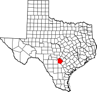 | |
| Towns | ||
| CDPs | ||
| Other unincorporated communities | ||
| Footnotes | ‡This populated place also has portions in an adjacent county or counties | |