Nixon, Texas
| Nixon, Texas | |
|---|---|
| City | |
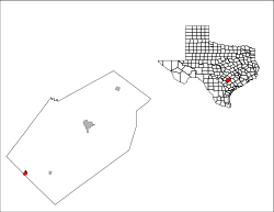
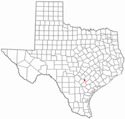 Location of Nixon, Texas | |
 | |
| Coordinates: 29°16′14″N 97°45′45″W / 29.27056°N 97.76250°WCoordinates: 29°16′14″N 97°45′45″W / 29.27056°N 97.76250°W | |
| Country | United States |
| State | Texas |
| Counties | Gonzales, Wilson |
| Area | |
| • Total | 1.1 sq mi (2.9 km2) |
| • Land | 1.1 sq mi (2.9 km2) |
| • Water | 0.0 sq mi (0.0 km2) |
| Elevation | 390 ft (119 m) |
| Population (2000) | |
| • Total | 2,186 |
| • Density | 1,928.1/sq mi (744.5/km2) |
| Time zone | Central (CST) (UTC-6) |
| • Summer (DST) | CDT (UTC-5) |
| ZIP code | 78140 |
| Area code(s) | 830 |
| FIPS code | 48-51588[1] |
| GNIS feature ID | 1363917[2] |
Nixon is a city in Gonzales and Wilson Counties in the U.S. state of Texas. The population was 2,238 at the 2010 census.
The Wilson County portion of Nixon is part of the San Antonio Metropolitan Statistical Area.
Geography
Nixon is located at 29°16′14″N 97°45′45″W / 29.27056°N 97.76250°W (29.270443, -97.762423),[3] primarily within Gonzales County.
According to the United States Census Bureau, the city has a total area of 1.1 square miles (2.9 km²), all of it land.
History
Nixon was founded in 1906 as Nixonville, when the Galveston, Harrisburg and San Antonio Railway built its lines through the John T. Nixon Ranch.
Economy
Nixon, Texas is the location of the Nixon Refinery belonging to Blue Dolphin Energy.
Demographics
| Historical population | |||
|---|---|---|---|
| Census | Pop. | %± | |
| 1920 | 1,124 | — | |
| 1930 | 1,037 | −7.7% | |
| 1940 | 1,835 | 77.0% | |
| 1950 | 1,875 | 2.2% | |
| 1960 | 1,751 | −6.6% | |
| 1970 | 1,925 | 9.9% | |
| 1980 | 2,008 | 4.3% | |
| 1990 | 1,995 | −0.6% | |
| 2000 | 2,186 | 9.6% | |
| 2010 | 2,385 | 9.1% | |
| Est. 2015 | 2,465 | [4] | 3.4% |
As of the census[1] of 2000, there were 2,186 people, 686 households, and 506 families residing in the city. The population density was 1,928.1 people per square mile (746.9/km²). There were 803 housing units at an average density of 708.3 per square mile (274.4/km²). The racial makeup of the city was 69.99% White, 2.84% African American, 0.91% Native American, 0.09% Asian, 24.15% from other races, and 2.01% from two or more races. Hispanic or Latino of any race were 61.57% of the population.
There were 686 households out of which 42.1% had children under the age of 18 living with them, 48.0% were married couples living together, 17.2% had a female householder with no husband present, and 26.2% were non-families. 24.1% of all households were made up of individuals and 13.3% had someone living alone who was 65 years of age or older. The average household size was 3.02 and the average family size was 3.53.
In the city the population was spread out with 31.5% under the age of 18, 10.8% from 18 to 24, 26.7% from 25 to 44, 16.2% from 45 to 64, and 14.7% who were 65 years of age or older. The median age was 31 years. For every 100 females there were 94.8 males. For every 100 females age 18 and over, there were 89.5 males.
The median income for a household in the city was $22,104, and the median income for a family was $25,139. Males had a median income of $21,250 versus $15,491 for females. The per capita income for the city was $10,135. About 22.3% of families and 27.5% of the population were below the poverty line, including 37.7% of those under age 18 and 25.0% of those age 65 or over.
Education
The City of Nixon is served by the Nixon-Smiley Consolidated Independent School District.
Notable people
- Andre Marrou - 1992 Libertarian Party presidential nominee.
- Chris Marrou - former news anchor for KENS 5-TV in San Antonio, Texas
- Little Joe - singer
- Carly Hester - Professional wings n more eater
- Carlton Mckinney - Retired Professional Basketball Player
References
- 1 2 "American FactFinder". United States Census Bureau. Retrieved 2008-01-31.
- ↑ "US Board on Geographic Names". United States Geological Survey. 2007-10-25. Retrieved 2008-01-31.
- ↑ "US Gazetteer files: 2010, 2000, and 1990". United States Census Bureau. 2011-02-12. Retrieved 2011-04-23.
- ↑ "Annual Estimates of the Resident Population for Incorporated Places: April 1, 2010 to July 1, 2015". Retrieved July 2, 2016.
- ↑ "Census of Population and Housing". Census.gov. Retrieved June 4, 2015.
External links
Municipalities and communities of Gonzales County, Texas, United States | ||
|---|---|---|
| Cities | 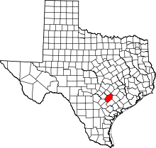 | |
| Unincorporated communities | ||
| Ghost towns |
| |
| Footnotes | ‡This populated place also has portions in an adjacent county or counties | |
Municipalities and communities of Wilson County, Texas, United States | ||
|---|---|---|
| Cities | 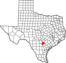 | |
| Town | ||
| Unincorporated communities | ||
| Ghost towns | ||
| Footnotes | ‡This populated place also has portions in an adjacent county or counties | |