Jourdanton, Texas
| Jourdanton, Texas | |
|---|---|
| City | |
|
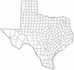
Atascosa County Courthouse | |
 Location of Jourdanton, Texas | |
 | |
| Coordinates: 28°55′18″N 98°32′47″W / 28.92167°N 98.54639°WCoordinates: 28°55′18″N 98°32′47″W / 28.92167°N 98.54639°W | |
| Country | United States |
| State | Texas |
| County | Atascosa |
| Area | |
| • Total | 3.5 sq mi (9.1 km2) |
| • Land | 3.5 sq mi (9.1 km2) |
| • Water | 0.0 sq mi (0.0 km2) |
| Elevation | 459 ft (140 m) |
| Population (2010) | |
| • Total | 3,871 |
| • Density | 1,105/sq mi (426.5/km2) |
| Time zone | Central (CST) (UTC-6) |
| • Summer (DST) | CDT (UTC-5) |
| ZIP code | 78026 |
| Area code(s) | 830 |
| FIPS code | 48-38116[1] |
| GNIS feature ID | 1360436[2] |

Jourdanton (/ˈdʒɜːrdəntən/ JUR-dən-tən) is a city in and the county seat of Atascosa County, Texas, United States.[3] The population was 3,871 at the 2010 census.[4] It is part of the San Antonio Metropolitan Statistical Area. The Mayor is Robert "Doc" Williams. The City Manager is Kendall Schorsch. The Police Chief is Eric Kaiser. The Volunteer Fire Chief is David Prasifka.
History
Jourdanton was founded in 1909 and was named after founder Jourdan Campbell. The county seat was moved from Pleasanton to Jourdanton in 1910.
Geography
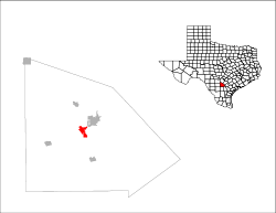
Jourdanton is located near the center of Atascosa County at 28°55′18″N 98°32′47″W / 28.92167°N 98.54639°W (28.921530, -98.546440),[5] about 37 miles (60 km) south of downtown San Antonio. At the center of the city is the intersection of Texas State Highways 16 and 97. Highway 16 leads north to San Antonio and south 165 miles (266 km) to Zapata near the Mexican border. Highway 97 leads northeast 4 miles (6 km) to Pleasanton and 28 miles (45 km) to Floresville, and southwest 67 miles (108 km) to Cotulla.
According to the United States Census Bureau, Jourdanton has a total area of 3.5 square miles (9.1 km2), all land.[4]
Demographics
| Historical population | |||
|---|---|---|---|
| Census | Pop. | %± | |
| 1920 | 682 | — | |
| 1930 | 767 | 12.5% | |
| 1940 | 950 | 23.9% | |
| 1950 | 1,481 | 55.9% | |
| 1960 | 1,504 | 1.6% | |
| 1970 | 1,841 | 22.4% | |
| 1980 | 2,743 | 49.0% | |
| 1990 | 3,220 | 17.4% | |
| 2000 | 3,732 | 15.9% | |
| 2010 | 3,871 | 3.7% | |
| Est. 2015 | 4,275 | [6] | 10.4% |
As of the census[1] of 2010, there were 3,871 people, 1,187 households, and 923 families residing in the city. The population density was 1,071.1 people per square mile (414.1/km²). There were 1,353 housing units at an average density of 388.3 per square mile (150.1/km²). The racial makeup of the city was 74.44% White, 1.13% African American, 0.96% Native American, 0.29% Asian, 0.03% Pacific Islander, 20.42% from other races, and 2.73% from two or more races. Hispanic or Latino of any race were 52.87% of the population.
There were 1,187 households out of which 44.4% had children under the age of 18 living with them, 58.5% were married couples living together, 15.2% had a female householder with no husband present, and 22.2% were non-families. 19.9% of all households were made up of individuals and 9.5% had someone living alone who was 65 years of age or older. The average household size was 2.98 and the average family size was 3.42.
In the city the population was spread out with 32.2% under the age of 18, 9.0% from 18 to 24, 29.4% from 25 to 44, 18.6% from 45 to 64, and 10.8% who were 65 years of age or older. The median age was 31 years. For every 100 females there were 95.5 males. For every 100 females age 18 and over, there were 92.3 males.
The median income for a household in the city was $34,975, and the median income for a family was $38,389. Males had a median income of $30,222 versus $16,313 for females. The per capita income for the city was $16,910. About 12.4% of families and 13.4% of the population were below the poverty line, including 13.1% of those under age 18 and 19.3% of those age 65 or over.
Education
Jourdanton is served by the Jourdanton Independent School District and home to the Jourdanton High School Indians
Climate
The climate in this area is characterized by hot, humid summers and generally mild to cool winters. According to the Köppen Climate Classification system, Jourdanton has a humid subtropical climate, abbreviated "Cfa" on climate maps.[8]
References
- 1 2 "American FactFinder". United States Census Bureau. Retrieved 2008-01-31.
- ↑ "US Board on Geographic Names". United States Geological Survey. 2007-10-25. Retrieved 2008-01-31.
- ↑ "Find a County". National Association of Counties. Retrieved 2011-06-07.
- 1 2 "Geographic Identifiers: 2010 Demographic Profile Data (G001): Jourdanton city, Texas". U.S. Census Bureau, American Factfinder. Retrieved August 23, 2013.
- ↑ "US Gazetteer files: 2010, 2000, and 1990". United States Census Bureau. 2011-02-12. Retrieved 2011-04-23.
- ↑ "Annual Estimates of the Resident Population for Incorporated Places: April 1, 2010 to July 1, 2015". Retrieved July 2, 2016.
- ↑ "Census of Population and Housing". Census.gov. Retrieved June 4, 2015.
- ↑ Climate Summary for Jourdanton, Texas
External links
- Jourdanton I.S.D: A Century of Service
- Jourdanton Chamber of Commerce
- Jourdanton Independent School District
- Jourdanton Police Department
- Handbook of Texas Online article
Municipalities and communities of Atascosa County, Texas, United States | ||
|---|---|---|
| Cities | 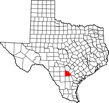 | |
| Town | ||
| CDP | ||
| Other unincorporated communities | ||
| Footnotes | ‡This populated place also has portions in an adjacent county or counties | |
