Amelia, Ohio
| Amelia, Ohio | |
|---|---|
| Village | |
| Motto: Where Vision Becomes Reality | |
 Location of Amelia, Ohio | |
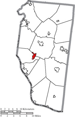 Location of Amelia in Clermont County | |
| Coordinates: 39°1′45″N 84°13′16″W / 39.02917°N 84.22111°WCoordinates: 39°1′45″N 84°13′16″W / 39.02917°N 84.22111°W | |
| Country | United States |
| State | Ohio |
| County | Clermont |
| Government | |
| • Mayor | Todd J. Hart |
| Area[1] | |
| • Total | 1.79 sq mi (4.64 km2) |
| • Land | 1.79 sq mi (4.64 km2) |
| • Water | 0 sq mi (0 km2) |
| Elevation[2] | 876 ft (267 m) |
| Population (2010)[3] | |
| • Total | 4,801 |
| • Estimate (2012[4]) | 4,855 |
| • Density | 2,682.1/sq mi (1,035.6/km2) |
| Time zone | Eastern (EST) (UTC-5) |
| • Summer (DST) | EDT (UTC-4) |
| ZIP code | 45102 |
| Area code(s) | 513 |
| FIPS code | 39-01742[5] |
| GNIS feature ID | 1064319[2] |
| Website | http://www.ameliavillage.com/ |
Amelia is a village in Clermont County, Ohio, United States. The population was 4,801 at the 2010 census.
Gallery
-
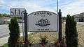
Amelia community sign.
-
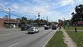
Looking east on Main Street Minnesota Highway 125) in Amelia.
-

The Amelia Bowdoin House.
History
Amelia was not officially platted.[6] The name Amelia was adopted in honor of Amelia Bowdoin, a well known and popular tollgate operator on the Ohio Turnpike - Main Street, today State Route 125. Her home still stands at 94 W. Main St., across the street from where it stood when it was a tollhouse.[7] A post office called Amelia has been in operation since 1836.[8]
In May 2009, Amelia survived an initiative on dissolving the village into Pierce and Batavia Townships.[9][10]
Geography
Amelia is located at 39°1′45″N 84°13′16″W / 39.02917°N 84.22111°W (39.029123, -84.221111).[11]
According to the United States Census Bureau, the village has a total area of 1.79 square miles (4.64 km2), all land.[1]
Demographics
| Historical population | |||
|---|---|---|---|
| Census | Pop. | %± | |
| 1880 | 185 | — | |
| 1910 | 417 | — | |
| 1920 | 658 | 57.8% | |
| 1930 | 427 | −35.1% | |
| 1940 | 550 | 28.8% | |
| 1950 | 601 | 9.3% | |
| 1960 | 913 | 51.9% | |
| 1970 | 820 | −10.2% | |
| 1980 | 1,108 | 35.1% | |
| 1990 | 1,837 | 65.8% | |
| 2000 | 2,752 | 49.8% | |
| 2010 | 4,801 | 74.5% | |
| Est. 2015 | 4,932 | [12] | 2.7% |
2010 census
As of the census[3] of 2010, there were 4,801 people, 1,830 households, and 1,238 families residing in the village. The population density was 2,682.1 inhabitants per square mile (1,035.6/km2). There were 1,974 housing units at an average density of 1,102.8 per square mile (425.8/km2). The racial makeup of the village was 95.1% White, 1.6% African American, 0.3% Native American, 0.7% Asian, 0.6% from other races, and 1.6% from two or more races. Hispanic or Latino of any race were 1.9% of the population.
There were 1,830 households of which 41.5% had children under the age of 18 living with them, 49.2% were married couples living together, 13.3% had a female householder with no husband present, 5.1% had a male householder with no wife present, and 32.3% were non-families. 26.0% of all households were made up of individuals and 7.2% had someone living alone who was 65 years of age or older. The average household size was 2.62 and the average family size was 3.15.
The median age in the village was 30.5 years. 29.7% of residents were under the age of 18; 8.3% were between the ages of 18 and 24; 36.6% were from 25 to 44; 19.7% were from 45 to 64; and 5.9% were 65 years of age or older. The gender makeup of the village was 48.5% male and 51.5% female.
2000 census
As of the census[5] of 2000, there were 2,752 people, 1,063 households, and 738 families residing in the village. The population density was 2,007.2 people per square mile (775.6/km²). There were 1,112 housing units at an average density of 811.1 per square mile (313.4/km²). The racial makeup of the village was 96.77% White, 0.58% African American, 0.07% Native American, 0.29% Asian, 0.73% from other races, and 1.56% from two or more races. Hispanic or Latino of any race were 1.27% of the population.
There were 1,063 households out of which 41.1% had children under the age of 18 living with them, 53.0% were married couples living together, 12.0% had a female householder with no husband present, and 30.5% were non-families. 24.8% of all households were made up of individuals and 10.3% had someone living alone who was 65 years of age or older. The average household size was 2.59 and the average family size was 3.10.
In the village the population was spread out with 28.5% under the age of 18, 10.6% from 18 to 24, 39.3% from 25 to 44, 13.9% from 45 to 64, and 7.6% who were 65 years of age or older. The median age was 29 years. For every 100 females there were 89.0 males. For every 100 females age 18 and over, there were 86.9 males.
The median income for a household in the village was $44,900, and the median income for a family was $51,699. Males had a median income of $37,500 versus $26,295 for females. The per capita income for the village was $17,772. About 5.0% of families and 7.6% of the population were below the poverty line, including 5.7% of those under age 18 and 14.1% of those age 65 or over.
References
| Wikivoyage has a travel guide for Amelia (Ohio). |
- 1 2 "US Gazetteer files 2010". United States Census Bureau. Archived from the original on 2012-01-24. Retrieved 2013-01-06.
- 1 2 "US Board on Geographic Names". United States Geological Survey. 2007-10-25. Retrieved 2008-01-31.
- 1 2 "American FactFinder". United States Census Bureau. Retrieved 2013-01-06.
- ↑ "Population Estimates". United States Census Bureau. Archived from the original on 2013-06-17. Retrieved 2013-06-17.
- 1 2 "American FactFinder". United States Census Bureau. Archived from the original on 2013-09-11. Retrieved 2008-01-31.
- ↑ Everts, Louis H. (1880). History of Clermont County, Ohio, with Illustrations and Biographical Sketches of Its Prominent Men and Pioneers. Philadelphia: J.B. Lippincott & Co. p. 435.
- ↑ Clermont County, Ohio: History of Amelia
- ↑ "Clermont County". Jim Forte Postal History. Retrieved 16 January 2016.
- ↑ Brunsman, Barrett J. (2009-01-29). "Abolish Amelia, petitioners demand". The Cincinnati Enquirer. Gannett Company. Retrieved 2009-01-29.
Residents who want to dissolve this Clermont County village have submitted petitions asking that voters be allowed to decide the matter in May. ... Village Council must adopt a resolution before Feb. 19 to get the issue on the May 5 ballot.
- ↑ Giroud, Lynn (2009-05-06). "Amelia Voters Decide Against Dissolution". WCPO-TV. Cincinnati, Ohio: E. W. Scripps Company. Archived from the original on 7 May 2009. Retrieved 2009-05-08.
- ↑ "US Gazetteer files: 2010, 2000, and 1990". United States Census Bureau. 2011-02-12. Retrieved 2011-04-23.
- ↑ "Annual Estimates of the Resident Population for Incorporated Places: April 1, 2010 to July 1, 2015". Retrieved July 2, 2016.
- ↑ "Census of Population and Housing". Census.gov. Archived from the original on May 11, 2015. Retrieved June 4, 2015.
Municipalities and communities of Clermont County, Ohio, United States | ||
|---|---|---|
| Cities | 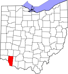 | |
| Villages | ||
| Townships | ||
| CDPs | ||
| Unincorporated communities |
| |
| Ghost towns | ||
| Footnotes | ‡This populated place also has portions in an adjacent county or counties | |