Asbury, Iowa
| Asbury, Iowa | |
|---|---|
| City | |
| Motto: "You're Home." | |
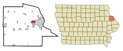 Location in the State of Iowa | |
| Coordinates: 42°30′56″N 90°45′48″W / 42.51556°N 90.76333°WCoordinates: 42°30′56″N 90°45′48″W / 42.51556°N 90.76333°W | |
| Country |
|
| State |
|
| County | Dubuque |
| Incorporated | 1933 |
| Government | |
| • Mayor | Jim Adams |
| Area[1] | |
| • City | 2.66 sq mi (6.89 km2) |
| • Land | 2.66 sq mi (6.89 km2) |
| • Water | 0 sq mi (0 km2) |
| Elevation | 932 ft (284 m) |
| Population (2010)[2] | |
| • City | 5,451 (according to special census in 2,016) |
| • Estimate (2012[3]) | 4,866 |
| • Density | 1,567.7/sq mi (605.3/km2) |
| • Metro | 92,359 |
| Time zone | CST (UTC-6) |
| • Summer (DST) | CDT (UTC-5) |
| ZIP code | 52002 |
| Area code(s) | 563 |
| FIPS code | 19-03160 |
| GNIS feature ID | 0454247 |
| Website | www.cityofasbury.com |

Asbury is a city in Dubuque County, Iowa, United States, and a suburb of the city of Dubuque. It is part of the Dubuque, Iowa Metropolitan Statistical Area. The population was 4,357 at the 2010 census.[4] Asbury is the second-largest city in Dubuque County, surpassing Dyersville, Iowa to become the second-largest in the 2010 U.S. Census count. The city is largely a bedroom community, made up of spacious, new subdivisions whose residents work in Dubuque or Peosta, Iowa.
History
Asbury was settled beginning in the 1830s, at first by Methodists. The city is named after British-born Bishop Francis Asbury, one of the first two bishops of the Methodist Episcopal Church in the United States. The city was incorporated in 1933, following the passage of the Twenty-first Amendment to the United States Constitution, which ended prohibition. The city incorporated to gain the legal standing necessary to sell alcohol, as liquor licenses were still forbidden in rural areas.[5]
For most of its history, Asbury was very small, much like hundreds of other towns in rural Iowa. In the 1960 census, Asbury still had only 71 residents. During this time, the City of Dubuque grew immensely, and the sprawl reached the Asbury area beginning in the 1960s. By 1970, Asbury had 410 residents and had grown fast enough to become the fastest growing city in the state of Iowa.[5]
Asbury continues to grow at a rapid pace today, expanding over 50% since the year 2000, and currently (2010) counts 4,357 residents. This number is certain to increase, as an ever-growing number of new subdivisions are being built or planned for the area.
Law and government
Asbury has a mayor-council form of government, employing a full-time city administrator, and part-time city council (mayor and 5 at-large city council members). The city administrator is Beth Bonz, the current mayor is Jim Adams, and the council members are: Bob Reisch, Craig Miller, John Richey, Curt Kiessling and Larry Nagle. The city council meets at 7 P.M. on the second and fourth Tuesdays of every month at Asbury City Hall.[6]
The city council works on the advice of a number of citizen committees, including the following: Building Code Commission, Park & Recreation Board, Planning & Zoning Commission, Zoning Board of Adjustment, and the Water Board. In addition, Asbury sends commissioners to the Eastern Iowa Housing Authority.[7]
Asbury has 3 city departments: Public Safety (police & fire), Public Works, and Parks.
In the Iowa General Assembly, Asbury is represented by Senator Tom Hancock (D-Epworth) in the Iowa Senate, and Representative Steven Lukan (R-New Vienna) in the Iowa House of Representatives. At the federal level, it is within Iowa's 1st congressional district, represented by Bruce Braley (D-Waterloo) in the U.S. House of Representatives. Asbury, and all of Iowa, are represented by U.S. Senators Chuck Grassley (R) and Tom Harkin (D).
Geography
Asbury is located at 42°30′56″N 90°45′48″W / 42.51556°N 90.76333°W (42.515648, -90.763235).[8]
According to the United States Census Bureau, the city has a total area of 2.66 square miles (6.89 km2), all of it land.[1]
The city operates three parks and a pedestrian trail. The parks include: Althaus Wetland & Nature Preserve, Asbury Park, and Maple Hills Park. The trail runs from Asbury Rd. to Maple Hills Park, and is part of Asbury's plan for having a city-wide trail network.[9]
Economy
Serving primarily as a bedroom community, Asbury has only a small local economy. Most of its residents commute to work in Dubuque. Only a handful of businesses operate within the City of Asbury, however, this number has grown in recent years, along with an expanding population. Most people who do work in Asbury either are employed by the city government, or in the service-related businesses along Asbury and Saratoga Roads.
Demographics
| Historical populations | ||
|---|---|---|
| Year | Pop. | ±% |
| 1940 | 27 | — |
| 1950 | 52 | +92.6% |
| 1960 | 71 | +36.5% |
| 1970 | 410 | +477.5% |
| 1980 | 2,017 | +392.0% |
| 1990 | 2,013 | −0.2% |
| 2000 | 2,450 | +21.7% |
| 2010 | 4,170 | +70.2% |
| 2014 | 5,171 | +24.0% |
| 2015 | 5,291 | +2.3% |
| Source:"American FactFinder". United States Census Bureau. and Iowa Data Center Source: | ||
2010 census
As of the census[2] of 2010, there were 4,170 people, 1,433 households, and 1,164 families residing in the city. The population density was 1,567.7 inhabitants per square mile (605.3/km2). There were 1,463 housing units at an average density of 550.0 per square mile (212.4/km2). The racial makeup of the city was 96.8% White, 1.0% African American, 1.1% Asian, 0.3% from other races, and 0.8% from two or more races. Hispanic or Latino of any race were 1.4% of the population.
There were 1,433 households of which 45.4% had children under the age of 18 living with them, 71.5% were married couples living together, 7.0% had a female householder with no husband present, 2.8% had a male householder with no wife present, and 18.8% were non-families. 15.3% of all households were made up of individuals and 5.7% had someone living alone who was 65 years of age or older. The average household size was 2.91 and the average family size was 3.27.
The median age in the city was 35.6 years. 32.9% of residents were under the age of 18; 6% were between the ages of 18 and 24; 26% were from 25 to 44; 25.4% were from 45 to 64; and 9.9% were 65 years of age or older. The gender makeup of the city was 49.2% male and 50.8% female.
2000 census
As of the census[11] of 2000, there were 2,450 people, 846 households, and 728 families residing in the city. The population density was 971.8 people per square mile (375.4/km²). There were 867 housing units at an average density of 343.9 per square mile (132.8/km²). The racial makeup of the city was 98.49% White, 0.49% African American, 0.37% Asian, 0.04% Pacific Islander, 0.24% from other races, and 0.37% from two or more races. Hispanic or Latino of any race were 0.73% of the population.
There were 846 households out of which 44.4% had children under the age of 18 living with them, 77.8% were married couples living together, 6.6% had a female householder with no husband present, and 13.9% were non-families. 11.0% of all households were made up of individuals and 2.8% had someone living alone who was 65 years of age or older. The average household size was 2.90 and the average family size was 3.13.
30.7% are under the age of 18, 7.1% from 18 to 24, 27.7% from 25 to 44, 27.8% from 45 to 64, and 6.7% who were 65 years of age or older. The median age was 36 years. For every 100 females there were 98.5 males. For every 100 females age 18 and over, there were 98.5 males.
The median income for a household in the city was $60,100, and the median income for a family was $64,097. Males had a median income of $41,935 versus $25,337 for females. The per capita income for the city was $21,447. About 4.5% of families and 4.0% of the population were below the poverty line, including 4.3% of those under age 18 and 7.9% of those age 65 or over.
Education
All students living in Asbury are zoned to schools in the Dubuque Community School District. Elementary school students living in the central, eastern, and southern parts of Asbury are zoned to Carver Elementary School.[12] Other students in northern, western, and southwestern Asbury (Arrowhead, Brook Haven, Forest Hills, Long Grove, Wedgewood) are zoned to Kennedy Elementary School.[13] Asbury's middle school students are zoned to Roosevelt Middle School,[14] and high school students are zoned to Hempstead High School.[15]
There are no private schools currently operating in Asbury, but many parochial school students attend private schools in Dubuque, as they are open to anyone, regardless of location. Many of these students are enrolled in the Holy Family Catholic School System, and attend nearby Resurrection Elementary School, Mazzuchelli Middle School, and Wahlert High School. There is also a private elementary school serving the Lutheran community in the area, the Dubuque Lutheran School (LCMS affiliated).
Neighborhoods
Asbury is a city of neighborhoods. Since the city is very young, and much of its growth has occurred only recently, its subdivisions are still clearly identifiable. Generally, eastern and southern parts of the city are older, while northern and western areas are of entirely new construction. Asbury's "main street" is Asbury Road, and most of the neighborhoods branch off of this artery. The city is growing at a phenomenal clip, adding 544 new single-family homes since 2000.[16]
References
- 1 2 "US Gazetteer files 2010". United States Census Bureau. Archived from the original on 2012-01-24. Retrieved 2012-05-11.
- 1 2 "American FactFinder". United States Census Bureau. Retrieved 2012-05-11.
- ↑ "Population Estimates". United States Census Bureau. Archived from the original on 2013-06-17. Retrieved 2013-05-23.
- ↑ "Asbury population 2010" (PDF). Archived (PDF) from the original on 20 June 2011. Retrieved July 30, 2011.
- 1 2 "History of Asbury". Archived from the original on October 9, 2006. Retrieved January 2, 2007.
- ↑ "Asbury city council members". Archived from the original on October 9, 2006. Retrieved January 2, 2007.
- ↑ "Asbury boards & commissions". Archived from the original on October 9, 2006. Retrieved January 2, 2007.
- ↑ "US Gazetteer files: 2010, 2000, and 1990". United States Census Bureau. 2011-02-12. Retrieved 2011-04-23.
- ↑ "Asbury city parks". Archived from the original on October 9, 2006. Retrieved January 2, 2007.
- ↑ "Census of Population and Housing". Census.gov. Archived from the original on May 11, 2015. Retrieved June 4, 2015.
- ↑ "American FactFinder". United States Census Bureau. Archived from the original on 2013-09-11. Retrieved 2008-01-31.
- ↑ "Carver ES boundaries". Retrieved January 2, 2007.
- ↑ "Kennedy ES boundaries". Retrieved January 2, 2007.
- ↑ "Roosevelt MS boundaries" (PDF). Retrieved January 2, 2007.
- ↑ "Hempstead HS boundaries" (PDF). Retrieved January 2, 2007.
- ↑ "Asbury single-family residential construction". Retrieved July 11, 2008.
External links
Municipalities and communities of Dubuque County, Iowa, United States | ||
|---|---|---|
| Cities | ||
| Townships | ||
| Unincorporated communities | ||
| Footnotes | ‡This populated place also has portions in an adjacent county or counties | |