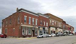
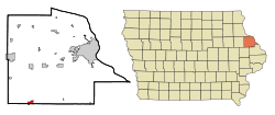
Cascade, Iowa
| Cascade, Iowa | |
|---|---|
| City | |
 | |
| Motto: "The Place We Call Home" | |
 Location in Iowa | |
| Coordinates: 42°17′51″N 91°00′44″W / 42.297535°N 91.012215°WCoordinates: 42°17′51″N 91°00′44″W / 42.297535°N 91.012215°W | |
| Country |
|
| State |
|
| Counties | Dubuque, Jones |
| Area[1] | |
| • City | 1.87 sq mi (4.84 km2) |
| • Land | 1.87 sq mi (4.84 km2) |
| • Water | 0 sq mi (0 km2) |
| Elevation | 827 ft (252 m) |
| Population (2010)[2] | |
| • City | 2,159 |
| • Estimate (2012[3]) | 2,202 |
| • Density | 1,154.5/sq mi (445.8/km2) |
| • Metro | 92,384 |
| Time zone | CST (UTC-6) |
| • Summer (DST) | CDT (UTC-5) |
| ZIP code | 52033 |
| Area code(s) | 563 |
| FIPS code | 19-11305 |
| GNIS feature ID | 0455196 |
| Website | www.cascadeiowa.org |

Cascade is a city in Dubuque County and Jones County, Iowa, United States. The Dubuque County portion is part of Dubuque Metropolitan Statistical Area, while the Jones County portion is part of Cedar Rapids Metropolitan Statistical Area. The population was 2,159 at the 2010 census, up from 1,958 at the 2000 census. The city is located at the southwestern edge of Dubuque County, at the border of Dubuque and Jones Counties.
Arguably the town's most notable historic event was the 1925 flood. Between 1880 and 1936 the town was connected to Bellevue via the Chicago, St. Paul & Milwaukee Railway Company.
U.S. Route 151 runs through Cascade but in 2002 a four-lane bypass took traffic north around the city. Iowa Highway 136 runs from north to south through Cascade.
Geography
According to the United States Census Bureau, the city has a total area of 1.87 square miles (4.84 km2), all of it land.[1] The North Fork Maquoketa River passes through Cascade.
Cascade is 25 miles southwest of Dubuque.
Demographics
| Historical populations | ||
|---|---|---|
| Year | Pop. | ±% |
| 1880 | 762 | — |
| 1890 | 955 | +25.3% |
| 1900 | 1,266 | +32.6% |
| 1910 | 1,268 | +0.2% |
| 1920 | 1,249 | −1.5% |
| 1930 | 1,221 | −2.2% |
| 1940 | 1,376 | +12.7% |
| 1950 | 1,299 | −5.6% |
| 1960 | 1,601 | +23.2% |
| 1970 | 1,744 | +8.9% |
| 1980 | 1,912 | +9.6% |
| 1990 | 1,812 | −5.2% |
| 2000 | 1,958 | +8.1% |
| 2010 | 2,159 | +10.3% |
| 2014 | 2,252 | +4.3% |
| 2015 | 2,271 | +0.8% |
| Source:"American FactFinder". United States Census Bureau. and Iowa Data Center Source: | ||
2010 census
As of the census[2] of 2010, there were 2,159 people, 880 households, and 578 families residing in the city. The population density was 1,154.5 inhabitants per square mile (445.8/km2). There were 974 housing units at an average density of 520.9 per square mile (201.1/km2). The racial makeup of the city was 96.2% White, 0.4% African American, 0.1% Native American, 0.2% Asian, 0.2% Pacific Islander, 2.5% from other races, and 0.4% from two or more races. Hispanic or Latino of any race were 3.6% of the population.
There were 880 households of which 32.3% had children under the age of 18 living with them, 53.4% were married couples living together, 8.5% had a female householder with no husband present, 3.8% had a male householder with no wife present, and 34.3% were non-families. 29.4% of all households were made up of individuals and 14.5% had someone living alone who was 65 years of age or older. The average household size was 2.39 and the average family size was 2.99.
The median age in the city was 38.7 years. 26.2% of residents were under the age of 18; 7% were between the ages of 18 and 24; 24% were from 25 to 44; 23.3% were from 45 to 64; and 19.4% were 65 years of age or older. The gender makeup of the city was 49.0% male and 51.0% female.
2000 census
As of the census[5] of 2000, there were 1,958 people, 776 households, and 511 families residing in the city. The population density was 1,731.2 people per square mile (669.0/km²). There were 820 housing units at an average density of 725.0 per square mile (280.2/km²). The racial makeup of the city was 99.28% White, 0.10% Native American, 0.10% Asian, and 0.51% from two or more races. Hispanic or Latino of any race were 0.31% of the population.
There were 776 households out of which 32.7% had children under the age of 18 living with them, 56.7% were married couples living together, 6.4% had a female householder with no husband present, and 34.1% were non-families. 29.9% of all households were made up of individuals and 13.3% had someone living alone who was 65 years of age or older. The average household size was 2.44 and the average family size was 3.08.
26.0% are under the age of 18, 8.6% from 18 to 24, 26.6% from 25 to 44, 20.0% from 45 to 64 and 18.8% who were 65 years of age or older. The median age was 37 years. For every 100 females there were 99.8 males. For every 100 females age 18 and over, there were 94.4 males.
The median income for a household in the city was $40,273, and the median income for a family was $47,813. Males had a median income of $31,324 versus $22,209 for females. The per capita income for the city was $18,280. About 7.8% of families and 11.1% of the population were below the poverty line, including 12.4% of those under age 18 and 13.4% of those age 65 or over.
Government
In the Iowa General Assembly, Cascade is represented by Senator Todd Bowman (D-Maquoketa) in the Iowa Senate, and Representative Brian Moore (R-Bellevue) in the Iowa House of Representatives. At federal level, it is within Iowa's 1st congressional district, represented by Rod Blum (R-Dubuque) in the U.S. House of Representatives. Cascade, and all of Iowa, are represented by U.S. Senators Chuck Grassley (R) and Joni Ernst (R).
Education
All public school students living in Cascade are zoned to schools in the Western Dubuque Community School District. Students first attend Cascade Elementary School for grades K-6, then the consolidated Cascade Junior-Senior High School for grades 7-12 (both in Cascade).
Cascade has a private school. Parochial school students attend Aquin Elementary School (in Cascade) for grades K-8, then Beckman High School (in Dyersville) for grades 9-12. These schools are affiliated with the Roman Catholic Church, and are a part of the Roman Catholic Archdiocese of Dubuque.
Notable people
- Gary Dolphin, broadcast announcer for University of Iowa basketball and football
- Red Faber, Chicago White Sox pitcher
- Julie Hosch, farmer and Iowa state legislator
- Loras Thomas Lane, Roman Catholic bishop
- Greg McDermott, head men's basketball coach at Creighton University
- William Menster, Roman Catholic priest
- Jeremie Miller, founder of the Jabber project
- Colin Rea, Pitcher for the San Diego Padres
References
- 1 2 "US Gazetteer files 2010". United States Census Bureau. Archived from the original on 2012-07-14. Retrieved 2012-05-11.
- 1 2 "American FactFinder". United States Census Bureau. Retrieved 2012-05-11.
- ↑ "Population Estimates". United States Census Bureau. Archived from the original on 2013-06-17. Retrieved 2013-05-23.
- ↑ "Census of Population and Housing". Census.gov. Archived from the original on April 22, 2013. Retrieved June 4, 2015.
- ↑ "American FactFinder". United States Census Bureau. Archived from the original on 2013-09-11. Retrieved 2008-01-31.
External links
| Wikimedia Commons has media related to Cascade, Iowa. |
- Portal style website Government, Historical Society, Chamber of Commerce and more
- City Data Comprehensive Statistical Data and more about Cascade
Municipalities and communities of Dubuque County, Iowa, United States | ||
|---|---|---|
| Cities | ||
| Townships | ||
| Unincorporated communities | ||
| Footnotes | ‡This populated place also has portions in an adjacent county or counties | |
Municipalities and communities of Jones County, Iowa, United States | ||
|---|---|---|
| Cities | ||
| Townships | ||
| CDP | ||
| Other unincorporated communities | ||
| Footnotes | ‡This populated place also has portions in an adjacent county or counties | |