Ashland, Missouri
| Ashland, Missouri | |
|---|---|
| City | |
 Location of Ashland, Missouri | |
| Coordinates: 38°46′24″N 92°15′28″W / 38.77333°N 92.25778°WCoordinates: 38°46′24″N 92°15′28″W / 38.77333°N 92.25778°W | |
| Country | United States |
| State | Missouri |
| County | Boone |
| Founded | 1853 |
| Government[1] | |
| • Mayor | Gene Rhrorer |
| • Administrator | Josh Hawkins |
| Area[2] | |
| • Total | 4.80 sq mi (12.43 km2) |
| • Land | 4.79 sq mi (12.41 km2) |
| • Water | 0.01 sq mi (0.03 km2) |
| Elevation | 902 ft (275 m) |
| Population (2010)[3] | |
| • Total | 3,707 |
| • Estimate (2012[4]) | 3,812 |
| • Density | 773.9/sq mi (298.8/km2) |
| Time zone | Central (CST) (UTC-6) |
| • Summer (DST) | CDT (UTC-5) |
| ZIP code | 65010 |
| Area code(s) | 573 |
| FIPS code | 29-02242[5] |
| GNIS feature ID | 0713434[6] |
| Website | ashlandmo.us |
Ashland is a city in Boone County, Missouri, United States. Ashland is part of the Columbia, Missouri Metropolitan Statistical Area. The population was 3,707 at the 2010 census.
History
Ashland was founded in 1853.[7] It was named from the Ashland estate of Kentucky Congressman Henry Clay in Lexington, Kentucky.[8] Clay was instrumental in the Missouri Compromise of 1820, which allowed Missouri's admission as the 24th state.
Geography
Ashland is located at 38°46′24″N 92°15′28″W / 38.77333°N 92.25778°W (38.773394, -92.257856).[9] According to the United States Census Bureau, the city has a total area of 4.80 square miles (12.43 km2), of which, 4.79 square miles (12.41 km2) is land and 0.01 square miles (0.03 km2) is water.[2]
Demographics
| Historical population | |||
|---|---|---|---|
| Census | Pop. | %± | |
| 1880 | 371 | — | |
| 1890 | 373 | 0.5% | |
| 1900 | 401 | 7.5% | |
| 1910 | 341 | −15.0% | |
| 1920 | 342 | 0.3% | |
| 1930 | 314 | −8.2% | |
| 1940 | 434 | 38.2% | |
| 1950 | 416 | −4.1% | |
| 1960 | 495 | 19.0% | |
| 1970 | 769 | 55.4% | |
| 1980 | 1,021 | 32.8% | |
| 1990 | 1,252 | 22.6% | |
| 2000 | 1,869 | 49.3% | |
| 2010 | 3,707 | 98.3% | |
| Est. 2015 | 3,865 | [10] | 4.3% |
2010 census
As of the census[3] of 2010, there were 3,707 people, 1,428 households, and 990 families residing in the city. The population density was 773.9 inhabitants per square mile (298.8/km2). There were 1,530 housing units at an average density of 319.4 per square mile (123.3/km2). The racial makeup of the city was 96.7% White, 0.8% African American, 0.3% Native American, 0.5% Asian, 0.4% from other races, and 1.3% from two or more races. Hispanic or Latino of any race were 1.5% of the population.
There were 1,428 households of which 42.4% had children under the age of 18 living with them, 51.4% were married couples living together, 13.8% had a female householder with no husband present, 4.1% had a male householder with no wife present, and 30.7% were non-families. 25.8% of all households were made up of individuals and 10.1% had someone living alone who was 65 years of age or older. The average household size was 2.54 and the average family size was 3.07.
The median age in the city was 33.9 years. 29.4% of residents were under the age of 18; 6.1% were between the ages of 18 and 24; 31.4% were from 25 to 44; 22% were from 45 to 64; and 11.3% were 65 years of age or older. The gender makeup of the city was 47.0% male and 53.0% female.
2000 census
At the 2000 census,[5] there were 1,869 people, 748 households and 495 families residing in the city. The population density was 2,106.7 per square mile (810.8/km²). There were 820 housing units at an average density of 924.3 per square mile (355.7/km²). The racial makeup of the city was 97.27% White, 0.43% African American, 0.43% Native American, 0.43% Asian, 0.80% from other races, and 0.64% from two or more races. Hispanic or Latino of any race were 1.34% of the population.
There were 748 households of which 37.4% had children under the age of 18 living with them, 46.4% were married couples living together, 17.4% had a female householder with no husband present, and 33.7% were non-families. 27.0% of all households were made up of individuals and 10.2% had someone living alone who was 65 years of age or older. The average household size was 2.37 and the average family size was 2.87.
27.2% of the population were under the age of 18, 8.3% from 18 to 24, 32.7% from 25 to 44, 16.3% from 45 to 64, and 15.5% who were 65 years of age or older. The median age was 33 years. For every 100 females there were 82.5 males. For every 100 females age 18 and over, there were 79.8 males.
The median household income was $34,750 and the median family income was $41,136. Males had a median income of $28,203 versus $24,180 for females. The per capita income for the city was $15,938. About 8.9% of families and 10.3% of the population were below the poverty line, including 14.9% of those under age 18 and 9.4% of those age 65 or over.
Education
Ashland is served by the Southern Boone County R-1 Public School District. The district's schools include:
- Southern Boone County High School (Grades 9 through 12)
- Southern Boone County Middle School (Grades 6 through 8)
- Southern Boone County Elementary School (Grades 3 through 5)
- Southern Boone County Primary School (Pre-School through Second Grade and Parents As Teachers)
Library
The Southern Boone County Public Library, a branch of the Daniel Boone Regional Library, is in Ashland.
References
- ↑ Ashland City Government Archived August 3, 2014, at the Wayback Machine.
- 1 2 "US Gazetteer files 2010". United States Census Bureau. Archived from the original on 2012-01-24. Retrieved 2012-07-08.
- 1 2 "American FactFinder". United States Census Bureau. Retrieved 2012-07-08.
- ↑ "Population Estimates". United States Census Bureau. Archived from the original on 2013-06-17. Retrieved 2013-05-30.
- 1 2 "American FactFinder". United States Census Bureau. Archived from the original on 2013-09-11. Retrieved 2008-01-31.
- ↑ "US Board on Geographic Names". United States Geological Survey. 2007-10-25. Retrieved 2008-01-31.
- ↑ Ramsay, Robert L. (1952). Our Storehouse of Missouri Place Names. University of Missouri Press. p. 22.
- ↑ "Citizen's Handbook for the City of Ashland" (PDF). Retrieved 2012-02-02.
- ↑ "US Gazetteer files: 2010, 2000, and 1990". United States Census Bureau. 2011-02-12. Retrieved 2011-04-23.
- ↑ "Annual Estimates of the Resident Population for Incorporated Places: April 1, 2010 to July 1, 2015". Retrieved July 2, 2016.
- ↑ "Census of Population and Housing". Census.gov. Archived from the original on May 11, 2015. Retrieved June 4, 2015.
External links
- City of Ashland Official site
- Daniel Boone Regional Library - Southern Boone County Public Library
- Southern Boone County R-1 School District
- Boone County Journal, local newspaper
- Historic Sanborn Map of Ashland (1922) from University of Missouri Digital Library
Municipalities and communities of Boone County, Missouri, United States | ||
|---|---|---|
| Cities | 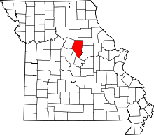 | |
| Villages | ||
| Townships | ||
| Unincorporated communities | ||
| Ghost towns | ||
| Footnotes | ‡This populated place also has portions in an adjacent county or counties | |