Aspin-Aure
| Aspin-Aure | ||
|---|---|---|
|
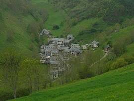
The village seen from the road to the Col d'Aspin | ||
| ||
 Aspin-Aure | ||
|
Location within Occitanie region  Aspin-Aure | ||
| Coordinates: 42°55′59″N 0°20′28″E / 42.9331°N 0.3411°ECoordinates: 42°55′59″N 0°20′28″E / 42.9331°N 0.3411°E | ||
| Country | France | |
| Region | Occitanie | |
| Department | Hautes-Pyrénées | |
| Arrondissement | Bagnères-de-Bigorre | |
| Canton | Arreau | |
| Intercommunality | Aure | |
| Government | ||
| • Mayor (2008–2014) | Jean Fourtine | |
| Area1 | 12.27 km2 (4.74 sq mi) | |
| Population (2009)2 | 55 | |
| • Density | 4.5/km2 (12/sq mi) | |
| Time zone | CET (UTC+1) | |
| • Summer (DST) | CEST (UTC+2) | |
| INSEE/Postal code | 65039 / 65240 | |
| Elevation |
739–1,759 m (2,425–5,771 ft) (avg. 900 m or 3,000 ft) | |
|
1 French Land Register data, which excludes lakes, ponds, glaciers > 1 km² (0.386 sq mi or 247 acres) and river estuaries. 2 Population without double counting: residents of multiple communes (e.g., students and military personnel) only counted once. | ||
.svg.png)
Aspin-Aure is a commune in the Hautes-Pyrénées department in southwestern France.
Population
| Historical population | ||
|---|---|---|
| Year | Pop. | ±% |
| 1962 | 78 | — |
| 1968 | 82 | +5.1% |
| 1975 | 64 | −22.0% |
| 1982 | 69 | +7.8% |
| 1990 | 51 | −26.1% |
| 1999 | 42 | −17.6% |
| 2007 | 52 | +23.8% |
| 2009 | 55 | +5.8% |
See also
References
| Wikimedia Commons has media related to Aspin-Aure. |
This article is issued from Wikipedia - version of the 9/16/2015. The text is available under the Creative Commons Attribution/Share Alike but additional terms may apply for the media files.