Baltic, Ohio
| Baltic, Ohio | |
|---|---|
| Village | |
|
Baltic Elementary School | |
 Location of Baltic, Ohio | |
 Location of Baltic in Tuscarawas County | |
| Coordinates: 40°26′36″N 81°42′10″W / 40.44333°N 81.70278°WCoordinates: 40°26′36″N 81°42′10″W / 40.44333°N 81.70278°W | |
| Country | United States |
| State | Ohio |
| Counties | Tuscarawas, Holmes, Coshocton |
| Townships | Bucks, Clark |
| Area[1] | |
| • Total | 0.80 sq mi (2.07 km2) |
| • Land | 0.80 sq mi (2.07 km2) |
| • Water | 0 sq mi (0 km2) |
| Elevation[2] | 1,066 ft (325 m) |
| Population (2010)[3] | |
| • Total | 795 |
| • Estimate (2012[4]) | 800 |
| • Density | 993.8/sq mi (383.7/km2) |
| Time zone | Eastern (EST) (UTC−5) |
| • Summer (DST) | EDT (UTC−4) |
| ZIP code | 43804 |
| Area code | 330 |
| FIPS code | 39-03744[5] |
| GNIS feature ID | 1064377[2] |

Baltic is a village in Coshocton, Holmes, and Tuscarawas counties in the U.S. state of Ohio. The population was 795 at the 2010 census. The Raber's Almanac for the Amish community is published here. Baltic is also home to the garage door opener factory of The Genie Company, one of the few companies to manufacture them in the USA.
Baltic was originally called Rowville, and under the latter name was platted in 1848.[6]
Geography
Baltic is located at 40°26′36″N 81°42′10″W / 40.44333°N 81.70278°W (40.443367, -81.702656).[7]
According to the United States Census Bureau, the village has a total area of 0.80 square miles (2.07 km2), all land.[1] Baltic is one hour and forty five minutes south of Cleveland, Ohio.
Demographics
| Historical population | |||
|---|---|---|---|
| Census | Pop. | %± | |
| 1910 | 377 | — | |
| 1920 | 406 | 7.7% | |
| 1930 | 545 | 34.2% | |
| 1940 | 492 | −9.7% | |
| 1950 | 493 | 0.2% | |
| 1960 | 537 | 8.9% | |
| 1970 | 571 | 6.3% | |
| 1980 | 563 | −1.4% | |
| 1990 | 659 | 17.1% | |
| 2000 | 743 | 12.7% | |
| 2010 | 795 | 7.0% | |
| Est. 2015 | 789 | [8] | −0.8% |
90.2% spoke English, 5.3% German, 2.3% Dutch and Pennsylvania German as their first language.[10]
2010 census
As of the census[3] of 2010, there were 795 people, 277 households, and 187 families residing in the village. The population density was 993.8 inhabitants per square mile (383.7/km2). There were 298 housing units at an average density of 372.5 per square mile (143.8/km2). The racial makeup of the village was 98.5% White, 0.6% African American, 0.1% Asian, and 0.8% from two or more races. Hispanic or Latino of any race were 0.3% of the population. 65.1% were of German, 14.3% Irish, 9.5% Swiss, and 5.8% English descent.[11]
There were 277 households of which 33.9% had children under the age of 18 living with them, 54.5% were married couples living together, 8.7% had a female householder with no husband present, 4.3% had a male householder with no wife present, and 32.5% were non-families. 27.1% of all households were made up of individuals and 15.6% had someone living alone who was 65 years of age or older. The average household size was 2.53 and the average family size was 3.11.
The median age in the village was 40.9 years. 25.2% of residents were under the age of 18; 6.1% were between the ages of 18 and 24; 23.9% were from 25 to 44; 23.5% were from 45 to 64; and 21.4% were 65 years of age or older. The gender makeup of the village was 50.1% male and 49.9% female.
2000 census
As of the census[5] of 2000, there were 743 people, 275 households, and 196 families residing in the village. The population density was 891.0 people per square mile (345.6/km²). There were 286 housing units at an average density of 343.0 per square mile (133.0/km²). The racial makeup of the village was 98.65% White, 0.13% African American, 0.13% Native American, 0.27% Asian, and 0.81% from two or more races. Hispanic or Latino of any race were 0.13% of the population.
There were 275 households out of which 32.7% had children under the age of 18 living with them, 58.9% were married couples living together, 9.5% had a female householder with no husband present, and 28.7% were non-families. 26.9% of all households were made up of individuals and 10.9% had someone living alone who was 65 years of age or older. The average household size was 2.42 and the average family size was 2.94.
In the village the population was spread out with 22.7% under the age of 18, 7.1% from 18 to 24, 28.4% from 25 to 44, 18.4% from 45 to 64, and 23.3% who were 65 years of age or older. The median age was 39 years. For every 100 females there were 101.4 males. For every 100 females age 18 and over, there were 92.6 males.
The median income for a household in the village was $33,625, and the median income for a family was $41,944. Males had a median income of $28,750 versus $19,766 for females. The per capita income for the village was $15,820. About 4.3% of families and 5.7% of the population were below the poverty line, including 9.5% of those under age 18 and 2.8% of those age 65 or over.
Notable people
- Owen Scheetz, who appeared in six games for the Washington Senators during the 1943 season
- Robert P. Schumaker, Associate Professor at University of Texas at Tyler. Creator of the AZFinText textual financial prediction system and Sports Analytics expert.
References
- 1 2 "US Gazetteer files 2010". United States Census Bureau. Archived from the original on January 24, 2012. Retrieved 2013-01-06.
- 1 2 "US Board on Geographic Names". United States Geological Survey. 2007-10-25. Retrieved 2008-01-31.
- 1 2 "American FactFinder". United States Census Bureau. Retrieved 2013-01-06.
- ↑ "Population Estimates". United States Census Bureau. Retrieved 2013-06-17.
- 1 2 "American FactFinder". United States Census Bureau. Archived from the original on September 11, 2013. Retrieved 2008-01-31.
- ↑ Overman, William Daniel (1958). Ohio Town Names. Akron, OH: Atlantic Press. p. 8.
- ↑ "US Gazetteer files: 2010, 2000, and 1990". United States Census Bureau. 2011-02-12. Retrieved 2011-04-23.
- ↑ "Annual Estimates of the Resident Population for Incorporated Places: April 1, 2010 to July 1, 2015". Retrieved July 2, 2016.
- ↑ "Census of Population and Housing". Census.gov. Archived from the original on May 11, 2015. Retrieved June 4, 2015.
- ↑ http://www.mla.org/map_data_results&state_id=39&place_id=3744&cty_id=
- ↑ http://factfinder2.census.gov/faces/tableservices/jsf/pages/productview.xhtml?pid=ACS_10_5YR_DP02&prodType=table
Municipalities and communities of Coshocton County, Ohio, United States | ||
|---|---|---|
| City | 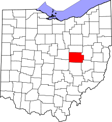 | |
| Villages | ||
| Townships | ||
| CDPs | ||
| Unincorporated communities |
| |
| Ghost towns | ||
| Footnotes | ‡This populated place also has portions in an adjacent county or counties | |
Municipalities and communities of Holmes County, Ohio, United States | ||
|---|---|---|
| Villages | 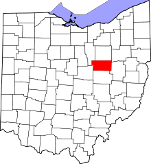 | |
| Townships | ||
| CDPs | ||
| Unincorporated communities | ||
| Footnotes | ‡This populated place also has portions in an adjacent county or counties | |
Municipalities and communities of Tuscarawas County, Ohio, United States | ||
|---|---|---|
| Cities | 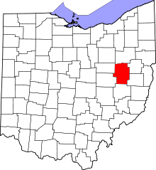 | |
| Villages | ||
| Townships | ||
| CDPs | ||
| Unincorporated communities | ||
| Ghost town | ||
| Footnotes | ‡This populated place also has portions in an adjacent county or counties | |