Bartenheim
| Bartenheim Bàrtene | ||
|---|---|---|
|
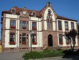
Town hall of Bartenheim | ||
| ||
 Bartenheim | ||
|
Location within Grand Est region  Bartenheim | ||
| Coordinates: 47°38′08″N 7°28′36″E / 47.6356°N 7.4767°ECoordinates: 47°38′08″N 7°28′36″E / 47.6356°N 7.4767°E | ||
| Country | France | |
| Region | Grand Est | |
| Department | Haut-Rhin | |
| Arrondissement | Mulhouse | |
| Canton | Sierentz | |
| Intercommunality | Trois Frontières | |
| Government | ||
| • Mayor (2001–2008) | Jacques Ginther | |
| Area1 | 12.86 km2 (4.97 sq mi) | |
| Population (2006)2 | 3,486 | |
| • Density | 270/km2 (700/sq mi) | |
| Time zone | CET (UTC+1) | |
| • Summer (DST) | CEST (UTC+2) | |
| INSEE/Postal code | 68021 / 68870 | |
| Elevation |
237–311 m (778–1,020 ft) (avg. 260 m or 850 ft) | |
|
1 French Land Register data, which excludes lakes, ponds, glaciers > 1 km² (0.386 sq mi or 247 acres) and river estuaries. 2 Population without double counting: residents of multiple communes (e.g., students and military personnel) only counted once. | ||
.svg.png)
Bartenheim (French pronunciation: [baʁtɛnaim]; Alsatian: Bàrtene[1]) is a commune in the Haut-Rhin department in Alsace in north-eastern France.
It is situated northwest of the EuroAirport Basel-Mulhouse-Freiburg, on the eastern edge of Sundgau.
See also
References
| Wikimedia Commons has media related to Bartenheim. |
This article is issued from Wikipedia - version of the 9/16/2015. The text is available under the Creative Commons Attribution/Share Alike but additional terms may apply for the media files.