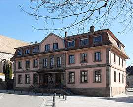
Burnhaupt-le-Haut
| Burnhaupt-le-Haut Ewer-Burnhàuipt | ||
|---|---|---|
 | ||
| ||
 Burnhaupt-le-Haut | ||
|
Location within Grand Est region  Burnhaupt-le-Haut | ||
| Coordinates: 47°43′51″N 7°08′46″E / 47.7308°N 7.1461°ECoordinates: 47°43′51″N 7°08′46″E / 47.7308°N 7.1461°E | ||
| Country | France | |
| Region | Grand Est | |
| Department | Haut-Rhin | |
| Arrondissement | Thann-Guebwiller | |
| Canton | Masevaux | |
| Intercommunality | Vallée de la Doller et du Soultzbach | |
| Government | ||
| • Mayor (2008–2014) | Antoine Muller | |
| Area1 | 12.49 km2 (4.82 sq mi) | |
| Population (2006)2 | 1,630 | |
| • Density | 130/km2 (340/sq mi) | |
| Time zone | CET (UTC+1) | |
| • Summer (DST) | CEST (UTC+2) | |
| INSEE/Postal code | 68060 / 68520 | |
| Elevation |
290–338 m (951–1,109 ft) (avg. 300 m or 980 ft) | |
| Website | http://www.burnhaupt-le-haut.fr | |
|
1 French Land Register data, which excludes lakes, ponds, glaciers > 1 km² (0.386 sq mi or 247 acres) and river estuaries. 2 Population without double counting: residents of multiple communes (e.g., students and military personnel) only counted once. | ||

Burnhaupt-le-Haut (German: Oberburnhaupt) is a commune in the Haut-Rhin department in Grand Est in north-eastern France.
See also
References
| Wikimedia Commons has media related to Burnhaupt-le-Haut. |
This article is issued from Wikipedia - version of the 11/13/2016. The text is available under the Creative Commons Attribution/Share Alike but additional terms may apply for the media files.