Sainte-Croix-aux-Mines
| Sainte-Croix-aux-Mines | ||
|---|---|---|
 | ||
| ||
 Sainte-Croix-aux-Mines | ||
|
Location within Grand Est region  Sainte-Croix-aux-Mines | ||
| Coordinates: 48°15′46″N 7°13′34″E / 48.2628°N 7.2261°ECoordinates: 48°15′46″N 7°13′34″E / 48.2628°N 7.2261°E | ||
| Country | France | |
| Region | Grand Est | |
| Department | Haut-Rhin | |
| Arrondissement | Colmar-Ribeauvillé | |
| Canton | Sainte-Marie-aux-Mines | |
| Intercommunality | Val d'Argent | |
| Government | ||
| • Mayor (2008–2014) | Agnès Henrichs | |
| Area1 | 27.85 km2 (10.75 sq mi) | |
| Population (2006)2 | 2,079 | |
| • Density | 75/km2 (190/sq mi) | |
| Time zone | CET (UTC+1) | |
| • Summer (DST) | CEST (UTC+2) | |
| INSEE/Postal code | 68294 / 68160 | |
| Elevation |
290–980 m (950–3,220 ft) (avg. 316 m or 1,037 ft) | |
|
1 French Land Register data, which excludes lakes, ponds, glaciers > 1 km² (0.386 sq mi or 247 acres) and river estuaries. 2 Population without double counting: residents of multiple communes (e.g., students and military personnel) only counted once. | ||
.svg.png)
Sainte-Croix-aux-Mines (German: Sankt Kreuz im Lebertal) is a commune in the Haut-Rhin department in Grand Est in north-eastern France. It is part of the arrondissement of Colmar-Ribeauvillé.[1]
Coal mines were operating in the village until 1849.
See also
References
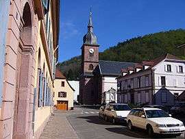
 View on Sainte Croix-au-mines
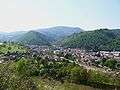
| Wikimedia Commons has media related to Sainte-Croix-aux-Mines. |
This article is issued from Wikipedia - version of the 11/13/2016. The text is available under the Creative Commons Attribution/Share Alike but additional terms may apply for the media files.