Bermuda Dunes, California
| Bermuda Dunes | |
|---|---|
| Census-designated place | |
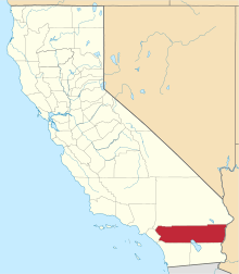
 Location in Riverside County and the state of California | |
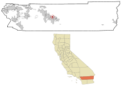
 Bermuda Dunes Location in the United States | |
| Coordinates: 33°44′40″N 116°17′7″W / 33.74444°N 116.28528°WCoordinates: 33°44′40″N 116°17′7″W / 33.74444°N 116.28528°W | |
| Country |
|
| State |
|
| County | Riverside |
| Area[1] | |
| • Total | 2.946 sq mi (7.630 km2) |
| • Land | 2.946 sq mi (7.630 km2) |
| • Water | 0 sq mi (0 km2) 0% |
| Elevation[2] | 95 ft (29 m) |
| Population (2010) | |
| • Total | 7,282 |
| • Density | 2,500/sq mi (950/km2) |
| Time zone | Pacific (UTC-8) |
| • Summer (DST) | PDT (UTC-7) |
| ZIP code | 92201 |
| Area codes | 442/760 |
| FIPS code | 06-06028 |
| GNIS feature IDs | 1866998, 2407831 |
Bermuda Dunes is a census-designated place (CDP) in Riverside County, California. The population was 7,282 at the 2010 census. Bermuda Dunes is located near Indio and 23 miles (37 km) east of Palm Springs.
Formerly the community's name was Myoma. The Bermuda Dunes Country Club was developed in 1958 by Ernie Dunlevie and Ray Ryan; it attracted celebrities such as Clark Gable as members.[3] Bermuda Dunes is served by the Bermuda Dunes Airport.
Geography
Bermuda Dunes is located at 33°44′40″N 116°17′7″W / 33.74444°N 116.28528°W (33.744503, -116.285241).[4]
The CDP's name originated from the Bermuda Dunes country club, a golf course community first opened in 1962 and the former site of the Bob Hope Chrysler Golf Classic. There are 10 other golf clubs and communities within the 5-mile (8.0 km) radius, including Sun City Palm Desert. Bermuda Dunes Airport is located in the community.
Public services
The area's public services: Education - the Desert Sands Unified School District, plus a private school: Christian Schools of the Desert, which is a preschool - grade 12 school. Electricity is provided by the Indio-based Imperial Irrigation District and Southern California Edison across Washington Street. Water is provided by both the IID the Myoma Dunes Water Company [5] and Telephone service is by Verizon.
According to the United States Census Bureau, the CDP has a total area of 2.9 square miles (7.5 km2), all of it land. The elevation of Bermuda Dunes is 30 feet (9.1 m) above sea level, but the surface drops by over 80 feet (24 m) from west to east.
The distance from Bermuda Dunes to Washington, D.C. is approximately 2,318 miles (3,730 km). The distance to Sacramento, the California state capital, is approximately 445 miles (716 km), and to Los Angeles, the state's largest city is 120 miles (190 km). Bermuda Dunes shares two ZIP codes with Indio: 92201 and 92203. Its telephone area code is 760.
Terrain and climate
Located in the Coachella Valley desert region, Bermuda Dunes is sheltered by the San Jacinto Mountains to the west, the Santa Rosa Mountains to the south and by the Little San Bernardino Mountains to the east. This geography gives Bermuda Dunes its hot, dry climate, with 354 days of sunshine and only 3.44 inches (87.4 mm) of rain annually.[6] Bermuda Dunes has a warm winter/hot summer climate: Its average annual high temperature is 89.5 °F (31.9 °C) and average annual low is 62.1 °F (16.7 °C) but summer highs above 110 °F (43 °C) are common and sometimes exceed 120 °F (49 °C), while summer night lows often stay above 82 °F (28 °C). Winters are warm with daytime highs often between 70–86 °F (21–30 °C) and corresponding night lows falling to 48 °F-68 °F (9 °C-20 °C). The mean annual temperature is 75.8 °F (24.3 °C).[7]
| Climate data for Bermuda Dunes, CA | |||||||||||||
|---|---|---|---|---|---|---|---|---|---|---|---|---|---|
| Month | Jan | Feb | Mar | Apr | May | Jun | Jul | Aug | Sep | Oct | Nov | Dec | Year |
| Record high °F (°C) | 97 (36) |
100 (38) |
103 (39) |
109 (43) |
117 (47) |
123 (51) |
125 (52) |
121 (49) |
122 (50) |
115 (46) |
101 (38) |
96 (36) |
125 (52) |
| Average high °F (°C) | 71.9 (22.2) |
75.3 (24.1) |
81.3 (27.4) |
87.5 (30.8) |
95.7 (35.4) |
103.1 (39.5) |
107.3 (41.8) |
106.6 (41.4) |
102.0 (38.9) |
91.9 (33.3) |
79.6 (26.4) |
71.0 (21.7) |
89.5 (31.9) |
| Average low °F (°C) | 44.6 (7) |
48.0 (8.9) |
54.8 (12.7) |
60.7 (15.9) |
67.7 (19.8) |
74.2 (23.4) |
80.3 (26.8) |
80.3 (26.8) |
74.0 (23.3) |
63.7 (17.6) |
51.8 (11) |
44.2 (6.8) |
62.1 (16.7) |
| Record low °F (°C) | 13 (−11) |
20 (−7) |
25 (−4) |
33 (1) |
38 (3) |
45 (7) |
59 (15) |
56 (13) |
46 (8) |
31 (−1) |
23 (−5) |
17 (−8) |
13 (−11) |
| Average precipitation inches (mm) | 0.56 (14.2) |
0.64 (16.3) |
0.43 (10.9) |
0.05 (1.3) |
0.07 (1.8) |
0.01 (0.3) |
0.04 (1) |
0.54 (13.7) |
0.04 (1) |
0.26 (6.6) |
0.18 (4.6) |
0.62 (15.7) |
3.44 (87.4) |
| Source: www.ncdc.noaa.gov [8] | |||||||||||||
Demographics and cultural characteristics
2010
The 2010 United States Census[9] reported that Bermuda Dunes had a population of 7,282. The population density was 2,471.7 people per square mile (954.3/km²). The racial makeup of Bermuda Dunes was 5,433 (74.6%) White (60.2% Non-Hispanic White),[10] 180 (2.5%) African American, 63 (0.9%) Native American, 241 (3.3%) Asian, 11 (0.2%) Pacific Islander, 1,126 (15.5%) from other races, and 228 (3.1%) from two or more races. Hispanic or Latino of any race were 2,371 persons (32.6%).
The Census reported that 7,277 people (99.9% of the population) lived in households, 5 (0.1%) lived in non-institutionalized group quarters, and 0 (0%) were institutionalized.
There were 2,942 households, out of which 927 (31.5%) had children under the age of 18 living in them, 1,456 (49.5%) were opposite-sex married couples living together, 349 (11.9%) had a female householder with no husband present, 178 (6.1%) had a male householder with no wife present. There were 252 (8.6%) unmarried opposite-sex partnerships, and 32 (1.1%) same-sex married couples or partnerships. 678 households (23.0%) were made up of individuals and 211 (7.2%) had someone living alone who was 65 years of age or older. The average household size was 2.47. There were 1,983 families (67.4% of all households); the average family size was 2.92.
The population was spread out with 1,640 people (22.5%) under the age of 18, 670 people (9.2%) aged 18 to 24, 1,823 people (25.0%) aged 25 to 44, 2,051 people (28.2%) aged 45 to 64, and 1,098 people (15.1%) who were 65 years of age or older. The median age was 39.1 years. For every 100 females there were 98.1 males. For every 100 females age 18 and over, there were 93.9 males.
There were 3,639 housing units at an average density of 1,235.2 per square mile (476.9/km²), of which 1,741 (59.2%) were owner-occupied, and 1,201 (40.8%) were occupied by renters. The homeowner vacancy rate was 4.4%; the rental vacancy rate was 19.8%. 4,252 people (58.4% of the population) lived in owner-occupied housing units and 3,025 people (41.5%) lived in rental housing units.
During 2009–2013, Bermuda Dunes had a median household income of $61,519, with 9.4% of the population living below the poverty line.[10]
2000
As of the census[11] of 2000, there were 6,229 people, 2,595 households, and 1,686 families residing in the CDP. The population density was 1,969.5 people per square mile (761.1/km²). There were 2,937 housing units at an average density of 928.6 per square mile (358.9/km²). The racial makeup of the CDP was 84.2% White, 2.1% Black or African American, 0.6% Native American, 2.8% Asian, 0.1% Pacific Islander, 6.9% from other races, and 3.4% from two or more races. 19.5% of the population were Hispanic or Latino of any race, but the statistic isn't regarded accurate by the United States Hispanic Chamber of Commerce, placed the CDP's Hispanic percentage well above 30 percent.
There were 2,595 households out of which 30.4% had children under the age of 18 living with them, 51.2% were married couples living together, 9.6% had a female householder with no husband present, and 35.0% were non-families. 25.6% of all households were made up of individuals and 8.4% had someone living alone who was 65 years of age or older. The average household size was 2.4 and the average family size was 2.9.
In the CDP the population was spread out with 23.6% under the age of 18, 8.9% from 18 to 24, 29.8% from 25 to 44, 23.6% from 45 to 64, and 14.1% who were 65 years of age or older. The median age was 38 years. For every 100 females there were 99.6 males. For every 100 females age 18 and over, there were 95.8 males. Many retirees (senior citizens) and families with young children moved to Bermuda Dunes enough to have a balance in age demographics.
The median income for a household in the CDP was $51,082, and the median income for a family was $62,453. Males had a median income of $43,900 versus $31,654 for females. The per capita income for the CDP was $29,343. About 4.5% of families and 6.9% of the population were below the poverty line, including 6.2% of those under age 18 and 2.2% of those age 65 or over. Median house value: $208,400 (year 2000), but said to increased 300 percent (over $600,000) by 2006.
Politics
In the California State Legislature, Bermuda Dunes is in the 28th Senate District, represented by Republican Jeff Stone, and in the 56th Assembly District, represented by Democrat Eduardo Garcia.[12]
In the United States House of Representatives, Bermuda Dunes is in California's 36th congressional district, represented by Democrat Raul Ruiz.[13]
Famous residents
- Casey Merrill, former running back of the Green Bay Packers, New York Giants and New Orleans Saints (NFL).[14]
References
- ↑ "2010 Census U.S. Gazetteer Files – Places – California". United States Census Bureau.
- ↑ "Bermuda Dunes". Geographic Names Information System. United States Geological Survey. Retrieved January 19, 2015.
- ↑ Neil, Denise Ortuno (July 16, 2016). "Early builders' gamble on Bermuda Dunes". The Desert Sun. Gannett.
- ↑ "US Gazetteer files: 2010, 2000, and 1990". United States Census Bureau. 2011-02-12. Retrieved 2011-04-23.
- ↑ http://www.manta.com/c/mtwmkj2/myoma-dunes-water
- ↑ "Monthly Normals for Indio, CA – Temperature and Precipitation". NOAA. Retrieved 2011-07-24.
- ↑ http://www1.ncdc.noaa.gov/pub/data/normals/1981-2010/products/station/USC00044259.normals.txt
- ↑ NOAA. "1981-2010 MONTHLY NORMALS for Indio, CA". NOAA. Retrieved 2011-07-19.
- ↑ "2010 Census Interactive Population Search: CA - Bermuda Dunes CDP". U.S. Census Bureau. Retrieved July 12, 2014.
- 1 2 "Bermuda Dunes CDP QuickFacts". United States Census Bureau. Retrieved March 10, 2015.
- ↑ "American FactFinder". United States Census Bureau. Archived from the original on 2013-09-11. Retrieved 2008-01-31.
- ↑ "Statewide Database". UC Regents. Retrieved December 15, 2014.
- ↑ "California's 36th Congressional District - Representatives & District Map". Civic Impulse, LLC.
- ↑ http://www.databasefootball.com/players/playerpage.htm?ilkid=MERRICAS01