High Desert (California)
High Desert is a name used to define geographic areas of southern California deserts that are above 2,000 feet (609.9m), and below 4,000 feet (1219.2m) in altitude. The High Desert generally refers to areas of the Mojave Desert. The term "High Desert" is used commonly by the news media,[1] especially in weather forecasts, because of the high desert's unique and moderate weather patterns compared to its low desert neighbors.[2] High Desert has also been incorporated into the names of businesses and organizations in these areas.[3][4] The term is used commonly to refer to Joshua Tree National Park, Twentynine Palms, and the Morongo Basin. However, the High Desert typically will be described as extending as far north as Victorville, California, and Lancaster areas, and as far northwest as Palmdale, and north to the Barstow, California desert and beyond. The term "High Desert" serves to differentiate it from southern California's Low Desert, which is defined by the differences in elevation, climate, animal life, and vegetation native to these regions. Comparison example: Palm Springs, California is considered Low Desert, at 100 feet (30.48m) above sea level. In contrast, Landers, California, is considered High Desert, at 3,100 feet (944.88m) above sea level.
Geography
Depending on how the boundaries of the Mojave and the Colorado Desert region are defined, the High Desert either includes the entire California portion of the Mojave Desert (using a smaller geographic designation than its ecoregion) or the northern portion of the California desert (using a larger geographic designation including the ecotope area of the lower and adjacent Sonoran Desert).
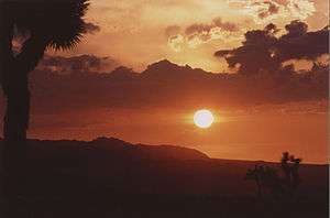
The name of the region comes from its higher elevations and more northern latitude with associated climate and plant communities distinct from the Low Desert, which includes the Colorado Desert and the below sea level Salton Sea. The High Desert is typically windier than the Low Desert, and averages between 12 degrees to 20 degrees Fahrenheit cooler in both the winter, and Summer seasons.
Regions
The High Desert is often divided into the following regions:
- The Los Angeles County portion, containing the Antelope Valley, part of the Palmdale-Lancaster Urbanized Area, and in the greater Los Angeles Metropolitan Area. This is the most populous area of the High Desert region, with close to 300,000 residents in the incorporated places alone.

- The San Bernardino County portion, containing Victor Valley, which is part of the Inland Empire area of Southern California, along with the Antelope Valley and the Morongo Basin, where Yucca Valley and the Twentynine Palms Marine Base are located, are all considered to be part of the Greater Los Angeles Area. Other parts of the San Bernardino County portion include the northeastern reaches of the High Desert, where the Fort Irwin Military Reservation and the Searles Valley are located, and the far eastern edge of the state where places like Needles and Earp are located along the Colorado River. San Bernardino County's portion of the High Desert region contains the most land mass of the four involved counties, making up approximately 70% of the total county's area.
- The Kern County portion, containing part of two valleys, with the southeastern part in the Antelope Valley, including Rosamond, California City, Boron, Edwards Air Force Base, and Mojave, which are all a part of the Palmdale-Lancaster Urbanized area, and the northeastern part being in the Indian Wells Valley, including the communities of Inyokern and Ridgecrest.
- The Inyo County portion, north of Kern County and containing the northern end of the Indian Wells Valley, Panamint Valley, and Saline Valley. This is the most sparsely populated area of the High Desert, with a single major community, Lone Pine in the southern Owens Valley.
Cities and communities
The major metropolitan centers in the region are primarily centered on the cities of Lancaster and Victorville. Lancaster, the largest city in the High Desert, is located in the Antelope Valley, with Palmdale, and anchors the area's largest and most populous region with a metro area of just over 500,000. The Victor Valley area, which includes such areas as Victorville, Hesperia, Adelanto, Apple Valley, and Lucerne Valley, boasts a population around 335,000.[5] The Barstow area, to the north of Victor Valley, and the Morongo Basin near the Joshua Tree National Park each have populations of around 60,000.
List of cities, towns, and census-designated places
Major highways
- Incorporated places are listed in bold. This list includes all places in the broadest definition of "High Desert." Population figures are most recent information available from the US Census Bureau.
|
Literature
- Louis L'Amour's Western novel The Lonesome Gods uses features of the Mojave and Colorado Deserts in its narrative.
Motion pictures
- Popular filming sites
- The Alabama Hills and Red Rock Canyon have been filming locations for numerous Westerns.
- Boomtowns that prospered during Route 66 and railroad travel in the early 20th Century including Amboy, Cima and Ludlow, and are also used in principal photography and location shots.
- Southern California Logistics Airport (George Air Force Base, decommissioned in 1992) is used often for military dramas and action films.
- Exemplary projects
- Stagecoach (1939), Lucerne Valley
- The Treasure of the Sierra Madre (1948), Red Rock Canyon State Park (California)−
- Westworld (1973), Red Rock Canyon State Park
- Bagdad Cafe (1987), Newberry Springs
- Jurassic Park (1993), Red Rock Canyon State Park
- Casino (1995), Palmdale
- Contact (1997), Adelanto
- Face/Off (1997), Victorville
- Jarhead (2005), Victorville
- Valkyrie (2008), Victorville
- Films using High Desert as a subject of the narrative
- Erin Brockovich (2000), centered on the PG&E environmental disaster in the town of Hinkley west of Barstow.
- Space Cowboys (2000), one of many examples that feature Edwards Air Force Base in the 1940s used in experimental test flights and for shuttle landings with the NASA Space Program.
References
- ↑ KEYC
- ↑ High Desert News
- ↑ High Desert Mavericks Baseball
- ↑ High Desert Academy of Applied Arts.
- ↑ "SANBAG Sub-Regional Corridor Studies". Sanbag.ca.gov. 2010-04-14. Retrieved 2012-11-07.
External links
| Wikimedia Commons has media related to Mojave Desert. |
| Wikivoyage has a travel guide for California Desert. |
Coordinates: 34°48′N 117°36′W / 34.8°N 117.6°W