Home Gardens, California
| Home Gardens | |
|---|---|
| census-designated place | |
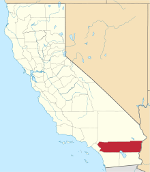
 Location in Riverside County and the state of California | |
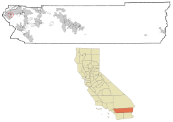
 Home Gardens Location in the United States | |
| Coordinates: 33°52′46″N 117°30′43″W / 33.87944°N 117.51194°WCoordinates: 33°52′46″N 117°30′43″W / 33.87944°N 117.51194°W | |
| Country |
|
| State |
|
| County | Riverside |
| Area[1] | |
| • Total | 1.556 sq mi (4.030 km2) |
| • Land | 1.556 sq mi (4.030 km2) |
| • Water | 0 sq mi (0 km2) 0% |
| Elevation[2] | 669 ft (204 m) |
| Population (2010) | |
| • Total | 11,570 |
| • Density | 7,400/sq mi (2,900/km2) |
| Time zone | PST (UTC-8) |
| • Summer (DST) | PDT (UTC-7) |
| ZIP code | 92879 |
| Area code(s) | 951 |
| FIPS code | 06-34302 |
| GNIS feature ID | 1656541 |
Home Gardens [aka Riverside Valley Home Gardens] is a census-designated place (CDP) in Riverside County, California, United States. The population was 11,570 at the 2010 census, up from 9,461 at the 2000 census.
Geography
Home Gardens is located at 33°52′46″N 117°30′43″W / 33.87944°N 117.51194°W (33.879450, -117.511951).[3]
According to the United States Census Bureau, the CDP has a total area of 1.6 square miles (4.1 km2), all of it land.
Demographics
2010
The 2010 United States Census[4] reported that Home Gardens had a population of 11,570. The population density was 7,435.7 people per square mile (2,871.0/km²). The racial makeup of Home Gardens was 5,275 (45.6%) White, 364 (3.1%) African American, 126 (1.1%) Native American, 667 (5.8%) Asian, 51 (0.4%) Pacific Islander, 4,500 (38.9%) from other races, and 587 (5.1%) from two or more races. Hispanic or Latino of any race were 8,524 persons (73.7%).
The Census reported that 11,562 people (99.9% of the population) lived in households, 8 (0.1%) lived in non-institutionalized group quarters, and 0 (0%) were institutionalized.
There were 2,760 households, out of which 1,553 (56.3%) had children under the age of 18 living in them, 1,687 (61.1%) were opposite-sex married couples living together, 434 (15.7%) had a female householder with no husband present, 215 (7.8%) had a male householder with no wife present. There were 172 (6.2%) unmarried opposite-sex partnerships, and 17 (0.6%) same-sex married couples or partnerships. 306 households (11.1%) were made up of individuals and 123 (4.5%) had someone living alone who was 65 years of age or older. The average household size was 4.19. There were 2,336 families (84.6% of all households); the average family size was 4.35.
The population was spread out with 3,618 people (31.3%) under the age of 18, 1,404 people (12.1%) aged 18 to 24, 3,358 people (29.0%) aged 25 to 44, 2,328 people (20.1%) aged 45 to 64, and 862 people (7.5%) who were 65 years of age or older. The median age was 29.3 years. For every 100 females there were 107.6 males. For every 100 females age 18 and over, there were 104.4 males.
There were 2,865 housing units at an average density of 1,841.3 per square mile (710.9/km²), of which 1,952 (70.7%) were owner-occupied, and 808 (29.3%) were occupied by renters. The homeowner vacancy rate was 2.3%; the rental vacancy rate was 2.5%. 7,749 people (67.0% of the population) lived in owner-occupied housing units and 3,813 people (33.0%) lived in rental housing units.
2000
As of the census[5] of 2000, there were 9,461 people, 2,302 households, and 1,952 families residing in the CDP. The population density was 8,793.4 people per square mile (3,382.3/km²). There were 2,365 housing units at an average density of 2,198.1/sq mi (845.5/km²). The racial makeup of the CDP was 47.9% White, 3.4% Black or African American, 1.3% Native American, 4.6% Asian, 0.2% Pacific Islander, 38.1% from other races, and 4.5% from two or more races. 66.5% of the population were Hispanic or Latino of any race.
There were 2,302 households out of which 49.5% had children under the age of 18 living with them, 66.2% were married couples living together, 11.8% had a female householder with no husband present, and 15.2% were non-families. 10.9% of all households were made up of individuals and 4.2% had someone living alone who was 65 years of age or older. The average household size was 4.11 and the average family size was 4.30.
In the CDP the population was spread out with 35.1% under the age of 18, 11.4% from 18 to 24, 30.7% from 25 to 44, 16.0% from 45 to 64, and 6.8% who were 65 years of age or older. The median age was 27 years. For every 100 females there were 105.0 males. For every 100 females age 18 and over, there were 104.5 males.
The median income for a household in the CDP was $47,535, and the median income for a family was $49,229. Males had a median income of $30,859 versus $22,130 for females. The per capita income for the CDP was $14,181. About 8.8% of families and 11.2% of the population were below the poverty line, including 14.7% of those under age 18 and 3.9% of those age 65 or over.
Politics
In the state legislature Home Gardens is located in the 37th Senate District, represented by Republican Bill Emmerson, and in the 71st Assembly District, represented by Republican Jeff Miller.
In the United States House of Representatives, Home Gardens is in California's 42nd congressional district, represented by Republican Ken Calvert.[6]
Education
Home Gardens is under the jurisdiction of the Corona-Norco Unified School District. Home Gardens Elementary School on 13550 Tolton Ave. is the primary and only school in the Home Gardens non-incorporated area.
Current zoning for graduates from Home Gardens Elementary are directed to Citrus Hills Intermediate School on 3211 S.Main St. Corona, CA 92882. From Citrus Hills Intermediate, graduates are then directed to Santiago High School on 1395 Foothill Pkwy Corona, CA 92881.
The Riverside County Library System offers local residents a branch on 3785 Neece St, Corona CA 92879. The YMCA is active in both the elementary school and library.
Students who live in Home Gardens fall within the Riverside Community College District. The District's nearest campus is Norco College at 2001 3rd St. Norco, CA 92860. The Riverside City College campus is also nearby, at 4800 Magnolia Ave. Riverside, CA 92506.
References
- ↑ "2010 Census U.S. Gazetteer Files – Places – California". United States Census Bureau.
- ↑ "Home Gardens". Geographic Names Information System. United States Geological Survey. Retrieved November 11, 2014.
- ↑ "US Gazetteer files: 2010, 2000, and 1990". United States Census Bureau. 2011-02-12. Retrieved 2011-04-23.
- ↑ "2010 Census Interactive Population Search: CA - Home Gardens CDP". U.S. Census Bureau. Retrieved July 12, 2014.
- ↑ "American FactFinder". United States Census Bureau. Retrieved 2008-01-31.
- ↑ "California's 42nd Congressional District - Representatives & District Map". Civic Impulse, LLC.