Romoland, California
| Romoland | |
|---|---|
| census-designated place | |
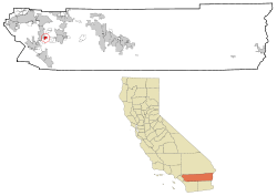 Location in Riverside County and the state of California | |
 Romoland Location in the United States | |
| Coordinates: 33°44′45″N 117°10′30″W / 33.74583°N 117.17500°WCoordinates: 33°44′45″N 117°10′30″W / 33.74583°N 117.17500°W[1] | |
| Country |
|
| State |
|
| County | Riverside |
| Area[2] | |
| • Total | 2.644 sq mi (6.849 km2) |
| • Land | 2.644 sq mi (6.849 km2) |
| • Water | 0 sq mi (0 km2) 0% |
| Elevation[1] | 1,444 ft (440 m) |
| Population (2010) | |
| • Total | 1,684 |
| • Density | 640/sq mi (250/km2) |
| Time zone | PST (UTC-8) |
| • Summer (DST) | PDT (UTC-7) |
| ZIP code | 92585 |
| Area code(s) | 951 |
| FIPS code | 06-62756 |
| GNIS feature ID | 1661327 |
Romoland is a census-designated place (CDP) in Riverside County, California, United States. The population was 1,684 at the 2010 census, down from 2,764 at the 2000 census.
History
In 1900 The first Ethanac Post Office was established across Highway 74, named after Ethan Allen Chase (an early settler to the area). In 1925 the town of Ethanac changed to "Romola Farms", developed by the Pacific Mutual Life Insurance Company.The developer sold off small ranches of four to five acres for the cultivation of fig trees, and grapes. The project became so popular, it was decided that the Ethanac post office be changed to Romola Farms. When the Post Office Department requested the name change, to avoid confusion with San Diego County's Ramona post office, the name was changed for a final time to Romoland. The origin of the development of the name has never been revealed. [3]
In 1985, Leon E. Motte builds the "Mottes Romola Farms" Barn off Highway 74 designed by architect Robert Morris. After building the Barn from all salvaged materials, the Motte’s sold produce for 10 years before leasing it out to other food vendors, such as Tom's Farms and Hamshaw Farms. In 2011 "Mottes Romola Farms" reopens as the "Motte Historical Museum". The Motte Historical Museum is now a Classic Car Museum and showcases the history of the surrounding valley, as well as documenting the areas agricultural roots. The "Mottes Romola Farms Barn has always been a longtime landmark on Highway 74.
On October 1, 2008, a significant portion of Romoland became part of the City of Menifee.
Geography
Romoland is located at 33°44′45″N 117°10′27″W / 33.74583°N 117.17417°W (33.745783, -117.174228).[4]
According to the United States Census Bureau, the CDP has a total area of 2.6 square miles (6.7 km2), all of it land.
As of the 2000 census, according to the United States Census Bureau, the CDP had a total area of 3.0 square miles (7.8 km2), all of it land.
However, the Romoland region includes the entire unincorporated area between Perris, Hemet, Lake Elsinore and Murrieta. The total population in the year 2008 may exceeded 100,000 residents in the 30-square-mile (78 km2) area, but carries the namesake of Romoland.
According to the Geographic Names Information System, the town has also had the toponyms Ethanac and Ethanac Siding in the past.
Demographics
2010
The 2010 United States Census[5] reported that Romoland had a population of 1,684. The population density was 636.8 people per square mile (245.9/km²). The racial makeup of Romoland was 958 (56.9%) White, 65 (3.9%) African American, 8 (0.5%) Native American, 35 (2.1%) Asian, 12 (0.7%) Pacific Islander, 514 (30.5%) from other races, and 92 (5.5%) from two or more races. Hispanic or Latino of any race were 865 persons (51.4%).
The Census reported that 1,684 people (100% of the population) lived in households, 0 (0%) lived in non-institutionalized group quarters, and 0 (0%) were institutionalized.
There were 455 households, out of which 232 (51.0%) had children under the age of 18 living in them, 287 (63.1%) were opposite-sex married couples living together, 46 (10.1%) had a female householder with no husband present, 34 (7.5%) had a male householder with no wife present. There were 27 (5.9%) unmarried opposite-sex partnerships, and 6 (1.3%) same-sex married couples or partnerships. 61 households (13.4%) were made up of individuals and 14 (3.1%) had someone living alone who was 65 years of age or older. The average household size was 3.70. There were 367 families (80.7% of all households); the average family size was 4.07.
The population was spread out with 502 people (29.8%) under the age of 18, 221 people (13.1%) aged 18 to 24, 395 people (23.5%) aged 25 to 44, 434 people (25.8%) aged 45 to 64, and 132 people (7.8%) who were 65 years of age or older. The median age was 32.0 years. For every 100 females there were 100.0 males. For every 100 females age 18 and over, there were 100.7 males.
There were 512 housing units at an average density of 193.6 per square mile (74.8/km²), of which 351 (77.1%) were owner-occupied, and 104 (22.9%) were occupied by renters. The homeowner vacancy rate was 3.3%; the rental vacancy rate was 3.7%. 1,288 people (76.5% of the population) lived in owner-occupied housing units and 396 people (23.5%) lived in rental housing units.
2000
As of the census[6] of 2000, there were 2,764 people, 785 households, and 620 families residing in the CDP. The population density was 926.4 people per square mile (358.1/km²). There were 867 housing units at an average density of 290.6 per square mile (112.3/km²). The racial makeup of the CDP was 54.1% White, 2.5% African American, 1.7% Native American, 0.3% Asian, 0.2% Pacific Islander, 36.7% from other races, and 4.6% from two or more races. Hispanic or Latino of any race were 55.4% of the population.
There were 785 households out of which 43.1% had children under the age of 18 living with them, 59.1% were married couples living together, 12.7% had a female householder with no husband present, and 20.9% were non-families. 15.9% of all households were made up of individuals and 7.3% had someone living alone who was 65 years of age or older. The average household size was 3.5 and the average family size was 3.9.
In the CDP the population was spread out with 34.8% under the age of 18, 9.8% from 18 to 24, 27.9% from 25 to 44, 19.0% from 45 to 64, and 8.5% who were 65 years of age or older. The median age was 29 years. For every 100 females there were 103.5 males. For every 100 females age 18 and over, there were 102.0 males.
The median income for a household in the CDP was $33,523, and the median income for a family was $37,574. Males had a median income of $23,850 versus $18,971 for females. The per capita income for the CDP was $12,932. About 20.5% of families and 25.9% of the population were below the poverty line, including 30.6% of those under age 18 and 20.6% of those age 65 or over.
Politics
In the state legislature Romoland is located in the 37th Senate District, represented by Republican Bill Emmerson, and in the 65th Assembly District, represented by Republican Paul Cook.
In the United States House of Representatives, Romoland is in California's 42nd congressional district, represented by Republican Ken Calvert.[7]
References
- 1 2 "Romoland". Geographic Names Information System. United States Geological Survey. Retrieved November 11, 2014.
- ↑ "2010 Census U.S. Gazetteer Files – Places – California". United States Census Bureau.
- ↑ Gunther, Jane (1984). Place Names, Their Origins and Their Stories. Riverside County, California.
- ↑ "US Gazetteer files: 2010, 2000, and 1990". United States Census Bureau. 2011-02-12. Retrieved 2011-04-23.
- ↑ "2010 Census Interactive Population Search: CA - Romoland CDP". U.S. Census Bureau. Retrieved July 12, 2014.
- ↑ "American FactFinder". United States Census Bureau. Retrieved 2008-01-31.
- ↑ "California's 42nd Congressional District - Representatives & District Map". Civic Impulse, LLC.