Bernardswiller
| Bernardswiller Batschwiller | ||
|---|---|---|
 | ||
| ||
 Bernardswiller | ||
|
Location within Grand Est region  Bernardswiller | ||
| Coordinates: 48°27′15″N 7°27′55″E / 48.4542°N 7.4653°ECoordinates: 48°27′15″N 7°27′55″E / 48.4542°N 7.4653°E | ||
| Country | France | |
| Region | Grand Est | |
| Department | Bas-Rhin | |
| Arrondissement | Sélestat-Erstein | |
| Canton | Obernai | |
| Intercommunality | Pays de Sainte-Odile | |
| Government | ||
| • Mayor (2008–2014) | Raymond Klein | |
| Area1 | 5.53 km2 (2.14 sq mi) | |
| Population (2009)2 | 1,421 | |
| • Density | 260/km2 (670/sq mi) | |
| Time zone | CET (UTC+1) | |
| • Summer (DST) | CEST (UTC+2) | |
| INSEE/Postal code | 67031 / 67210 | |
| Elevation | 183–311 m (600–1,020 ft) | |
|
1 French Land Register data, which excludes lakes, ponds, glaciers > 1 km² (0.386 sq mi or 247 acres) and river estuaries. 2 Population without double counting: residents of multiple communes (e.g., students and military personnel) only counted once. | ||

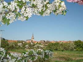
Bernardswiller (German: Bernhardsweiler) is a commune in the Bas-Rhin department in Alsace in northeastern France.
Population
| Historical population | ||
|---|---|---|
| Year | Pop. | ±% |
| 1962 | 815 | — |
| 1968 | 989 | +21.3% |
| 1975 | 1,018 | +2.9% |
| 1982 | 1,031 | +1.3% |
| 1990 | 1,056 | +2.4% |
| 1999 | 1,220 | +15.5% |
| 2006 | 1,387 | +13.7% |
| 2009 | 1,421 | +2.5% |
See also
References
| Wikimedia Commons has media related to Bernardswiller. |
This article is issued from Wikipedia - version of the 9/17/2015. The text is available under the Creative Commons Attribution/Share Alike but additional terms may apply for the media files.