Saales
| Saales | ||
|---|---|---|
|
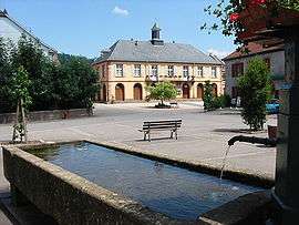
Town hall | ||
| ||
 Saales | ||
|
Location within Grand Est region  Saales | ||
| Coordinates: 48°20′57″N 7°06′23″E / 48.3492°N 7.1064°ECoordinates: 48°20′57″N 7°06′23″E / 48.3492°N 7.1064°E | ||
| Country | France | |
| Region | Grand Est | |
| Department | Bas-Rhin | |
| Arrondissement | Molsheim | |
| Canton | Mutzig | |
| Government | ||
| • Mayor (2008–2014) | Jean Vogel | |
| Area1 | 9.88 km2 (3.81 sq mi) | |
| Population (2006)2 | 942 | |
| • Density | 95/km2 (250/sq mi) | |
| Time zone | CET (UTC+1) | |
| • Summer (DST) | CEST (UTC+2) | |
| INSEE/Postal code | 67421 / 67420 | |
| Elevation |
517–831 m (1,696–2,726 ft) (avg. 555 m or 1,821 ft) | |
|
1 French Land Register data, which excludes lakes, ponds, glaciers > 1 km² (0.386 sq mi or 247 acres) and river estuaries. 2 Population without double counting: residents of multiple communes (e.g., students and military personnel) only counted once. | ||

Saales (German: Saal) is a commune in the Bas-Rhin department in Grand Est in north-eastern France.
Geography and geology
Saales is at the center of a two kilometer long plateau with an average altitude of 560 meters. It sits on the Fraize creek. The village is located at an altitude of 556 meters, and rests at the base of Sapinsus. The highest point is on the 'Rocher des Enfants', to the right of Solamont, and the lowest point is near the road at the beginning of the Hang Bruche Valley.
See also
References
| Wikimedia Commons has media related to Saales. |
This article is issued from Wikipedia - version of the 11/13/2016. The text is available under the Creative Commons Attribution/Share Alike but additional terms may apply for the media files.