Brokaw, Wisconsin
| Brokaw, Wisconsin | |
|---|---|
| Village | |
| Motto: Rising by the river | |
 Location of Brokaw, Wisconsin | |
| Coordinates: 45°1′42″N 89°39′23″W / 45.02833°N 89.65639°WCoordinates: 45°1′42″N 89°39′23″W / 45.02833°N 89.65639°W | |
| Country | United States |
| State | Wisconsin |
| County | Marathon |
| Area[1] | |
| • Total | 1.23 sq mi (3.19 km2) |
| • Land | 1.07 sq mi (2.77 km2) |
| • Water | 0.16 sq mi (0.41 km2) |
| Elevation[2] | 1,220 ft (372 m) |
| Population (2010)[3] | |
| • Total | 251 |
| • Estimate (2012[4]) | 251 |
| • Density | 234.6/sq mi (90.6/km2) |
| Time zone | Central (CST) (UTC-6) |
| • Summer (DST) | CDT (UTC-5) |
| Area code(s) | 715 & 534 |
| FIPS code | 55-09975[5] |
| GNIS feature ID | 1562231[2] |
| Website |
villageofbrokaw |
Brokaw is a village in Marathon County, Wisconsin, United States. It is part of the Wausau, Wisconsin Metropolitan Statistical Area. The population was 251 at the 2010 census.[6]
Geography
Brokaw is located at 45°1′42″N 89°39′23″W / 45.02833°N 89.65639°W (45.028457, -89.656366).[7]
According to the United States Census Bureau, the village has a total area of 1.23 square miles (3.19 km2), of which, 1.07 square miles (2.77 km2) of it is land and 0.16 square miles (0.41 km2) is water.[1]
Demographics
| Historical population | |||
|---|---|---|---|
| Census | Pop. | %± | |
| 1910 | 458 | — | |
| 1920 | 493 | 7.6% | |
| 1930 | 514 | 4.3% | |
| 1940 | 477 | −7.2% | |
| 1950 | 380 | −20.3% | |
| 1960 | 319 | −16.1% | |
| 1970 | 312 | −2.2% | |
| 1980 | 298 | −4.5% | |
| 1990 | 224 | −24.8% | |
| 2000 | 107 | −52.2% | |
| 2010 | 251 | 134.6% | |
| Est. 2015 | 252 | [8] | 0.4% |
2010 census
As of the census[3] of 2010, there were 251 people, 123 households, and 66 families residing in the village. The population density was 234.6 inhabitants per square mile (90.6/km2). There were 138 housing units at an average density of 129.0 per square mile (49.8/km2). The racial makeup of the village was 97.6% White, 1.6% Asian, 0.4% from other races, and 0.4% from two or more races. Hispanic or Latino of any race were 2.4% of the population.
There were 123 households of which 19.5% had children under the age of 18 living with them, 35.0% were married couples living together, 13.0% had a female householder with no husband present, 5.7% had a male householder with no wife present, and 46.3% were non-families. 33.3% of all households were made up of individuals and 5.7% had someone living alone who was 65 years of age or older. The average household size was 2.04 and the average family size was 2.59.
The median age in the village was 32.9 years. 13.9% of residents were under the age of 18; 12.9% were between the ages of 18 and 24; 32.3% were from 25 to 44; 25.2% were from 45 to 64; and 15.9% were 65 years of age or older. The gender makeup of the village was 45.8% male and 54.2% female.
2000 census
As of the census[5] of 2000, there were 107 people, 47 households, and 24 families residing in the village. The population density was 108.6 people per square mile (41.7/km²). There were 49 housing units at an average density of 49.7 per square mile (19.1/km²). The racial makeup of the village was 98.13% White, 0.93% Native American, and 0.93% from two or more races. Hispanic or Latino of any race were 1.87% of the population.
There were 47 households out of which 17.0% had children under the age of 18 living with them, 38.3% were married couples living together, 6.4% had a female householder with no husband present, and 48.9% were non-families. 38.3% of all households were made up of individuals and 21.3% had someone living alone who was 65 years of age or older. The average household size was 2.28 and the average family size was 2.92.
In the village the population was spread out with 17.8% under the age of 18, 15.0% from 18 to 24, 30.8% from 25 to 44, 19.6% from 45 to 64, and 16.8% who were 65 years of age or older. The median age was 35 years. For every 100 females there were 101.9 males. For every 100 females age 18 and over, there were 109.5 males.
The median income for a household in the village was $27,083, and the median income for a family was $54,167. Males had a median income of $26,458 versus $25,000 for females. The per capita income for the village was $28,290. There were 20.8% of families and 21.5% of the population living below the poverty line, including 50.0% of under eighteens and 17.6% of those over 64.
Notable people
- Red Smith, MLB player, NFL player and assistant coach, head coach of the Georgetown Hoyas football team and Wisconsin Badgers football team, athletic director of Seton Hall University.
References
- 1 2 "US Gazetteer files 2010". United States Census Bureau. Archived from the original on 2012-01-24. Retrieved 2012-11-18.
- 1 2 "US Board on Geographic Names". United States Geological Survey. 2007-10-25. Retrieved 2008-01-31.
- 1 2 "American FactFinder". United States Census Bureau. Retrieved 2012-11-18.
- ↑ "Population Estimates". United States Census Bureau. Archived from the original on 2013-06-17. Retrieved 2013-06-24.
- 1 2 "American FactFinder". United States Census Bureau. Archived from the original on 2013-09-11. Retrieved 2008-01-31.
- ↑ "Profile of General Population and Housing Characteristics: 2010 Demographic Profile Data (DP-1): Brokaw village, Wisconsin". U.S. Census Bureau, American Factfinder. Archived from the original on September 11, 2013. Retrieved September 7, 2012.
- ↑ "US Gazetteer files: 2010, 2000, and 1990". United States Census Bureau. 2011-02-12. Retrieved 2011-04-23.
- ↑ "Annual Estimates of the Resident Population for Incorporated Places: April 1, 2010 to July 1, 2015". Retrieved July 2, 2016.
- ↑ "Census of Population and Housing". Census.gov. Archived from the original on May 11, 2015. Retrieved June 4, 2015.
External links
Municipalities and communities of Marathon County, Wisconsin, United States | ||
|---|---|---|
| Cities | 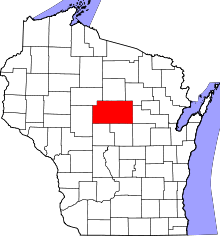 | |
| Villages | ||
| Towns |
| |
| CDPs | ||
| Unincorporated communities |
| |
| Ghost towns/ neighborhoods | ||
| Footnotes | ‡This populated place also has portions in an adjacent county or counties | |