Brownsville, Minnesota
| Brownsville, Minnesota | |
|---|---|
| City | |
 Location of Brownsville, Minnesota | |
| Coordinates: 43°41′55″N 91°16′50″W / 43.69861°N 91.28056°W | |
| Country | United States |
| State | Minnesota |
| County | Houston |
| Area[1] | |
| • Total | 1.94 sq mi (5.02 km2) |
| • Land | 1.75 sq mi (4.53 km2) |
| • Water | 0.19 sq mi (0.49 km2) |
| Elevation | 705 ft (215 m) |
| Population (2010)[2] | |
| • Total | 466 |
| • Estimate (2012[3]) | 461 |
| • Density | 266.3/sq mi (102.8/km2) |
| Time zone | Central (CST) (UTC-6) |
| • Summer (DST) | CDT (UTC-5) |
| ZIP code | 55919 |
| Area code(s) | 507 |
| FIPS code | 27-08218[4] |
| GNIS feature ID | 0640547[5] |
Brownsville is a city in Houston County, Minnesota, United States. The population was 466 at the 2010 census.[6]
History
A post office called Brownsville has been in operation since 1852.[7] Brownsville was platted in 1854 by the brothers Job and Charles Brown, and named for them.[8]
Geography
According to the United States Census Bureau, the city has a total area of 1.94 square miles (5.02 km2), of which 1.75 square miles (4.53 km2) is land and 0.19 square miles (0.49 km2) is water.[1]
Minnesota State Highway 26 and County Road 3 (Main Street) are two of the main routes in the community.
Demographics
| Historical population | |||
|---|---|---|---|
| Census | Pop. | %± | |
| 1870 | 625 | — | |
| 1880 | 607 | −2.9% | |
| 1890 | 447 | −26.4% | |
| 1900 | 453 | 1.3% | |
| 1910 | 361 | −20.3% | |
| 1920 | 338 | −6.4% | |
| 1930 | 274 | −18.9% | |
| 1940 | 298 | 8.8% | |
| 1950 | 330 | 10.7% | |
| 1960 | 382 | 15.8% | |
| 1970 | 417 | 9.2% | |
| 1980 | 418 | 0.2% | |
| 1990 | 415 | −0.7% | |
| 2000 | 517 | 24.6% | |
| 2010 | 466 | −9.9% | |
| Est. 2015 | 465 | [9] | −0.2% |
2010 census
As of the census[2] of 2010, there were 466 people, 213 households, and 137 families residing in the city. The population density was 266.3 inhabitants per square mile (102.8/km2). There were 280 housing units at an average density of 160.0 per square mile (61.8/km2). The racial makeup of the city was 99.1% White and 0.9% from two or more races. Hispanic or Latino of any race were 0.9% of the population.
There were 213 households of which 20.7% had children under the age of 18 living with them, 55.9% were married couples living together, 7.0% had a female householder with no husband present, 1.4% had a male householder with no wife present, and 35.7% were non-families. 27.2% of all households were made up of individuals and 10.3% had someone living alone who was 65 years of age or older. The average household size was 2.19 and the average family size was 2.62.
The median age in the city was 47.6 years. 17% of residents were under the age of 18; 6.7% were between the ages of 18 and 24; 20.8% were from 25 to 44; 40.3% were from 45 to 64; and 15.2% were 65 years of age or older. The gender makeup of the city was 52.1% male and 47.9% female.
2000 census
As of the census[4] of 2000, there were 517 people, 216 households, and 149 families residing in the city. The population density was 288.9 people per square mile (111.5/km²). There were 273 housing units at an average density of 152.6 per square mile (58.9/km²). The racial makeup of the city was 99.42% White, 0.39% Native American, and 0.19% from two or more races. Hispanic or Latino of any race were 0.58% of the population.
There were 216 households out of which 31.5% had children under the age of 18 living with them, 59.3% were married couples living together, 5.6% had a female householder with no husband present, and 31.0% were non-families. 25.5% of all households were made up of individuals and 12.0% had someone living alone who was 65 years of age or older. The average household size was 2.39 and the average family size was 2.91.
In the city the population was spread out with 23.2% under the age of 18, 6.6% from 18 to 24, 29.4% from 25 to 44, 27.1% from 45 to 64, and 13.7% who were 65 years of age or older. The median age was 41 years. For every 100 females there were 112.8 males. For every 100 females age 18 and over, there were 100.5 males.
The median income for a household in the city was $46,250, and the median income for a family was $51,875. Males had a median income of $32,426 versus $26,429 for females. The per capita income for the city was $20,442. About 1.5% of families and 3.5% of the population were below the poverty line, including 4.7% of those under age 18 and 9.4% of those age 65 or over.
Notable natives
- William Hauber - Film actor born here.
References
- 1 2 "US Gazetteer files 2010". United States Census Bureau. Archived from the original on 2012-07-14. Retrieved 2012-11-13.
- 1 2 "American FactFinder". United States Census Bureau. Retrieved 2012-11-13.
- ↑ "Population Estimates". United States Census Bureau. Archived from the original on 2013-06-17. Retrieved 2013-05-28.
- 1 2 "American FactFinder". United States Census Bureau. Archived from the original on 2013-09-11. Retrieved 2008-01-31.
- ↑ "US Board on Geographic Names". United States Geological Survey. 2007-10-25. Retrieved 2008-01-31.
- ↑ "2010 Census Redistricting Data (Public Law 94-171) Summary File". American FactFinder. United States Census Bureau. Archived from the original on 21 July 2011. Retrieved 27 April 2011.
- ↑ "Houston County". Jim Forte Postal History. Retrieved 5 July 2015.
- ↑ Upham, Warren (1920). Minnesota Geographic Names: Their Origin and Historic Significance. Minnesota Historical Society. p. 238.
- ↑ "Annual Estimates of the Resident Population for Incorporated Places: April 1, 2010 to July 1, 2015". Retrieved July 2, 2016.
- ↑ "Census of Population and Housing". Census.gov. Archived from the original on May 11, 2015. Retrieved June 4, 2015.
External links
Municipalities and communities of Houston County, Minnesota, United States | ||
|---|---|---|
| Cities | 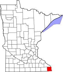 | |
| Townships | ||
| Unincorporated communities | ||
| Footnotes | ‡This populated place also has portions in an adjacent county or counties | |
Coordinates: 43°41′39″N 91°16′47″W / 43.69417°N 91.27972°W