Caledonia, Minnesota
| Caledonia, Minnesota | |
|---|---|
| City | |
|
Houston County Courthouse in Caledonia | |
| Motto: "Wild Turkey Capital of Minnesota" and "The Heart of Quilt Country" | |
 Location of Caledonia within Houston County and state of Minnesota | |
| Coordinates: 43°37′59″N 91°29′47″W / 43.63306°N 91.49639°W | |
| Country | United States |
| State | Minnesota |
| County | Houston |
| Founded | 1854 |
| Government | |
| • Mayor | Joshua Gran |
| Area[1] | |
| • Total | 2.84 sq mi (7.36 km2) |
| • Land | 2.84 sq mi (7.36 km2) |
| • Water | 0 sq mi (0 km2) |
| Elevation | 1,181 ft (360 m) |
| Population (2010)[2] | |
| • Total | 2,868 |
| • Estimate (2012[3]) | 2,821 |
| • Density | 1,009.9/sq mi (389.9/km2) |
| Time zone | Central (CST) (UTC-6) |
| • Summer (DST) | CDT (UTC-5) |
| ZIP code | 55921 |
| Area code(s) | 507 |
| FIPS code | 27-09226[4] |
| GNIS feature ID | 0640732[5] |
| Website | City of Caledonia |

Caledonia is a city in Houston County, Minnesota, United States and is part of the La Crosse, Wisconsin Metropolitan Statistical Area. The population was 2,868 at the 2010 census.[6] It is the county seat of Houston County.[7]
History
Caledonia was platted in 1854-1855.[8] The town was named by founder Col. Samuel McPhail for the ancient Roman word for Scotland.[9] A post office has been in operation at Caledonia since 1855.[10] Caledonia was incorporated in 1870, and was reincorporated in 1889.[11]
Geography
According to the United States Census Bureau, the city has a total area of 2.84 square miles (7.36 km2), all of it land.[1] Caledonia is located 17 miles southwest of La Crosse, Wisconsin.
Minnesota Highway 44 and Minnesota Highway 76 are two of the main routes in the community.
Demographics
| Historical population | |||
|---|---|---|---|
| Census | Pop. | %± | |
| 1870 | 470 | — | |
| 1880 | 894 | 90.2% | |
| 1890 | 927 | 3.7% | |
| 1900 | 1,175 | 26.8% | |
| 1910 | 1,372 | 16.8% | |
| 1920 | 1,570 | 14.4% | |
| 1930 | 1,554 | −1.0% | |
| 1940 | 1,985 | 27.7% | |
| 1950 | 2,243 | 13.0% | |
| 1960 | 2,563 | 14.3% | |
| 1970 | 2,619 | 2.2% | |
| 1980 | 2,691 | 2.7% | |
| 1990 | 2,846 | 5.8% | |
| 2000 | 2,965 | 4.2% | |
| 2010 | 2,868 | −3.3% | |
| Est. 2015 | 2,787 | [12] | −2.8% |
| U.S. Decennial Census | |||
2010 census
As of the census[2] of 2010, there were 2,868 people, 1,247 households, and 740 families residing in the city. The population density was 1,009.9 inhabitants per square mile (389.9/km2). There were 1,344 housing units at an average density of 473.2 per square mile (182.7/km2). The racial makeup of the city was 96.8% White, 1.3% African American, 0.3% Native American, 0.7% Asian, 0.1% from other races, and 0.8% from two or more races. Hispanic or Latino of any race were 0.6% of the population.
There were 1,247 households of which 27.4% had children under the age of 18 living with them, 43.5% were married couples living together, 11.5% had a female householder with no husband present, 4.4% had a male householder with no wife present, and 40.7% were non-families. 35.1% of all households were made up of individuals and 16.4% had someone living alone who was 65 years of age or older. The average household size was 2.25 and the average family size was 2.91.
The median age in the city was 40.5 years. 22.7% of residents were under the age of 18; 9.4% were between the ages of 18 and 24; 23.3% were from 25 to 44; 24.2% were from 45 to 64; and 20.4% were 65 years of age or older. The gender makeup of the city was 48.9% male and 51.1% female.
2000 census
As of the census[4] of 2000, there were 2,965 people, 1,223 households, and 754 families residing in the city. The population density was 1,037.1 people per square mile (400.3/km²). There were 1,286 housing units at an average density of 449.8 per square mile (173.6/km²). The racial makeup of the city was 98.35% White, 0.40% African American, 0.17% Native American, 0.30% Asian, 0.03% from other races, and 0.74% from two or more races. Hispanic or Latino of any race were 0.54% of the population.
There were 1,223 households out of which 30.7% had children under the age of 18 living with them, 49.1% were married couples living together, 9.8% had a female householder with no husband present, and 38.3% were non-families. 34.2% of all households were made up of individuals and 17.7% had someone living alone who was 65 years of age or older. The average household size was 2.31 and the average family size was 3.00.
In the city the population was spread out with 25.6% under the age of 18, 7.3% from 18 to 24, 24.6% from 25 to 44, 20.6% from 45 to 64, and 21.9% who were 65 years of age or older. The median age was 40 years. For every 100 females there were 88.0 males. For every 100 females age 18 and over, there were 84.4 males.
The median income for a household in the city was $32,455, and the median income for a family was $45,679. Males had a median income of $30,302 versus $20,091 for females. The per capita income for the city was $16,953. About 5.2% of families and 8.7% of the population were below the poverty line, including 7.8% of those under age 18 and 12.1% of those age 65 or over.
Education
Caledonia is home to Caledonia High School. St. Mary's Catholic School (K-8), and St. John's Lutheran School (K-12) are Private Schools.
Transportation
The Houston County Airport serves general aviation in the region.
Notable people
- William F. Dunbar, first Minnesota State Auditor.
- Karl Klug, Defensive End for the Tennessee Titans[13]
- Dave Kunst, First Person to Walk Around the Earth[14]
- Maurice J. McCauley, Minnesota state representative
- Ken Nelson, Country Music Hall of Fame member.
References
- 1 2 "US Gazetteer files 2010". United States Census Bureau. Archived from the original on 2012-07-14. Retrieved 2012-11-13.
- 1 2 "American FactFinder". United States Census Bureau. Retrieved 2012-11-13.
- ↑ "Population Estimates". United States Census Bureau. Archived from the original on 2013-06-17. Retrieved 2013-05-28.
- 1 2 "American FactFinder". United States Census Bureau. Archived from the original on 2013-09-11. Retrieved 2008-01-31.
- ↑ "US Board on Geographic Names". United States Geological Survey. 2007-10-25. Retrieved 2008-01-31.
- ↑ "2010 Census Redistricting Data (Public Law 94-171) Summary File". American FactFinder. United States Census Bureau. Archived from the original on 21 July 2011. Retrieved 27 April 2011.
- ↑ "Find a County". National Association of Counties. Archived from the original on 2011-05-31. Retrieved 2011-06-07.
- ↑ Upham, Warren (1920). Minnesota Geographic Names: Their Origin and Historic Significance. Minnesota Historical Society. p. 238.
- ↑ "Profile for Caledonia, Minnesota, MN". ePodunk. Retrieved 2012-06-30.
- ↑ "Houston County". Jim Forte Postal History. Retrieved 5 July 2015.
- ↑ "Caledonia Minnesota Community Guide". LakesnWoods. Retrieved 2012-06-30.
- ↑ "Annual Estimates of the Resident Population for Incorporated Places: April 1, 2010 to July 1, 2015". Retrieved July 2, 2016.
- ↑ http://www.nfl.com/player/karlklug/2495300/profile
- ↑ http://hometownargus.com/2013/04/09/hbo-making-film-about-caledonia-native/
External links
Municipalities and communities of Houston County, Minnesota, United States | ||
|---|---|---|
| Cities | 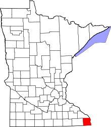 | |
| Townships | ||
| Unincorporated communities | ||
| Footnotes | ‡This populated place also has portions in an adjacent county or counties | |
Coordinates: 43°38′4.74″N 91°29′49.20″W / 43.6346500°N 91.4970000°W