Canton, Kansas
| Canton, Kansas | |
|---|---|
| City | |
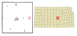 Location within McPherson County and Kansas | |
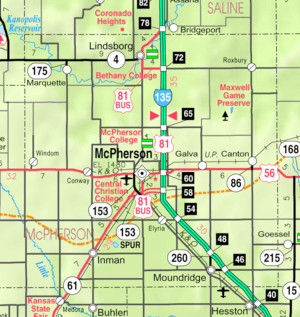 KDOT map of McPherson County (legend) | |
| Coordinates: 38°23′14″N 97°25′40″W / 38.38722°N 97.42778°WCoordinates: 38°23′14″N 97°25′40″W / 38.38722°N 97.42778°W | |
| Country | United States |
| State | Kansas |
| County | McPherson |
| Platted | 1879 |
| Incorporated | 1880 |
| Government | |
| • Type | Mayor-Council |
| Area[1] | |
| • Total | 0.50 sq mi (1.29 km2) |
| • Land | 0.50 sq mi (1.29 km2) |
| • Water | 0 sq mi (0 km2) |
| Elevation | 1,591 ft (485 m) |
| Population (2010)[2] | |
| • Total | 748 |
| • Estimate (2015)[3] | 734 |
| • Density | 1,500/sq mi (580/km2) |
| Time zone | CST (UTC-6) |
| • Summer (DST) | CDT (UTC-5) |
| ZIP code | 67428 |
| Area code | 620 |
| FIPS code | 20-10475 [4] |
| GNIS feature ID | 0485453 [5] |
| Website | CantonKS.org |
Canton is a city in McPherson County, Kansas, United States. As of the 2010 census, the city population was 748.[6] It is named after Canton, Ohio.[7]
History
Early history
For many millennia, the Great Plains of North America was inhabited by nomadic Native Americans. From the 16th century to 18th century, the Kingdom of France claimed ownership of large parts of North America. In 1762, after the French and Indian War, France secretly ceded New France to Spain, per the Treaty of Fontainebleau.
19th century
In 1802, Spain returned most of the land to France. In 1803, most of the land for modern day Kansas was acquired by the United States from France as part of the 828,000 square mile Louisiana Purchase for 2.83 cents per acre.
From the 1820s to the 1870s, one of the most significant land routes in the United States was the Santa Fe Trail. It was located southeast of Canton. Two DAR markers were located on the trail near Canton, one at the Jones Cemetery east of Canton, and another south of Canton.[8] The trail was active across McPherson County from 1821 to 1866.[9]
In 1854, the Kansas Territory was organized, then in 1861 Kansas became the 34th U.S. state. In 1867, McPherson County was established within the Kansas Territory, which included the land for modern day Canton.
As early as 1875, city leaders of Marion held a meeting to consider a branch railroad from Florence. In 1878, Atchison, Topeka and Santa Fe Railway and parties from Marion County and McPherson County chartered the Marion and McPherson Railway Company.[10] In 1879, a branch line was built from Florence to McPherson, in 1880 it was extended to Lyons, in 1881 it was extended to Ellinwood.[11] The line was leased and operated by the Atchison, Topeka and Santa Fe Railway. The line from Florence to Marion, was abandoned in 1968.[12] In 1992, the line from Marion to McPherson was sold to Central Kansas Railway. In 1993, after heavy flood damage, the line from Marion through Canton to McPherson was abandoned and removed. The original branch line connected Florence, Marion, Canada, Hillsboro, Lehigh, Canton, Galva, McPherson, Conway, Windom, Little River, Mitchell, Lyons, Chase, Ellinwood.
After the railroad was built through the area in 1879, a village was established that grew to over 300 inhabitants, then it was incorporated as a city in 1880 and named after Canton, Ohio because an early settler came from Ohio.[7]
In 1887, the Chicago, Kansas and Nebraska Railway built a main line from Herington through Canton to Pratt.[13] In 1888, this line was extended to Liberal. Later, it was extended to Tucumcari, New Mexico and El Paso, Texas. It foreclosed in 1891 and taken over by Chicago, Rock Island and Pacific Railway, which shut down in 1980 and reorganized as Oklahoma, Kansas and Texas Railroad, merged in 1988 with Missouri Pacific Railroad, merged in 1997 with Union Pacific Railroad. Most locals still refer to this railroad as the "Rock Island".
Geography
Canton is located at 38°23′14″N 97°25′40″W / 38.38722°N 97.42778°W (38.387129, -97.427853).[14] According to the United States Census Bureau, the city has a total area of 0.50 square miles (1.29 km2), all of it land.[1]
Area attractions
- Canton is the site of the McPherson County Fairgrounds. The McPherson County Fair has been held in Canton since 1948.[15]
- Six miles north of Canton on 27th Avenue and one half-mile west on Pueblo Rd is the Maxwell Wildlife Refuge. In fact, Canton has been identified as the "Gateway to Maxwell Wildlife Refuge."[16] This section of land is preserved natural prairie, comprising rolling hills, creeks, springs, and beautiful prairie grasses and wildflowers. Here 200 head of bison and 50 elk roam free. It was established in 1859 by John Gault Maxwell to allow future generations to experience Kansas as it was in the 1800s, prior to settlement.[17] This 2,254 acres (9.12 km2) refuge is owned and managed by the Kansas Department of Wildlife and Parks.[18]
- Canton has two water towers, labeled "HOT" (in red) and "COLD" (in blue).[19] The words were painted on as a tourist attraction in 1956 at the suggestion of local real estate agent Mrs. M.D. Fisher.[20] In fact, both tanks hold water at an ambient temperature.[20]
Demographics
| Historical population | |||
|---|---|---|---|
| Census | Pop. | %± | |
| 1880 | 396 | — | |
| 1890 | 420 | 6.1% | |
| 1900 | 493 | 17.4% | |
| 1910 | 684 | 38.7% | |
| 1920 | 700 | 2.3% | |
| 1930 | 728 | 4.0% | |
| 1940 | 796 | 9.3% | |
| 1950 | 771 | −3.1% | |
| 1960 | 784 | 1.7% | |
| 1970 | 893 | 13.9% | |
| 1980 | 926 | 3.7% | |
| 1990 | 794 | −14.3% | |
| 2000 | 829 | 4.4% | |
| 2010 | 748 | −9.8% | |
| Est. 2015 | 734 | [3] | −1.9% |
| U.S. Decennial Census | |||
2010 census
As of the census[2] of 2010, there were 748 people, 301 households, and 205 families residing in the city. The population density was 1,496.0 inhabitants per square mile (577.6/km2). There were 336 housing units at an average density of 672.0 per square mile (259.5/km2). The racial makeup of the city was 96.9% White, 0.4% African American, 0.1% Native American, 0.1% Asian, 0.3% Pacific Islander, 0.3% from other races, and 1.9% from two or more races. Hispanic or Latino of any race were 1.9% of the population.
There were 301 households of which 33.6% had children under the age of 18 living with them, 55.8% were married couples living together, 10.3% had a female householder with no husband present, 2.0% had a male householder with no wife present, and 31.9% were non-families. 25.9% of all households were made up of individuals and 10.3% had someone living alone who was 65 years of age or older. The average household size was 2.49 and the average family size was 2.96.
The median age in the city was 37.9 years. 25.3% of residents were under the age of 18; 6.1% were between the ages of 18 and 24; 26.3% were from 25 to 44; 25.8% were from 45 to 64; and 16.4% were 65 years of age or older. The gender makeup of the city was 46.8% male and 53.2% female.
2000 census
As of the census[4] of 2000, there were 829 people, 315 households, and 230 families residing in the city. The population density was 1,669.0 people per square mile (640.2/km²). There were 342 housing units at an average density of 688.5 per square mile (264.1/km²). The racial makeup of the city was 97.71% White, 0.24% African American (two people), 0.12% Native American, 0.36% Asian (three people), 0.12% Pacific Islander (1 Native Hawaiian), and 1.45% from two or more races. Hispanic or Latino of any race were 0.72% of the population.
There were 315 households out of which 34.0% had children under the age of 18 living with them, 62.9% were married couples living together, 5.7% had a female householder with no husband present, and 26.7% were non-families. 24.4% of all households were made up of individuals and 11.4% had someone living alone who was 65 years of age or older. The average household size was 2.48 and the average family size was 2.94.
In the city the population was spread out with 24.8% under the age of 18, 8.3% from 18 to 24, 25.3% from 25 to 44, 21.5% from 45 to 64, and 20.0% who were 65 years of age or older. The median age was 39 years. For every 100 females there were 90.1 males. For every 100 females age 18 and over, there were 88.2 males.
The median income for a household in the city was $34,808, and the median income for a family was $45,357. Males had a median income of $30,556 versus $20,588 for females. The per capita income for the city was $16,428. About 4.2% of families and 4.8% of the population were below the poverty line, including 6.2% of those under age 18 and 3.3% of those age 65 or over.
Government
The Canton consists of a mayor and five council members. The council meets the 1st Monday of each month at 7PM.[21]
- City Hall, 100 South Main St.
Education
Primary and secondary education
Canton is part of Unified School District 419.[22][23] This school district includes:
- Canton-Galva Elementary School, located in Canton
- Canton-Galva Middle School, located in Galva
- Canton-Galva High School, located in Canton
Infrastructure
Utilities
- Internet
- Wireless is provided by Pixius Communications.
- Satellite is provided by HughesNet, StarBand, WildBlue.
- TV
- Satellite is provided by DirecTV, Dish Network.
- Terrestrial is provided by regional digital TV stations.
- Electricity
- City is provided by Westar Energy.
- Gas
- Service is provided by Kansas Gas Service.
- Water
- City is provided by City of Canton.
- Rural is provided by Marion County RWD #4.
- Sewer
- Service is provided by City of Canton.
- Trash
- Service is provided by McPherson Area Solid Waste Utility.
Popular culture
On July 21, 2008, Stephen Colbert made a comment on The Colbert Report about John McCain making a campaign stop in Canton, Ohio, and "not the crappy Canton in Georgia."[24] The comment resulted in a local uproar, which prompted Stephen to apologize for the story during his July 30, 2008, show, insisting that he was incorrect and that the "real" crappy Canton was Canton, Kansas, after which he made several jokes at the town's expense.[25][26] Reaction from Mayor Brad Smiley[27] and local residents was negative[28] and Kansas governor Kathleen Sebelius invited Colbert to "spend a night" in Canton's historic jail.[29] On August 5, 2008, Colbert apologized to citizens of Canton, Kansas,[30] then continued the running gag by directing his mock derision in successive weeks towards Canton, South Dakota[31] and Canton, Texas.[32] On October 28, Colbert turned his attention back to Canton, Ohio after Barack Obama made a campaign stop there, forcing Colbert to find it "crappy".[33]
See also
- List of people from McPherson County, Kansas
- Santa Fe Trail
- National Register of Historic Places listings in McPherson County, Kansas
Further reading
- Canton, Kansas: History of the Canton Community, 1864-1988; Canton History Book Committee; 1988.
References
- 1 2 "US Gazetteer files 2010". United States Census Bureau. Archived from the original on 2012-07-14. Retrieved 2012-07-06.
- 1 2 "American FactFinder". United States Census Bureau. Retrieved 2012-07-06.
- 1 2 "Annual Estimates of the Resident Population for Incorporated Places: April 1, 2010 to July 1, 2015". Retrieved July 2, 2016.
- 1 2 "American FactFinder". United States Census Bureau. Archived from the original on 2013-09-11. Retrieved 2008-01-31.
- ↑ "US Board on Geographic Names". United States Geological Survey. 2007-10-25. Retrieved 2008-01-31.
- ↑ "2010 City Population and Housing Occupancy Status". U.S. Census Bureau. Archived from the original on 2011-07-21. Retrieved 2011-03-06.
- 1 2 History of Canton; City of Canton.
- ↑ 1997 Survey of DAR Markers in Kansas
- ↑ History of the Cottonwood Crossing Chapter, Santa Fe Trail Association.
- ↑ Marion County Kansas : Past and Present; Sondra Van Meter; MB Publishing House; LCCN 72-92041; 344 pages; 1972.
- ↑ Fourth Annual Report of the Board of Railroad Commissioners for the Year Ending December 1, 1886 in State of Kansas; Kansas Publishing House; 1886.
- ↑ Railway Abandonment 1968
- ↑ Rock Island Rail History
- ↑ "US Gazetteer files: 2010, 2000, and 1990". United States Census Bureau. 2011-02-12. Retrieved 2011-04-23.
- ↑ "Our History". McPherson County Fair Association.
- ↑ "Canton, Kansas". Kansas State Library. Retrieved 2008-07-31.
- ↑ "The Maxwell Legacy". Maxwell Wildlife Refuge.
- ↑ "Maxwell Wildlife Refuge and McPherson State Fishing Lake" (PDF). Kansas Department of Wildlife and Parks. Retrieved 2008-07-31.
- ↑ "Water tower pics at Flickr".
- 1 2 "Tank Labels Lure Visitors". Western Kansas Press. 1963-09-27. p. 1.
- ↑ Canton - Directory of Public Officials
- ↑ USD 419
- ↑ Kansas School District Boundary Map Archived July 21, 2011, at the Wayback Machine.
- ↑ Gumbrecht, Jamie (2008-07-23). "Colbert's 'crappy Canton' comment puzzles mayor". The Atlanta Journal-Constitution.
- ↑ Crawley, Paul (2008-07-31). "Colbert Apologizes To Canton... Sort Of". WXIA-TV.
- ↑ "Stephen Colbert slams Canton, Kansas". Kansas City Star. 2008-07-31.
In "apologizing" to Canton, Ga., on Wednesday's "The Colbert Report," Stephen Colbert slammed Canton, Kan.
- ↑ Clouston, David (2008-08-06). "Colbert stuck on Cantons". The Salina Journal.
- ↑ Stader, Megan (2008-07-31). "Canton Reacts to Colbert Comments". Wichita, Kansas: KWCH-TV.
- ↑ "Colbert's remarks draws Kan. governor's response". Associated Press. KWCH-TV. 2008-07-31.
- ↑ Colbert, Stephen (2008-08-05). "Canton, Kansas Apology". The Colbert Report. Archived from the original on 2008-09-10.
- ↑ "The Colbert Report pokes fun at Canton, S.D.". Argus Leader. 2008-08-06.
- ↑ "Stephen Colbert apologizes to Canton, S.D.". KTIV News Channel 4. 2008-08-13.
- ↑ "Canton, Ohio". 2008-10-28.
External links
| Wikimedia Commons has media related to Canton, Kansas. |
- City
- Schools
- USD 419, local school district
- USD 419 School District Boundary Map, KDOT
- Historical
- Historic Images of Canton, Special Photo Collections at Wichita State University Library.
- A Library Between The Pages on YouTube, from Hatteberg's People on KAKE TV news
- Maps
Municipalities and communities of McPherson County, Kansas, United States | ||
|---|---|---|
| Cities | 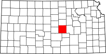 | |
| CDP | ||
| Unincorporated communities | ||
| Townships |
| |
| Footnotes | ‡This populated place also has portions in an adjacent county or counties | |