Caseyville, Illinois
| Caseyville | |
| Village | |
| Country | United States |
|---|---|
| State | Illinois |
| County | St. Clair |
| Coordinates | 38°37′59″N 90°1′58″W / 38.63306°N 90.03278°WCoordinates: 38°37′59″N 90°1′58″W / 38.63306°N 90.03278°W |
| Area | 7.17 sq mi (19 km2) |
| - land | 7.01 sq mi (18 km2) |
| - water | 0.16 sq mi (0 km2) |
| Population | 4,310 (2000) |
| Density | 694.0/sq mi (268/km2) |
| Timezone | CST (UTC-6) |
| - summer (DST) | CDT (UTC-5) |
| Postal code | 62232 |
| Area code | 618 |
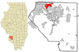 Location in St. Clair County and the state of Illinois.
| |
.svg.png) Location of Illinois in the United States
| |
| Wikimedia Commons: Caseyville, Illinois | |
| Website: www | |
Caseyville is a village in St. Clair County, Illinois, United States. The population was 4,245 at the 2010 census, a decline from 4,310 in 2000.
History
A wealthy man named Charles Harbour built a house here, and in 1845 built a sawmill. There were deposits of coal in the area, and Harbour was one of several members of the Illinois Coal Company, along with Zadok Casey, Walter Seates, Malcomb Robinson, Charles Barrett and John Roy. Casey had held several offices including United States Representative and Lieutenant Governor of Illinois. In 1849, the Illinois Coal Company founded the town and named it for Casey.[1] Coal mining began, and in 1851 the company constructed a railroad to nearby Brooklyn to transport the coal. In 1850 there were about 40 people here, and by 1851 this had increased to about 150; by 1881 the population was approximately 800. The first post office was established here in 1856, and the village was incorporated in May 1869. A school was built in 1872, and a church in 1879.[2]
Geography
Caseyville is located at 38°37′59″N 90°1′58″W / 38.63306°N 90.03278°W (38.633176, -90.032785).[3]
According to the 2010 census, Caseyville has a total area of 7.168 square miles (18.57 km2), of which 7.01 square miles (18.16 km2) (or 97.8%) is land and 0.158 square miles (0.41 km2) (or 2.2%) is water.[4]
Demographics
| Historical population | |||
|---|---|---|---|
| Census | Pop. | %± | |
| 1880 | 658 | — | |
| 1890 | 475 | −27.8% | |
| 1900 | 449 | −5.5% | |
| 1910 | 613 | 36.5% | |
| 1920 | 675 | 10.1% | |
| 1930 | 743 | 10.1% | |
| 1940 | 865 | 16.4% | |
| 1950 | 1,209 | 39.8% | |
| 1960 | 2,455 | 103.1% | |
| 1970 | 3,411 | 38.9% | |
| 1980 | 4,308 | 26.3% | |
| 1990 | 4,419 | 2.6% | |
| 2000 | 4,310 | −2.5% | |
| 2010 | 4,245 | −1.5% | |
| Est. 2015 | 4,045 | [5] | −4.7% |
As of the census[7] of 2000, there were 4,310 people, 1,686 households, and 1,126 families residing in the village. The population density was 694.0 people per square mile (268.0/km²). There were 1,786 housing units at an average density of 287.6 per square mile (111.0/km²). The racial makeup of the village was 89.30% White, 7.84% African American, 0.35% Native American, 0.16% Asian, 1.04% from other races, and 1.30% from two or more races. Hispanic or Latino of any race were 3.53% of the population.
There were 1,686 households out of which 28.2% had children under the age of 18 living with them, 46.4% were married couples living together, 14.5% had a female householder with no husband present, and 33.2% were non-families. 25.8% of all households were made up of individuals and 12.6% had someone living alone who was 65 years of age or older. The average household size was 2.48 and the average family size was 2.98.
In the village the population was spread out with 23.3% under the age of 18, 8.7% from 18 to 24, 27.9% from 25 to 44, 22.2% from 45 to 64, and 17.9% who were 65 years of age or older. The median age was 39 years. For every 100 females there were 93.4 males. For every 100 females age 18 and over, there were 89.5 males.
The median income for a household in the village was $31,512, and the median income for a family was $36,429. Males had a median income of $30,943 versus $20,713 for females. The per capita income for the village was $15,467. About 6.8% of families and 9.8% of the population were below the poverty line, including 15.4% of those under age 18 and 5.6% of those age 65 or over.
Notable people
- Larry Doyle, second baseman for the New York Giants, Chicago Cubs, and New York Giants
- Yadier Molina, catcher for St. Louis Cardinals, resides here
References
- ↑ Callary, Edward (2009). Place Names of Illinois. Urbana, Illinois: University of Illinois Press. p. 61.
- ↑ History of St. Clair County, Illinois. Philadelphia: Brink, McDonough and Company. 1881. pp. 247–248.
- ↑ "US Gazetteer files: 2010, 2000, and 1990". United States Census Bureau. 2011-02-12. Retrieved 2011-04-23.
- ↑ "G001 - Geographic Identifiers - 2010 Census Summary File 1". United States Census Bureau. Retrieved 2015-08-02.
- ↑ "Annual Estimates of the Resident Population for Incorporated Places: April 1, 2010 to July 1, 2015". Retrieved July 2, 2016.
- ↑ "Census of Population and Housing". Census.gov. Archived from the original on April 22, 2013. Retrieved June 4, 2015.
- ↑ "American FactFinder". United States Census Bureau. Archived from the original on 2013-09-11. Retrieved 2008-01-31.
External links
Municipalities and communities of St. Clair County, Illinois, United States | ||
|---|---|---|
| Cities | ||
| Villages | ||
| Townships | ||
| CDPs | ||
| Other unincorporated communities | ||
| Footnotes | ‡This populated place also has portions in an adjacent county or counties | |