Lebanon, Illinois
| Lebanon | |
| City | |
| Country | United States |
|---|---|
| State | Illinois |
| County | St. Clair |
| Coordinates | 38°36′12″N 89°48′41″W / 38.60333°N 89.81139°WCoordinates: 38°36′12″N 89°48′41″W / 38.60333°N 89.81139°W |
| Area | 2.47 sq mi (6 km2) |
| - land | 2.46 sq mi (6 km2) |
| - water | 0.01 sq mi (0 km2) |
| Population | 4,418 (2010) |
| Density | 1,641.4/sq mi (634/km2) |
| Timezone | CST (UTC-6) |
| - summer (DST) | CDT (UTC-5) |
| Postal code | 62254 |
| Area code | 618 |
 Location in St. Clair County and the state of Illinois. | |
.svg.png) Location of Illinois in the United States | |
| Wikimedia Commons: Lebanon, Illinois | |
| Website: www | |
Lebanon is a city in St. Clair County, Illinois, United States. The population was 5,523 at the 2010 census. Like many other places in "Little Egypt" or Southern Illinois, Lebanon was named after the Middle Eastern country of the same name.[1] It is a part of the Metro-East region of the Greater St. Louis metropolitan area.
Lebanon is home to McKendree University, the oldest college in Illinois.
Registered historic places
Geography
Lebanon is located at 38°36′12″N 89°48′41″W / 38.60333°N 89.81139°W (38.603398, -89.811271).[2]
According to the 2010 census, Lebanon has a total area of 2.474 square miles (6.41 km2), of which 2.46 square miles (6.37 km2) (or 99.43%) is land and 0.014 square miles (0.04 km2) (or 0.57%) is water.[3]
Demographics
| Historical population | |||
|---|---|---|---|
| Census | Pop. | %± | |
| 1860 | 1,691 | — | |
| 1870 | 2,117 | 25.2% | |
| 1880 | 1,924 | −9.1% | |
| 1890 | 1,636 | −15.0% | |
| 1900 | 1,812 | 10.8% | |
| 1910 | 1,907 | 5.2% | |
| 1920 | 1,883 | −1.3% | |
| 1930 | 1,828 | −2.9% | |
| 1940 | 1,867 | 2.1% | |
| 1950 | 2,417 | 29.5% | |
| 1960 | 2,863 | 18.5% | |
| 1970 | 3,564 | 24.5% | |
| 1980 | 3,245 | −9.0% | |
| 1990 | 3,688 | 13.7% | |
| 2000 | 3,523 | −4.5% | |
| 2010 | 4,418 | 25.4% | |
| Est. 2015 | 4,467 | [4] | 1.1% |

As of the census[6] of 2010, there were 5,523 people, 2,275 households, and 804 families residing in the city. The population density was 1,641.4 people per square mile (632.7/km²). There were 1,389 housing units at an average density of 647.2 per square mile (249.4/km²). The racial makeup of the city was 78.46% White, 18.45% African American, 0.34% Native American, 0.48% Asian, 0.09% Pacific Islander, 0.40% from other races, and 1.79% from two or more races. Hispanic or Latino of any race were 1.53% of the population.
There were 1,275 households out of which 28.8% had children under the age of 18 living with them, 48.2% were married couples living together, 11.5% had a female householder with no husband present, and 36.9% were non-families. 28.5% of all households were made up of individuals and 12.9% had someone living alone who was 65 years of age or older. The average household size was 2.41 and the average family size was 2.98.
In the city the population was spread out with 20.8% under the age of 18, 18.6% from 18 to 24, 22.9% from 25 to 44, 21.0% from 45 to 64, and 16.7% who were 65 years of age or older. The median age was 36 years. For every 100 females there were 84.7 males. For every 100 females age 18 and over, there were 80.8 males.
The median income for a household in the city was $37,042, and the median income for a family was $48,711. Males had a median income of $30,597 versus $21,341 for females. The per capita income for the city was $17,125. About 9.8% of families and 13.4% of the population were below the poverty line, including 14.2% of those under age 18 and 7.1% of those age 65 or over.
Notable people

- Christine Brewer, Grammy-award winning operatic/classical singer, graduate of McKendree University, has resided in Lebanon, Illinois for many years.
- Ed Busch, MLB shortstop for the St. Louis Browns and Philadelphia Phillies
- Mark Consuelos, daytime soap actor, known for playing Mateo Santos on All My Children, married to Kelly Ripa
- Neal Cotts, a relief pitcher for the Minnesota Twins and formerly of the Milwaukee Brewers, Texas Rangers, Chicago Cubs, Chicago White Sox, and the Oakland Athletics.
- Craig Virgin, two-time world cross-country champion and three-time Olympian in track and field
Schools
Lebanon is home to the oldest founded college in the state of Illinois, McKendree University, and is also home to Lebanon Grade School And Lebanon High School (home of the Greyhounds).
Newspapers
There have been at least a dozen newspapers that have called Lebanon home. The Lebanon Advertiser has operated there since 1911. On December 26, 2013, it was purchased by David Porter. The former owner, Harrison Leon Church, owned the newspaper for 40 years. Except for a few months between Harrison and his father, Leon Church, the Church family owned the newspaper for 75 years.[7]
References
- ↑ Allen, John W. (January 11, 1963). "Place Names Have Colorful History". The Southeast Missourian. p. 6. Retrieved 27 April 2015.
- ↑ "US Gazetteer files: 2010, 2000, and 1990". United States Census Bureau. 2011-02-12. Retrieved 2011-04-23.
- ↑ "G001 - Geographic Identifiers - 2010 Census Summary File 1". United States Census Bureau. Retrieved 2015-12-27.
- ↑ "Annual Estimates of the Resident Population for Incorporated Places: April 1, 2010 to July 1, 2015". Retrieved July 2, 2016.
- ↑ "Census of Population and Housing". Census.gov. Retrieved June 4, 2015.
- ↑ "American FactFinder". United States Census Bureau. Retrieved 2008-01-31.
- ↑ Information provided by David Porter, publisher and editor.
External links
Municipalities and communities of St. Clair County, Illinois, United States | ||
|---|---|---|
| Cities | ||
| Villages | ||
| Townships | ||
| CDPs | ||
| Other unincorporated communities | ||
| Footnotes | ‡This populated place also has portions in an adjacent county or counties | |
| Counties | 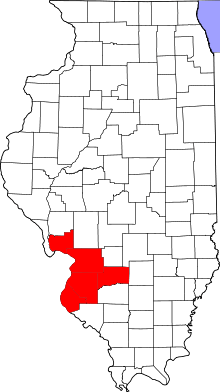 | |
|---|---|---|
| Major Cities (25,000+) | ||
| Cities (5,000-25,000) | ||
| Villages and Towns (1,000-5,000) |
| |
| Interstates in the Metro-East | ||
| Airports/Military Bases | ||
| List of Colleges in the Metro-East | ||
| Sports teams based in the Metro East |
| |
| Topics |  | |
|---|---|---|
| Central city | ||
| Largest cities (over 50,000 in 2010) | ||
| Medium-sized cities (over 20,000 in 2010) | ||
| Largest towns and villages (over 10,000 in 2010) |
| |
| Missouri Counties | ||
| Illinois Counties | ||
| Subregions | ||