St. Clair County, Illinois
| St. Clair County, Illinois | ||
|---|---|---|
 St. Clair County Courthouse, Belleville | ||
| ||
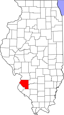
 Location in the U.S. state of Illinois | ||
 Illinois's location in the U.S. | ||
| Founded | 1790 | |
| Named for | Arthur St. Clair | |
| Seat | Belleville | |
| Largest city | Belleville | |
| Area | ||
| • Total | 674 sq mi (1,746 km2) | |
| • Land | 658 sq mi (1,704 km2) | |
| • Water | 16 sq mi (41 km2), 2.4% | |
| Population | ||
| • (2010) | 270,056 | |
| • Density | 411/sq mi (159/km²) | |
| Congressional district | 12th | |
| Time zone | Central: UTC-6/-5 | |
| Website |
www | |
St. Clair County is the oldest county in the U.S. state of Illinois. According to the 2010 census, it had a population of 270,056,[1] making it the eighth most populous county in Illinois and the most populous in the southern portion of the state. Its county seat is Belleville.[2] The county was founded in 1790, before the establishment of Illinois itself, and contains the historic French settlement and former mission, Cahokia Village, founded 1697.
St. Clair County is part of the American Bottom or Metro-East area of the St. Louis, MO-IL Metropolitan Statistical Area.
In 1970, the U.S. Census Bureau placed the mean center of U.S. population in St. Clair County.[3]
History
St. Clair County was the first county established in what is today Illinois. In fact the county antedates Illinois' existence as a separate entity. It was established in 1790 by proclamation of Arthur St. Clair, first governor of the Northwest Territory, who named it after himself. In its original boundaries, St. Clair county covered a large area between the Mackinaw and Ohio Rivers. In 1801, Governor William Henry Harrison re-established St. Clair County as part of the Indiana Territory, extending its northern border to Lake Superior and the international border with Rupert's Land.[4]
In 1809, when the Illinois Territory was created, Territorial Secretary Nathaniel Pope, in his capacity as acting governor, issued a proclamation establishing St. Clair and Randolph County as the two original counties of Illinois.
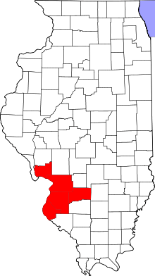
 St. Clair County as it was re-established in 1809. This diagonal border line had been drawn by the Indiana Territorial government in 1803.[5]
 St. Clair County between 1812 and 1813
 St. Clair County between 1813 and 1816
 St. Clair County between 1816 and 1818
 St. Clair County between 1818 and 1825
 St. Clair County between 1825 and 1827
 St. Clair County in 1827, when an adjustment to its border brought it to its present size
Geography
According to the U.S. Census Bureau, the county has a total area of 674 square miles (1,750 km2), of which 658 square miles (1,700 km2) is land and 16 square miles (41 km2) (2.4%) is water.[6]
Urban decay, and urban prairie are common in the formerly industrialized and once heavily populated East St. Louis. Other cities in St. Clair County border agricultural or vacant lands. Unlike the suburbs on the Missouri side of the metro area, those in Metro-East are typically separated by agriculture, or otherwise undeveloped land left after the decline of industry. The central portion of St. Clair county, sitting atop the Mississippi River bluff, is becoming increasingly suburban with new homes being built every year, particularly in Belleville, and its satellite cities. The eastern and southern portion of the county is sparsely populated, dotted with older small communities and small tracts of newer suburban villages between large swathes of corn and soybean fields.
Climate and weather
| Belleville, Illinois | ||||||||||||||||||||||||||||||||||||||||||||||||||||||||||||
|---|---|---|---|---|---|---|---|---|---|---|---|---|---|---|---|---|---|---|---|---|---|---|---|---|---|---|---|---|---|---|---|---|---|---|---|---|---|---|---|---|---|---|---|---|---|---|---|---|---|---|---|---|---|---|---|---|---|---|---|---|
| Climate chart (explanation) | ||||||||||||||||||||||||||||||||||||||||||||||||||||||||||||
| ||||||||||||||||||||||||||||||||||||||||||||||||||||||||||||
| ||||||||||||||||||||||||||||||||||||||||||||||||||||||||||||
In recent years, average temperatures in the county seat of Belleville have ranged from a low of 22 °F (−6 °C) in January to a high of 90 °F (32 °C) in July, although a record low of −27 °F (−33 °C) was recorded in January 1977 and a record high of 117 °F (47 °C) at East St. Louis, Illinois was recorded in July 1954.[8][9][10] Average monthly precipitation ranged from 2.02 inches (51 mm) in January to 4.18 inches (106 mm) in May.[7]
Transportation
Major highways
 Interstate 55
 Interstate 64
 Interstate 70
 Interstate 255
 U.S. Highway 40
 U.S. Highway 50
 Illinois Route 3
 Illinois Route 4
 Illinois Route 13
 Illinois Route 15
 Illinois Route 111
 Illinois Route 156
 Illinois Route 157
 Illinois Route 158
 Illinois Route 159
 Illinois Route 161
 Illinois Route 163
 Illinois Route 177
 Illinois Route 203
Public transit
St. Clair County is home to 11 St. Louis MetroLink stations on the Red and Blue Lines.
- East Riverfront
- 5th & Missouri
- Emerson Park
- Jackie Joyner-Kersee Center
- Washington Park
- Fairview Heights
- Memorial Hospital
- Swansea
- Belleville
- College
- Shiloh-Scott
St. Clair County is also served by Metrobus and Madison County Transit.
Adjacent counties and city
- Madison County (north)
- Clinton County (northeast)
- Washington County (east)
- Randolph County (south)
- Monroe County (southwest)
- St. Louis, Missouri (west)
- St. Louis County, Missouri (west)
Demographics
| Historical population | |||
|---|---|---|---|
| Census | Pop. | %± | |
| 1820 | 5,253 | — | |
| 1830 | 7,078 | 34.7% | |
| 1840 | 13,631 | 92.6% | |
| 1850 | 20,180 | 48.0% | |
| 1860 | 37,694 | 86.8% | |
| 1870 | 51,068 | 35.5% | |
| 1880 | 61,806 | 21.0% | |
| 1890 | 66,571 | 7.7% | |
| 1900 | 86,685 | 30.2% | |
| 1910 | 119,870 | 38.3% | |
| 1920 | 136,520 | 13.9% | |
| 1930 | 157,775 | 15.6% | |
| 1940 | 166,899 | 5.8% | |
| 1950 | 205,995 | 23.4% | |
| 1960 | 262,509 | 27.4% | |
| 1970 | 285,176 | 8.6% | |
| 1980 | 267,531 | −6.2% | |
| 1990 | 262,852 | −1.7% | |
| 2000 | 256,082 | −2.6% | |
| 2010 | 270,056 | 5.5% | |
| Est. 2015 | 264,052 | [11] | −2.2% |
| U.S. Decennial Census[12] 1790-1960[13] 1900-1990[14] 1990-2000[15] 2010-2013[1] | |||
As of the 2010 United States Census, there were 270,056 people, 105,045 households, and 70,689 families residing in the county.[16] The population density was 410.6 inhabitants per square mile (158.5/km2). There were 116,249 housing units at an average density of 176.7 per square mile (68.2/km2).[6] The racial makeup of the county was 64.6% white, 30.5% black or African American, 1.2% Asian, 0.2% American Indian, 0.1% Pacific islander, 1.2% from other races, and 2.2% from two or more races. Those of Hispanic or Latino origin made up 3.3% of the population.[16] In terms of ancestry, 27.5% were German, 11.1% were Irish, 7.4% were English, and 4.6% were American.[17]
Of the 105,045 households, 34.7% had children under the age of 18 living with them, 44.6% were married couples living together, 17.7% had a female householder with no husband present, 32.7% were non-families, and 27.5% of all households were made up of individuals. The average household size was 2.53 and the average family size was 3.09. The median age was 36.9 years.[16]
The median income for a household in the county was $48,562 and the median income for a family was $61,042. Males had a median income of $47,958 versus $34,774 for females. The per capita income for the county was $24,770. About 12.3% of families and 15.5% of the population were below the poverty line, including 24.7% of those under age 18 and 9.7% of those age 65 or over.[18]
Government and infrastructure
The Southwestern Illinois Correctional Center, operated by the Illinois Department of Corrections, is near East St. Louis in St. Clair County.[19]
Also located in St. Clair County is Scott Air Force Base, which is home to U.S. Transportation Command, the Air Force's Air Mobility Command, and the Military Surface Deployment and Distribution Command.
Communities
Cities
Villages
Census-designated places
Unincorporated communities
Townships
St. Clair County is divided into these townships:
See also
References
- 1 2 "State & County QuickFacts". United States Census Bureau. Retrieved July 8, 2014.
- ↑ "Find a County". National Association of Counties. Retrieved 2011-06-07.
- ↑ "Mean Center of Population for the United States: 1790 to 2000" (PDF). United States Census Bureau. Retrieved 2011-09-17.
- ↑ White, Jesse. Origin and Evolution of Illinois Counties. State of Illinois, March 2010.
- ↑ White, Jesse. Origin and Evolution of Illinois Counties. State of Illinois, March 2010.
- 1 2 "Population, Housing Units, Area, and Density: 2010 - County". United States Census Bureau. Retrieved 2015-07-12.
- 1 2 "Monthly Averages for Belleville, Illinois". The Weather Channel. Retrieved 2011-01-27.
- ↑ Westcott, Nancy E. (July 2011). "The Prolonged 1954 Midwestern U.S. Heat Wave: Impacts and Responses". Wea. Climate Soc. 3 (3): 165–76. doi:10.1175/WCAS-D-10-05002.1.
- ↑ "Lessons Learned from 1950s' Heat Wave Show Planning Needed for Future Severe Events" (Press release). Illinois State Water Survey. 2011-05-18. Retrieved 2011-11-04.
- ↑ Westcott, Nancy (2010-01-19). "Impacts of the 1954 Heat Wave". 18th Conference on Applied Climatology. Atlanta, GA: American Meteorological Society.
- ↑ "County Totals Dataset: Population, Population Change and Estimated Components of Population Change: April 1, 2010 to July 1, 2015". Retrieved July 2, 2016.
- ↑ "U.S. Decennial Census". United States Census Bureau. Retrieved July 8, 2014.
- ↑ "Historical Census Browser". University of Virginia Library. Retrieved July 8, 2014.
- ↑ "Population of Counties by Decennial Census: 1900 to 1990". United States Census Bureau. Retrieved July 8, 2014.
- ↑ "Census 2000 PHC-T-4. Ranking Tables for Counties: 1990 and 2000" (PDF). United States Census Bureau. Retrieved July 8, 2014.
- 1 2 3 "DP-1 Profile of General Population and Housing Characteristics: 2010 Demographic Profile Data". United States Census Bureau. Retrieved 2015-07-12.
- ↑ "DP02 SELECTED SOCIAL CHARACTERISTICS IN THE UNITED STATES – 2006-2010 American Community Survey 5-Year Estimates". United States Census Bureau. Retrieved 2015-07-12.
- ↑ "DP03 SELECTED ECONOMIC CHARACTERISTICS – 2006-2010 American Community Survey 5-Year Estimates". United States Census Bureau. Retrieved 2015-07-12.
- ↑ "Southwestern Illinois Correctional Center." Illinois Department of Corrections. Retrieved on July 10, 2010.
External links
 |
Madison County | Clinton County |  | |
| City of St. Louis, Missouri and St. Louis County, Missouri | |
Washington County | ||
| ||||
| | ||||
| Monroe County | Randolph County |
Coordinates: 38°28′N 89°56′W / 38.47°N 89.93°W


