Cenves
| Cenves | |
|---|---|
|
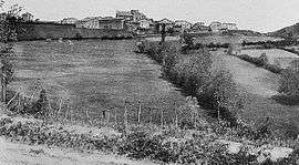
Cenves at the beginning of the 20th century | |
 Cenves | |
|
Location within Auvergne-Rhône-Alpes region  Cenves | |
| Coordinates: 46°16′17″N 4°38′51″E / 46.2714°N 4.6475°ECoordinates: 46°16′17″N 4°38′51″E / 46.2714°N 4.6475°E | |
| Country | France |
| Region | Auvergne-Rhône-Alpes |
| Department | Rhône |
| Arrondissement | Villefranche-sur-Saône |
| Canton | Belleville |
| Intercommunality | Communauté de communes du Haut–Beaujolais |
| Government | |
| • Mayor (2008–2014) | Marcel Guillaumin |
| Area1 | 26.48 km2 (10.22 sq mi) |
| Population (1999)2 | 327 |
| • Density | 12/km2 (32/sq mi) |
| Time zone | CET (UTC+1) |
| • Summer (DST) | CEST (UTC+2) |
| INSEE/Postal code | 69035 / 69840 |
| Elevation |
335–747 m (1,099–2,451 ft) (avg. 620 m or 2,030 ft) |
|
1 French Land Register data, which excludes lakes, ponds, glaciers > 1 km² (0.386 sq mi or 247 acres) and river estuaries. 2 Population without double counting: residents of multiple communes (e.g., students and military personnel) only counted once. | |
Cenves is a commune in the Rhône department in eastern France.
See also
Communes of the Rhône department
References
| Wikimedia Commons has media related to Cenves. |
This article is issued from Wikipedia - version of the 2/11/2016. The text is available under the Creative Commons Attribution/Share Alike but additional terms may apply for the media files.