Lantignié
| Lantignié | |
|---|---|
|
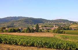
A general view of Lantignié | |
 Lantignié | |
|
Location within Auvergne-Rhône-Alpes region  Lantignié | |
| Coordinates: 46°08′52″N 4°37′27″E / 46.1478°N 4.6242°ECoordinates: 46°08′52″N 4°37′27″E / 46.1478°N 4.6242°E | |
| Country | France |
| Region | Auvergne-Rhône-Alpes |
| Department | Rhône |
| Arrondissement | Villefranche-sur-Saône |
| Canton | Belleville |
| Intercommunality | Communauté de communes de la Région de Beaujeu |
| Government | |
| • Mayor (2008–2014) | Claude-Marie Joubert |
| Area1 | 7.4 km2 (2.9 sq mi) |
| Population (2005)2 | 685 |
| • Density | 93/km2 (240/sq mi) |
| Time zone | CET (UTC+1) |
| • Summer (DST) | CEST (UTC+2) |
| INSEE/Postal code | 69109 / 69430 |
| Elevation |
256–841 m (840–2,759 ft) (avg. 295 m or 968 ft) |
|
1 French Land Register data, which excludes lakes, ponds, glaciers > 1 km² (0.386 sq mi or 247 acres) and river estuaries. 2 Population without double counting: residents of multiple communes (e.g., students and military personnel) only counted once. | |
Lantignié is a commune in the Rhône department in eastern France.
See also
References
| Wikimedia Commons has media related to Lantignié. |
This article is issued from Wikipedia - version of the 10/28/2016. The text is available under the Creative Commons Attribution/Share Alike but additional terms may apply for the media files.