Pusignan
| Pusignan | ||
|---|---|---|
|
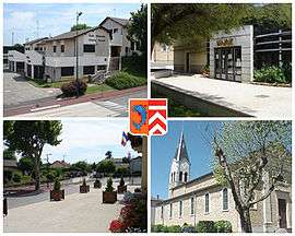
Views of Pusignan, including the town hall and church | ||
| ||
 Pusignan | ||
|
Location within Auvergne-Rhône-Alpes region  Pusignan | ||
| Coordinates: 45°45′23″N 5°04′05″E / 45.7564°N 5.0681°ECoordinates: 45°45′23″N 5°04′05″E / 45.7564°N 5.0681°E | ||
| Country | France | |
| Region | Auvergne-Rhône-Alpes | |
| Department | Rhône | |
| Arrondissement | Villefranche-sur-Saône | |
| Canton | Genas | |
| Intercommunality | Communauté de communes de l'Est Lyonnais | |
| Government | ||
| • Mayor (2014-2020) | Gilbert Marboeuf | |
| Area1 | 13.04 km2 (5.03 sq mi) | |
| Population (2012)2 | 3,730 | |
| • Density | 290/km2 (740/sq mi) | |
| Time zone | CET (UTC+1) | |
| • Summer (DST) | CEST (UTC+2) | |
| INSEE/Postal code | 69285 / 69330 | |
| Elevation |
199–271 m (653–889 ft) (avg. 220 m or 720 ft) | |
|
1 French Land Register data, which excludes lakes, ponds, glaciers > 1 km² (0.386 sq mi or 247 acres) and river estuaries. 2 Population without double counting: residents of multiple communes (e.g., students and military personnel) only counted once. | ||
.svg.png)
Pusignan is a commune in the Rhône department in eastern France.
See also
References
| Wikimedia Commons has media related to Pusignan. |
This article is issued from Wikipedia - version of the 2/12/2016. The text is available under the Creative Commons Attribution/Share Alike but additional terms may apply for the media files.