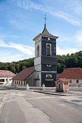
Chapelle-d'Huin
| Chapelle-d'Huin | |
|---|---|
 | |
 Chapelle-d'Huin | |
|
Location within Bourgogne-Franche-Comté region  Chapelle-d'Huin | |
| Coordinates: 46°56′00″N 6°10′03″E / 46.9333°N 6.1675°ECoordinates: 46°56′00″N 6°10′03″E / 46.9333°N 6.1675°E | |
| Country | France |
| Region | Bourgogne-Franche-Comté |
| Department | Doubs |
| Arrondissement | Pontarlier |
| Canton | Levier |
| Intercommunality | Altitude 800 |
| Government | |
| • Mayor (2008–2014) | Dominique Mamet |
| Area1 | 23.71 km2 (9.15 sq mi) |
| Population (2012)2 | 488 |
| • Density | 21/km2 (53/sq mi) |
| Time zone | CET (UTC+1) |
| • Summer (DST) | CEST (UTC+2) |
| INSEE/Postal code | 25122 / 25270 |
| Elevation | 710–893 m (2,329–2,930 ft) |
|
1 French Land Register data, which excludes lakes, ponds, glaciers > 1 km² (0.386 sq mi or 247 acres) and river estuaries. 2 Population without double counting: residents of multiple communes (e.g., students and military personnel) only counted once. | |
Chapelle-d'Huin is a commune in the Doubs department in the Bourgogne-Franche-Comté region in eastern France.
Population
| Historical population | ||
|---|---|---|
| Year | Pop. | ±% |
| 1962 | 385 | — |
| 1968 | 320 | −16.9% |
| 1975 | 252 | −21.3% |
| 1982 | 278 | +10.3% |
| 1990 | 297 | +6.8% |
| 1999 | 351 | +18.2% |
| 2008 | 391 | +11.4% |
| 2012 | 488 | +24.8% |
See also
References
| Wikimedia Commons has media related to Chapelle-d'Huin. |
This article is issued from Wikipedia - version of the 10/29/2016. The text is available under the Creative Commons Attribution/Share Alike but additional terms may apply for the media files.