Church Hill, Tennessee
| Church Hill, Tennessee | |
|---|---|
| City | |
 | |
 Location of Church Hill, Tennessee | |
| Coordinates: 36°31′15″N 82°43′32″W / 36.52083°N 82.72556°W | |
| Country | United States |
| State | Tennessee |
| County | Hawkins |
| Area | |
| • Total | 9.4 sq mi (24.3 km2) |
| • Land | 8.9 sq mi (23.0 km2) |
| • Water | 0.5 sq mi (1.3 km2) |
| Elevation | 1,217 ft (371 m) |
| Population (2010)[1] | |
| • Total | 6,737 |
| • Density | 665.8/sq mi (257.1/km2) |
| Time zone | Eastern (EST) (UTC-5) |
| • Summer (DST) | EDT (UTC-4) |
| ZIP codes | 37642, 37645 |
| Area code(s) | 423 |
| FIPS code | 47-14980[2] |
| GNIS feature ID | 1305931[3] |
| Website |
www |
Church Hill is a city in Hawkins County, Tennessee, United States. The population was 5,916 at the 2000 census and 6,737 at the 2010 census. It is part of the Kingsport–Bristol (TN)–Bristol (VA) Metropolitan Statistical Area, which is a component of the Johnson City–Kingsport–Bristol, TN-VA Combined Statistical Area – commonly known as the "Tri-Cities" region.
History
The city of Church Hill was incorporated in 1958, though the community was established as a trading post and stagecoach stop called Spencer's Mill and Patterson Mill in the late 18th century. The name Church Hill came later, following the establishment of a Methodist church "on the hill" overlooking the Holston River Valley.[4] The church still stands today on Grandview Street.
One of Church Hill's most notable landmarks is the New Canton Plantation and its antebellum mansion, Canton Hall, built by slave labor and owned by the Hord family.[5] Other landmarks include Smith Place, built in the early 20th century, and the former site of Carter's Store, a 1770s-era trading outpost established by Tennessee pioneer John Carter.[6]
Geography
Church Hill is located at 36°31′15″N 82°43′32″W / 36.52083°N 82.72556°W (36.520845, -82.725472).[7] The city is situated among rolling hills on the northern portion of Smith Bend, overlooking the Holston River. The city borders Mount Carmel on the northeast, and the Holston Army Ammunition Plant lies to the southeast. Bays Mountain, a prominent Ridge-and-Valley formation, dominates the horizon to the south.
U.S. Route 11W connects Church Hill with Rogersville to southwest and the Tri-Cities area to the northeast. State Route 346 intersects 11W near the center of the city.
According to the United States Census Bureau, the city has a total area of 9.4 square miles (24 km2), of which 8.9 square miles (23 km2) is land and 0.5 square miles (1.3 km2) (5.23%) is water.
Demographics
| Historical population | |||
|---|---|---|---|
| Census | Pop. | %± | |
| 1960 | 769 | — | |
| 1970 | 2,822 | 267.0% | |
| 1980 | 4,110 | 45.6% | |
| 1990 | 4,834 | 17.6% | |
| 2000 | 5,916 | 22.4% | |
| 2010 | 6,737 | 13.9% | |
| Est. 2015 | 6,719 | [8] | −0.3% |
| Sources:[9][10] | |||
As of the census[2] of 2000, there were 5,916 people, 2,482 households, and 1,772 families residing in the city. The population density was 665.8 people per square mile (256.9/km²). There were 2,709 housing units at an average density of 304.9 per square mile (117.7/km²). The racial makeup of the city was 97.95% White, 1.30% African American, 0.12% Native American, 0.22% Asian, 0.07% from other races, and 0.34% from two or more races. Hispanic or Latino of any race were 0.41% of the population.
There were 2,482 households out of which 29.2% had children under the age of 18 living with them, 59.5% were married couples living together, 9.9% had a female householder with no husband present, and 28.6% were non-families. 25.5% of all households were made up of individuals and 9.1% had someone living alone who was 65 years of age or older. The average household size was 2.34 and the average family size was 2.78.
In the city the population was spread out with 21.4% under the age of 18, 6.5% from 18 to 24, 30.2% from 25 to 44, 26.9% from 45 to 64, and 15.0% who were 65 years of age or older. The median age was 39 years. For every 100 females there were 89.4 males. For every 100 females age 18 and over, there were 85.7 males.
The median income for a household in the city was $36,563, and the median income for a family was $43,423. Males had a median income of $32,305 versus $25,010 for females. The per capita income for the city was $19,656. About 10.0% of families and 12.0% of the population were below the poverty line, including 16.2% of those under age 18 and 10.5% of those age 65 or over.
Arts and culture
Church Hill has one library, Church Hill Public Library, which is part of the Eastern Branch of the Hawkins County Library System. It was founded in 1952, and was moved into a new building in 2007. The library holds over 20,000 materials and services over 6,000 patrons.[11]
Hate group
Church Hill is home to the headquarters of the Ku Klos Knights of the Ku Klux Klan.[12]
Education
Five schools are located in Church Hill city limits: Carter's Valley Elementary, Church Hill Elementary, Church Hill Middle School, Church Hill Intermediate and Volunteer High School.[13] All fall under the Hawkins County Schools system.
Parks and recreation
Church Hill has six parks: A.S. Derrick Park, Jaycees Park, J.W. Sally Park, S.L. Taylor Park, Bill Castle Park, and Church Hill Skate Park. The city also has one swimming pool, Church Hill Municipal Pool.[14]
The City of Church Hill, Town of Mount Carmel, and Town of Surgoinsville have joined together to form a joint Recreation Department. They offer indoor/outdoor soccer, baseball, football, and basketball.[15]
Government and infrastructure
The city is governed by a mayor[16] and six aldermen.[17]
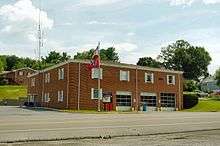
The city has a police department that also provides animal control services [18] and a fire department that handles public safety, hazmat and fire emergencies.[19]
Utilities
Church Hill provides the community with trash pickup, snow and ice removal, mowing and park maintenance services.[20] Residents of the city obtain power services from Holston Electric Cooperative or Appalachian Power. Water services are provided by a private utility, First Utility District of Hawkins County. Hawkins County Gas Utility provides natural gas services and internet and phone services are provided by Charter Communications or CenturyLink.[21]
Notable people
- Lloyd Carr, former football head coach for the University of Michigan was born in Church Hill, and lived there as a child.[22]
- Blake Leeper, 2012 U.S. Paralympian competing in Track & Field.
- James Alan Shelton, Bluegrass guitarist, resides in Church Hill.[23]
References
- ↑ Tennessee Department of Economic and Community Development, Certified Population of Tennessee Incorporated Municipalities and Counties, State of Tennessee official website, 14 July 2011. Retrieved: 6 December 2013.
- 1 2 "American FactFinder". United States Census Bureau. Archived from the original on 2013-09-11. Retrieved 2008-01-31.
- ↑ "US Board on Geographic Names". United States Geological Survey. 2007-10-25. Retrieved 2008-01-31.
- ↑ Larry L. Miller (2001). Tennessee place-names. Indiana University Press. p. 45. ISBN 978-0-253-33984-3. Retrieved 29 January 2012.
- ↑ Katina Rose, "New Canton Plantation Offers Home for Elegant Southern Weddings," Kingsport (TN) Times News, 27 February 2012. Retrieved: 24 July 2015.
- ↑ Tennessee Historical Commission marker 1B4, "Carter's Store," in Church Hill, Tennessee. Accessed at Waymarking.com 24 July 2015.
- ↑ "US Gazetteer files: 2010, 2000, and 1990". United States Census Bureau. 2011-02-12. Retrieved 2011-04-23.
- ↑ "Annual Estimates of the Resident Population for Incorporated Places: April 1, 2010 to July 1, 2015". Retrieved July 2, 2016.
- ↑ "Census of Population and Housing: Decennial Censuses". United States Census Bureau. Retrieved 2012-03-04.
- ↑ "Incorporated Places and Minor Civil Divisions Datasets: Subcounty Resident Population Estimates: April 1, 2010 to July 1, 2012". Population Estimates. U.S. Census Bureau. Archived from the original on 17 June 2013. Retrieved 11 December 2013.
- ↑ "Welcome to the Library!". Residents. City of Church Hill, Tennessee. Retrieved 29 January 2012.
- ↑ https://www.splcenter.org/fighting-hate/intelligence-report/2016/active-hate-groups-united-states-2015
- ↑ "Education". Residents. City of Church Hill, Tennessee. Retrieved 29 January 2012.
- ↑ "City Parks and Pool". Residents. City of Church Hill, Tennessee. Retrieved 29 January 2012.
- ↑ Welcome! Play Ball! City of Church Hill, Tennessee. Retrieved: 24 July 2015.
- ↑ Dennis Deal. "Mayor". Government. City of Church Hill, Tennessee. Retrieved 29 January 2012.
- ↑ "Alderman". Government. City of Church Hill, Tennessee. Retrieved 29 January 2012.
- ↑ "Police Department". Residents. City of Church Hill, Tennessee. Retrieved 29 January 2012.
- ↑ "Church Hill Fire Department". Residents. City of Church Hill, Tennessee. Retrieved 29 January 2012.
- ↑ "Public Works". Residents. City of Church Hill, Tennessee. Retrieved 29 January 2012.
- ↑ "FAQs for new residents". Residents. City of Church Hill, Tennessee. Retrieved 29 January 2012.
- ↑ Dave Link (2008). "Carr grew to appreciate legacy of UT's General". Scripps Interactive Newspapers Group. Retrieved 29 January 2012.
- ↑ John Lupton (2002). "James Alan Shelton clinches his dream". Country Standard Time. Retrieved 29 January 2012.
External links
| Wikimedia Commons has media related to Church Hill, Tennessee. |
Coordinates: 36°31′15″N 82°43′32″W / 36.520845°N 82.725472°W
Municipalities and communities of Hawkins County, Tennessee, United States | ||
|---|---|---|
| Cities | ||
| Towns | ||
| CDP | ||
| Unincorporated communities | ||
| Ghost town | ||
| Footnotes | ‡This populated place also has portions in an adjacent county or counties | |