Cierp-Gaud
| Cierp-Gaud | ||
|---|---|---|
 | ||
| ||
 Cierp-Gaud | ||
|
Location within Occitanie region  Cierp-Gaud | ||
| Coordinates: 42°54′59″N 0°38′22″E / 42.9164°N 0.6394°ECoordinates: 42°54′59″N 0°38′22″E / 42.9164°N 0.6394°E | ||
| Country | France | |
| Region | Occitanie | |
| Department | Haute-Garonne | |
| Arrondissement | Saint-Gaudens | |
| Canton | Saint-Béat | |
| Intercommunality | Canton de Saint-Béat | |
| Government | ||
| • Mayor (2008–2014) | Joël Gros | |
| Area1 | 13.90 km2 (5.37 sq mi) | |
| Population (2008)2 | 917 | |
| • Density | 66/km2 (170/sq mi) | |
| Time zone | CET (UTC+1) | |
| • Summer (DST) | CEST (UTC+2) | |
| INSEE/Postal code | 31144 / 31440 | |
| Elevation | 460–1,840 m (1,510–6,040 ft) | |
|
1 French Land Register data, which excludes lakes, ponds, glaciers > 1 km² (0.386 sq mi or 247 acres) and river estuaries. 2 Population without double counting: residents of multiple communes (e.g., students and military personnel) only counted once. | ||
.svg.png)
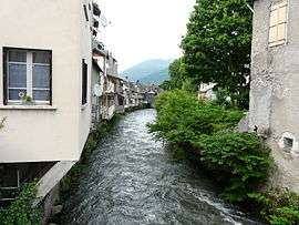
Cierp-Gaud is a commune in the Haute-Garonne department in southwestern France.
Population
| Historical population | ||
|---|---|---|
| Year | Pop. | ±% |
| 1962 | 922 | — |
| 1968 | 954 | +3.5% |
| 1975 | 950 | −0.4% |
| 1982 | 944 | −0.6% |
| 1990 | 990 | +4.9% |
| 1999 | 862 | −12.9% |
| 2008 | 917 | +6.4% |
See also
References
| Wikimedia Commons has media related to Cierp-Gaud. |
This article is issued from Wikipedia - version of the 3/19/2014. The text is available under the Creative Commons Attribution/Share Alike but additional terms may apply for the media files.