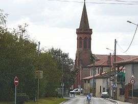
Saint-Hilaire, Haute-Garonne
| Saint-Hilaire | ||
|---|---|---|
 | ||
| ||
 Saint-Hilaire | ||
|
Location within Occitanie region  Saint-Hilaire | ||
| Coordinates: 43°25′25″N 1°16′44″E / 43.4236°N 1.2789°ECoordinates: 43°25′25″N 1°16′44″E / 43.4236°N 1.2789°E | ||
| Country | France | |
| Region | Occitanie | |
| Department | Haute-Garonne | |
| Arrondissement | Muret | |
| Canton | Muret | |
| Intercommunality | Muretain | |
| Government | ||
| • Mayor (2008–2014) | José Pardillos | |
| Area1 | 6.33 km2 (2.44 sq mi) | |
| Population (2008)2 | 1,070 | |
| • Density | 170/km2 (440/sq mi) | |
| Time zone | CET (UTC+1) | |
| • Summer (DST) | CEST (UTC+2) | |
| INSEE/Postal code | 31486 / 31410 | |
| Elevation |
175–198 m (574–650 ft) (avg. 182 m or 597 ft) | |
|
1 French Land Register data, which excludes lakes, ponds, glaciers > 1 km² (0.386 sq mi or 247 acres) and river estuaries. 2 Population without double counting: residents of multiple communes (e.g., students and military personnel) only counted once. | ||

Saint-Hilaire is a commune in the Haute-Garonne department in southwestern France.
Population
| Historical population | ||
|---|---|---|
| Year | Pop. | ±% |
| 1962 | 234 | — |
| 1968 | 315 | +34.6% |
| 1975 | 389 | +23.5% |
| 1982 | 459 | +18.0% |
| 1990 | 504 | +9.8% |
| 1999 | 708 | +40.5% |
| 2008 | 1,070 | +51.1% |
See also
References
| Wikimedia Commons has media related to Saint-Hilaire (Haute-Garonne). |
This article is issued from Wikipedia - version of the 4/4/2014. The text is available under the Creative Commons Attribution/Share Alike but additional terms may apply for the media files.