Aurin, Haute-Garonne
| Aurin | |
|---|---|
 | |
 Aurin | |
|
Location within Occitanie region  Aurin | |
| Coordinates: 43°32′15″N 1°41′03″E / 43.5375°N 1.6842°ECoordinates: 43°32′15″N 1°41′03″E / 43.5375°N 1.6842°E | |
| Country | France |
| Region | Occitanie |
| Department | Haute-Garonne |
| Arrondissement | Toulouse |
| Canton | Lanta |
| Government | |
| • Mayor (2008–2014) | Claude Latapie |
| Area1 | 7.49 km2 (2.89 sq mi) |
| Population (2008)2 | 284 |
| • Density | 38/km2 (98/sq mi) |
| Time zone | CET (UTC+1) |
| • Summer (DST) | CEST (UTC+2) |
| INSEE/Postal code | 31029 / 31570 |
| Elevation |
167–265 m (548–869 ft) (avg. 225 m or 738 ft) |
|
1 French Land Register data, which excludes lakes, ponds, glaciers > 1 km² (0.386 sq mi or 247 acres) and river estuaries. 2 Population without double counting: residents of multiple communes (e.g., students and military personnel) only counted once. | |
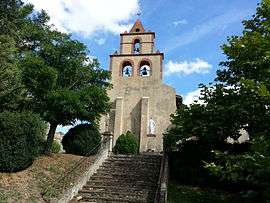
Aurin is a commune in the Haute-Garonne department in southwestern France.
Population
| Historical population | ||
|---|---|---|
| Year | Pop. | ±% |
| 1962 | 158 | — |
| 1968 | 168 | +6.3% |
| 1975 | 169 | +0.6% |
| 1982 | 177 | +4.7% |
| 1990 | 177 | +0.0% |
| 1999 | 245 | +38.4% |
| 2008 | 284 | +15.9% |
See also
References
| Wikimedia Commons has media related to Aurin (Haute-Garonne). |
This article is issued from Wikipedia - version of the 3/19/2014. The text is available under the Creative Commons Attribution/Share Alike but additional terms may apply for the media files.