Montesquieu-Lauragais
| Montesquieu-Lauragais | ||
|---|---|---|
|
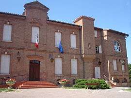
Town hall | ||
| ||
 Montesquieu-Lauragais | ||
|
Location within Occitanie region  Montesquieu-Lauragais | ||
| Coordinates: 43°25′02″N 1°37′46″E / 43.4172°N 1.6294°ECoordinates: 43°25′02″N 1°37′46″E / 43.4172°N 1.6294°E | ||
| Country | France | |
| Region | Occitanie | |
| Department | Haute-Garonne | |
| Arrondissement | Toulouse | |
| Canton | Villefranche-de-Lauragais | |
| Government | ||
| • Mayor (2008–2014) | Claude Lafon | |
| Area1 | 24.75 km2 (9.56 sq mi) | |
| Population (2008)2 | 905 | |
| • Density | 37/km2 (95/sq mi) | |
| Time zone | CET (UTC+1) | |
| • Summer (DST) | CEST (UTC+2) | |
| INSEE/Postal code | 31374 / 31450 | |
| Elevation | 158–274 m (518–899 ft) | |
|
1 French Land Register data, which excludes lakes, ponds, glaciers > 1 km² (0.386 sq mi or 247 acres) and river estuaries. 2 Population without double counting: residents of multiple communes (e.g., students and military personnel) only counted once. | ||
.svg.png)
Montesquieu-Lauragais is a commune in the Haute-Garonne department in southwestern France.
Population
| Historical population | ||
|---|---|---|
| Year | Pop. | ±% |
| 1962 | 612 | — |
| 1968 | 646 | +5.6% |
| 1975 | 564 | −12.7% |
| 1982 | 654 | +16.0% |
| 1990 | 742 | +13.5% |
| 1999 | 846 | +14.0% |
| 2008 | 905 | +7.0% |
See also
References
| Wikimedia Commons has media related to Montesquieu-Lauragais. |
This article is issued from Wikipedia - version of the 3/31/2014. The text is available under the Creative Commons Attribution/Share Alike but additional terms may apply for the media files.