Bryan–College Station
| Bryan-College Station | |
|---|---|
| Metropolitan Statistical Area | |
|
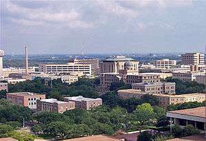
Texas A&M University | |
 Map of Texas highlighting the Bryan-College Station Metropolitan Area. | |
| Country |
|
| State |
|
| Principal cities |
|
| Area | |
| • Urban | 71.4 sq mi (185 km2) |
| Population (2014)[1] | |
| • Urban | 178,111 (197th) |
| • Urban density | 2,399/sq mi (926/km2) |
| • MSA | 251,252 (190th) |
| Time zone | CST (UTC-6) |
| • Summer (DST) | CDT (UTC-5) |
The Bryan-College Station is a metropolitan area centering on the twin cities of Bryan and College Station in the Brazos Valley region of Texas. The 2010 Census placed the population of the three county metropolitan area at 255,519.[2]
The area's economic and social life is centered on the main campus of Texas A&M University in College Station; thus, the area is popularly known as "Aggieland" in reference to the Aggies nickname for the university's sports teams and students.
Counties
Communities
Places with more than 75,000 people
Places with 1,000 to 7,000 people
Places with fewer than 1,000 people
Unincorporated places
- Bedias
- Benchley
- Chriesman
- Deanville
- Easterly
- Frenstat
- Hammond
- Iola
- Lyons
- Mumford
- New Baden
- Ridge
- Tidwell Prairie
- Wheelock
Metropolitian Statistical Area
The College Station–Bryan, TX Metropolitan Statistical Area (MSA) encompasses three counties: Brazos, Burleson, and Robertson. The College Station–Bryan MSA encompasses 2,123 sq mi (5,524 km2) of area, of which 2,100 sq mi (5,439 km2) is land and 33.5 sq mi (87 km2) is water.
Demographics
| Historical populations | |||
|---|---|---|---|
| Census | Pop. | %± | |
| 1960 | 44,895 | — | |
| 1970 | 57,978 | 29.1% | |
| 1980 | 93,588 | 61.4% | |
| 1990 | 121,862 | 30.2% | |
| 2000 | 184,885 | 51.7% | |
| 2010 | 228,660 | 23.7% | |
| Est. 2012 | 234,501 | 2.6% | |
As of the census[3] of 2000, there were 184,885 people, 67,744 households, and 39,346 families residing within the MSA. The racial makeup of the MSA was 63.71% White, 30.27% African American, 0.38% Native American, 3.33% Asian, 0.06% Pacific Islander, 8.30% from other races, and 1.95% from two or more races. Hispanic or Latino of any race were 17.32% of the population.
The median income for a household in the MSA was $30,339 and the median income for a family was $40,442. Males had a median income of $30,818 versus $21,951 for females. The per capita income for the MSA was $15,847.
See also
- List of cities in Texas
- Texas census statistical areas
- List of Texas metropolitan areas
- Brazos Valley, the geographic region of Texas in which the area is located
- Texas Triangle
References
- ↑ "Table 1. Annual Estimates of the Population of Metropolitan and Micropolitan Statistical Areas: April 1, 2010 to July 1, 2012". 2012 Population Estimates. United States Census Bureau, Population Division. Retrieved 2014-03-15.
- ↑ "Table 1. Annual Estimates of the Population of Metropolitan and Micropolitan Statistical Areas: April 1, 2000 to July 1, 2009 (CBSA-EST2009-01)". 2009 Population Estimates (CSV). United States Census Bureau, Population Division. 2010-03-23.
- ↑ "American FactFinder". United States Census Bureau. Archived from the original on September 11, 2013. Retrieved 2008-01-31.
External links
| Wikivoyage has a travel guide for Bryan-College Station. |
- The City of College Station
- The City of Bryan
- Bryan/College Station Chamber of Commerce
- Bryan/College Station Convention and Visitors Bureau
Coordinates: 30°38′00″N 96°20′26″W / 30.633468°N 96.340556°W
