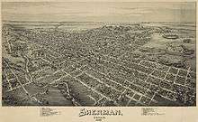
Sherman, Texas
| Sherman, Texas | |
|---|---|
| City | |
|
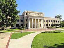
Paul Brown United States Courthouse in Sherman | |
| Motto: "Classic Town. Broad Horizon." | |
 Location of Sherman, Texas | |
| Coordinates: 33°38′28″N 96°36′36″W / 33.64111°N 96.61000°WCoordinates: 33°38′28″N 96°36′36″W / 33.64111°N 96.61000°W | |
| Country |
|
| State |
|
| County | Grayson |
| Founded | 1846 |
| Government | |
| • Type | Council-Manager |
| • City Council |
Mayor Aldo Ramirez Deputy Mayor Jason Sofey Aaron Soltero Pamela Howeth Terrence Steele Lawrence Davis Tammy Johnson |
| • City Manager | Bryan Carrasco |
| Area | |
| • City | 38.6 sq mi (100.0 km2) |
| • Land | 38.5 sq mi (99.8 km2) |
| • Water | 0.1 sq mi (0.2 km2) |
| • Urban | 35.9 sq mi (93.1 km2) |
| • Metro | 979 sq mi (2,536 km2) |
| Elevation | 735 ft (224 m) |
| Population (2010) | |
| • City | 38,521 |
| • Density | 977.5/sq mi (384.8/km2) |
| • Urban | 61,900 [1] (US: 438th) |
| • Urban density | 1,722.9/sq mi (665.2/km2) |
| • Metro | 120,877 |
| • Metro density | 130/sq mi (50/km2) |
| Time zone | Central (CST) (UTC-6) |
| • Summer (DST) | CDT (UTC-5) |
| ZIP codes | 75090-75092 |
| Area code(s) | 903 |
| FIPS code | 48-67496[2] |
| GNIS feature ID | 1368131[3] |
| Website | CityOfSherman.com |

Sherman is a city in and the county seat of Grayson County, Texas, United States.[4] The city's population in 2010 was 38,521.[5] It is also one of two principal cities in the Sherman–Denison Metropolitan Statistical Area. It is also a part of the Texoma region.
History
Sherman was named after General Sidney Sherman (July 23, 1805 – August 1, 1873), a hero of the Texas Revolution. The community was designated as the county seat by the act of the Texas legislature which created Grayson County on March 17, 1846. In 1847, a post office began operation. Sherman was originally located at the center of the county, but in 1848 it was moved about three miles (5 km) east to its current location. By 1850, Sherman had become an incorporated town under Texas law. It had also become a stop on the Butterfield Overland Mail route through Texas. By 1852, Sherman had a population of 300. It consisted of a public square with a log court house, and several businesses, a district clerk's office, and a church along the east side of the square.
During the 1850s and 1860s, Sherman continued to develop and it participated in the regional politics. The first flour mill was built in 1861. In 1862 the publisher of Sherman's anti-secessionist Whig newspaper, the Patriot, was murdered. During and after the Civil War, north Texas outlaw bands led by Jesse James and William Quantrill were seen in Sherman. Years later, James spent at least part of his honeymoon in Sherman, where he was photographed on horseback.
Education also developed in north Texas during this time. The Sherman Male and Female High School started accepting students during 1866, under the patronage of the North Texas Methodist Conference. It was one of three private schools in Sherman at the time. This school operated under several names (North Texas Female College and Conservatory of Music beginning in 1892 and Kidd-Key College and Conservatory beginning in 1919) until 1935.[6] It gradually lost Methodist support, after the opening of Southern Methodist University in 1915 in Dallas, TX. In 1876, Austin College, the oldest continuously operating college in Texas, relocated from Huntsville to Sherman. Sherman Female Institute, later known as Mary Nash College,[7] opened in 1877 under sponsorship of the Baptist Church. It continued operation until 1901 when the campus was sold to Kidd-Key College. Carr-Burdette College, a women's college affiliated with Disciples of Christ, operated there from 1894 to 1929. Jews have had a long history in Sherman, too, settling in the area and meeting for the High Holidays by 1873.[8]
While there was general depression and lawlessness during Reconstruction, Sherman remained commercially active. During the 1870s Sherman's population reached 6000. In 1875, two fires destroyed many buildings east of the square. They were rebuilt with superior materials. This included a new Grayson County Courthouse built in 1876. In 1879, Old Settlers' Association of North Texas formed and met near Sherman. The Old Settlers' Association of Grayson County incorporated in 1898 and completed purchase of Old Settlers' Park in 1909.
On May 15, 1896, a tornado measuring F5 on the Fujita scale struck Sherman. The tornado had a damage path 400 yards (370 m) wide and 28 miles (45 km) long, killing 73 people and injuring 200. About 50 homes were destroyed, with 20 of them being completely obliterated.
In 1901 the first electric "Interurban" railway in Texas, the Denison and Sherman Railway, was completed between Sherman and Denison, Texas.[9] The Texas Traction Company completed a 65-mile (105 km) interurban between Sherman and Dallas, Texas in 1908 and it purchased the Denison and Sherman Railway in 1911. Through the connections in Dallas and Denison, it was possible to travel to Terrell, Texas; Corsicana, Texas; Waco, Texas; Fort Worth, Texas; Cleburne, Texas; Denton, Texas; and to Durant, Oklahoma by interurban railways. One popular destination on the Interurban between Sherman and Denison was Wood Lake Park, a private amusement park at the time. By 1948, all interurban rail service in Texas had been discontinued.
During the Sherman Riot of 1930 (May 9, 1930),[10] Sherman's elegant 1876 courthouse was burned down by arson during the trial of an African American man, George Hughes. During the riot, Hughes was locked in the vault at the courthouse and died in the fire. After rioters retrieved Hughes' body from the vault, it was dragged behind a car, hanged, and set afire. Texas Ranger Frank Hamer was in Sherman during this riot and reported the situation to Texas Governor Dan Moody.[11] Governor Moody sent National Guard troops to Sherman on May 9 and more on May 10 to control the situation. Fourteen men were later indicted. Two were convicted, of arson and rioting.[10]
Geography
The city has a total area of 38.6 square miles (100 km2), of which, 38.5 square miles (100 km2) of it is land and 0.1 square miles (0.26 km2) of it (0.18%) is water.[12]
Sherman is located about 65 miles (105 km) northeast of Dallas.[13]
Climate
Sherman is considered to be part of the humid subtropical area.
Demographics
| Historical population | |||
|---|---|---|---|
| Census | Pop. | %± | |
| 1850 | 35 | — | |
| 1860 | 613 | 1,651.4% | |
| 1870 | 1,439 | 134.7% | |
| 1880 | 6,093 | 323.4% | |
| 1890 | 7,335 | 20.4% | |
| 1900 | 10,243 | 39.6% | |
| 1910 | 12,412 | 21.2% | |
| 1920 | 15,031 | 21.1% | |
| 1930 | 15,713 | 4.5% | |
| 1940 | 17,156 | 9.2% | |
| 1950 | 20,150 | 17.5% | |
| 1960 | 24,988 | 24.0% | |
| 1970 | 29,061 | 16.3% | |
| 1980 | 30,413 | 4.7% | |
| 1990 | 31,601 | 3.9% | |
| 2000 | 35,082 | 11.0% | |
| 2010 | 38,521 | 9.8% | |
| Est. 2015 | 40,667 | [14] | 5.6% |
As of the 2000 census,[2] there were 35,082 people, 13,739 households, and 8,820 families residing in the city. The population density was 910.0 people per square mile (351.4/km²). There were 14,926 housing units at an average density of 387.2/sq mi (149.5/km²). The racial makeup of the city was 78.46% White, 11.23% African American, 1.33% Native American, 1.06% Asian, 0.03% Pacific Islander, 5.26% from other races, and 2.62% from two or more races. Hispanic or Latino of any race were 12.14% of the population.
There were 13,739 households out of which 30.9% had children under the age of 18 living with them, 46.7% were married couples living together, 13.4% had a female householder with no husband present, and 35.8% were non-families. 30.4% of all households were made up of individuals and 12.5% had someone living alone who was 65 years of age or older. The average household size was 2.42 and the average family size was 3.01.
In the city the population was spread out with 24.6% under the age of 18, 13.1% from 18 to 24, 27.8% from 25 to 44, 19.3% from 45 to 64, and 15.1% who were 65 years of age or older. The median age was 34 years. For every 100 females there were 92.1 males. For every 100 females age 18 and over, there were 89.3 males.
The median income for a household in the city is $34,211, and the median income for a family is $42,528. Males have a median income of $31,828 versus $23,363 for females. The per capita income for the city is $18,717. About 9.6% of families and 13.3% of the population were below the poverty line, including 14.7% of those under the age of 18 and 11.7% of those 65 and older.
Government
The Texas Department of Criminal Justice (TDCJ) operates the Sherman District Parole Office in Sherman.[16]
Education
Public schools
Most children in Sherman are zoned to the Sherman Independent School District, which includes Sherman High School. Some parts are in Denison Independent School District or Howe Independent School District.
Private schools
A small percent of children attend one of the four private schools in Sherman. The four schools are Grayson Christian School, Cornerstone Christian Academy, St. Mary's Catholic School, and Texoma Christian School.
Colleges and universities
Austin College, a private, Presbyterian, liberal arts college, relocated to Sherman in 1876. Founded in 1849, it is the oldest college or university in Texas operating under its original charter. Grayson County College, based in neighboring Denison, operates a branch campus in Sherman.
Libraries
The Sherman Public Library serves the city.
Media

Magazine
- Texoma Living! Magazine[17]
Newspaper
Radio stations
- KLAK Adult Contemporary 97.5
- KMAD Mad Rock 102.5
- KMKT Katy Country 93.1
- KDOC Doc FM 107.3
Television stations
- KTEN Channel 10 - (NBC)
- KTEN DT Channel 10.2 - (The CW Texoma)
- KTEN DT Channel 10.3 - (ABC)
- KXII Channel 12 - (CBS)
- KXII DT Channel 12.2 (My Texoma)
- KXII DT Channel 12.3 (Fox Texoma)
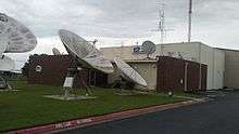
Infrastructure
.jpg)
Transportation
Sherman is served by two U.S. Highways: US 75 (Sam Rayburn Freeway) and US 82 (the latter is locally designated as the Buck Owens Freeway after the famous musician who was born in Sherman). It is also served by three Texas State Highways, which extend beyond Grayson County: State Highway 11, State Highway 56, and State Highway 91 (Texoma Parkway) which is one of the main commercial strips that connects Sherman and Denison and also extends to Lake Texoma.

General aviation service is provided by Sherman Municipal Airport and North Texas Regional Airport/Perrin Field in Denison.

TAPS Public Transit is the sole transit provider for Sherman, with two fixed routes (the Roo and Viking Routes), and curb to curb paratransit for all residents. TAPS Public Transit also provides routes connecting Sherman to Dallas (via the DART Plano Park-and-Ride), to DFW International Airport, and other cities in the Texoma region.[18]
Medical Care
The city of Sherman is served by Wilson N. Jones Regional Medical Center.
Top Employers

- Tyson Foods
- Texas Instruments
- Sherman Independent School District
- Grayson County
- City of Sherman
- Cooper B-Line Systems
- West Asset Management
- Austin College
- Fisher Controls/ Emerson Process Management
- Kaiser Aluminum
- Presco Products
- Progress Rail Services
- Consolidated Containers
- Plyler Construction
- Starr Aircraft
- ACTI Tech
- Douglass Distributing
- GCEC
- GlobiTech
- Sunny Delight Beverages Co.
- TXU Oncor
- Verizon[19]
Notable people
See also
References
- ↑ Census of Urban areas
- 1 2 "American FactFinder". United States Census Bureau. Retrieved 2008-01-31.
- ↑ "US Board on Geographic Names". United States Geological Survey. 2007-10-25. Retrieved 2008-01-31.
- ↑ "Find a County". National Association of Counties. Retrieved 2011-06-07.
- ↑ Population Finder
- ↑ Handbook of Texas Online, s.v. "Kidd-Key College", (accessed March 18, 2007)
- ↑ Handbook of Texas Online, s.v. "Mary Nash College", (accessed March 18, 2007)
- ↑ "Sherman/Denison, Texas", found in the Encyclopedia of Southern Jewish Communities,
- ↑ Handbook of Texas Online, s.v. "Electric Interurban Railways" (accessed March 31, 2007)
- 1 2 Nolan Thompson, "SHERMAN RIOT OF 1930," Handbook of Texas Online (http://www.tshaonline.org/handbook/online/articles/jcs06), accessed June 04, 2015. Uploaded on June 15, 2010. Modified on February 7, 2014. Published by the Texas State Historical Association.
- ↑ Statement of Frank Hamer on May 13, 1930 (accessed March 6, 2007)
- ↑ "US Gazetteer files: 2010, 2000, and 1990". United States Census Bureau. 2011-02-12. Retrieved 2011-04-23.
- ↑ Christian, Carol. "Texas man sues after debt collector calls during visit to bathroom." Houston Chronicle. September 24, 2013. Retrieved on December 17, 2013.
- ↑ "Annual Estimates of the Resident Population for Incorporated Places: April 1, 2010 to July 1, 2015". Retrieved July 2, 2016.
- ↑ "Census of Population and Housing". Census.gov. Retrieved June 4, 2015.
- ↑ "Parole Division Region II." Texas Department of Criminal Justice. Retrieved on May 15, 2010.
- ↑ "Search every page of every issue published by Texoma Living! Magazine from 2006 to 2010.". Texoma Living! Online. Retrieved 16 July 2015.
- ↑ "TAPS Public Transit". TAPS Public Transit. Retrieved 16 July 2015.
- ↑ "Denison Development Alliance: Community Profile". www.denisontx.org. Retrieved 2016-06-04.
Further reading
- Grayson County Frontier Village, The History of Grayson County Texas, Hunter Publishing Co., Winston-Salem, North Carolina, 1979.
- Redshaw, Peggy A., “Sherman, Texas, and the 1918 Pandemic Flu,” East Texas Historical Journal, 51 (Spring 2013), 67–85.
External links
| Wikimedia Commons has media related to Sherman, Texas. |
Municipalities and communities of Grayson County, Texas, United States | ||
|---|---|---|
| Cities |  | |
| Towns | ||
| CDPs |
| |
| Other unincorporated communities | ||
| Footnotes | ‡This populated place also has portions in an adjacent county or counties | |
