Columbus Grove, Ohio
| Columbus Grove, Ohio | |
|---|---|
| Village | |
|
Buildings in downtown Columbus Grove | |
| Nickname(s): Grove | |
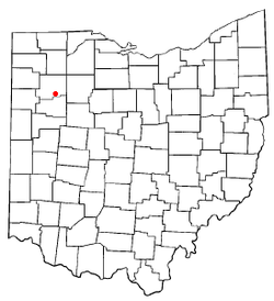 Location of Columbus Grove, Ohio | |
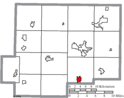 Location of Columbus Grove in Putnam County | |
| Coordinates: 40°55′10″N 84°3′36″W / 40.91944°N 84.06000°WCoordinates: 40°55′10″N 84°3′36″W / 40.91944°N 84.06000°W | |
| Country | United States |
| State | Ohio |
| County | Putnam |
| Area[1] | |
| • Total | 1.08 sq mi (2.80 km2) |
| • Land | 1.08 sq mi (2.80 km2) |
| • Water | 0 sq mi (0 km2) |
| Elevation[2] | 774 ft (236 m) |
| Population (2010)[3] | |
| • Total | 2,137 |
| • Estimate (2012[4]) | 2,094 |
| • Density | 1,978.7/sq mi (764.0/km2) |
| Time zone | Eastern (EST) (UTC-5) |
| • Summer (DST) | EDT (UTC-4) |
| ZIP code | 45830 |
| Area code(s) | 419 |
| FIPS code | 39-18014[5] |
| GNIS feature ID | 1056830[2] |
| Website | http://www.columbusgrove.org/ |

Columbus Grove is a village in Putnam County, Ohio, United States. The population was 2,137 at the 2010 census.
Etymology and history
Columbus Grove was founded in 1842.[6] A large share of the early settlers being natives of Columbus, Ohio caused the name to be selected.[7] A post office called Columbus Grove has been in operation since 1862.[8] The village was incorporated in 1864.[9]
Geography
Columbus Grove is located at 40°55′10″N 84°3′36″W / 40.91944°N 84.06000°W (40.919437, -84.059999).[10]
According to the United States Census Bureau, the village has a total area of 1.08 square miles (2.80 km2), all land.[1]
Demographics
| Historical population | |||
|---|---|---|---|
| Census | Pop. | %± | |
| 1850 | 118 | — | |
| 1870 | 578 | — | |
| 1880 | 1,392 | 140.8% | |
| 1890 | 1,677 | 20.5% | |
| 1900 | 1,935 | 15.4% | |
| 1910 | 1,802 | −6.9% | |
| 1920 | 1,768 | −1.9% | |
| 1930 | 1,633 | −7.6% | |
| 1940 | 1,737 | 6.4% | |
| 1950 | 1,936 | 11.5% | |
| 1960 | 2,104 | 8.7% | |
| 1970 | 2,290 | 8.8% | |
| 1980 | 2,313 | 1.0% | |
| 1990 | 2,231 | −3.5% | |
| 2000 | 2,200 | −1.4% | |
| 2010 | 2,137 | −2.9% | |
| Est. 2015 | 2,063 | [11] | −3.5% |
2010 census
As of the census[3] of 2010, there were 2,137 people, 858 households, and 594 families residing in the village. The population density was 1,978.7 inhabitants per square mile (764.0/km2). There were 916 housing units at an average density of 848.1 per square mile (327.5/km2). The racial makeup of the village was 94.2% White, 0.6% Native American, 0.2% Asian, 1.8% from other races, and 2.3% from two or more races. Hispanic or Latino of any race were 4.8% of the population.
There were 858 households of which 34.3% had children under the age of 18 living with them, 51.2% were married couples living together, 12.9% had a female householder with no husband present, 5.1% had a male householder with no wife present, and 30.8% were non-families. 27.4% of all households were made up of individuals and 12.6% had someone living alone who was 65 years of age or older. The average household size was 2.49 and the average family size was 3.03.
The median age in the village was 37.1 years. 27.7% of residents were under the age of 18; 8.9% were between the ages of 18 and 24; 23.8% were from 25 to 44; 23.8% were from 45 to 64; and 15.8% were 65 years of age or older. The gender makeup of the village was 48.6% male and 51.4% female.
2000 census
At the 2000 census,[5] there were 2,200 people, 880 households and 616 families residing in the village. The population density was 2,144.9 per square mile (824.7/km²). There were 927 housing units at an average density of 903.8 per square mile (347.5/km²). The racial makeup of the village was 97.50% White, 0.50% Native American, 0.05% Asian, 1.36% from other races, and 0.59% from two or more races. Hispanic or Latino of any race were 3.73% of the population.
There were 880 households of which 343.5% had children under the age of 18 living with them, 53.1% were married couples living together, 12.8% had a female householder with no husband present, and 30.0% were non-families. 27.2% of all households were made up of individuals and 13.6% had someone living alone who was 65 years of age or younger. The average household size was 2.50 and the average family size was 3.05.
27.1% of the population were under the age of 18, 9.7% from 18 to 24, 27.4% from 25 to 44, 20.9% from 45 to 64, and 15.0% who were 65 years of age or older. The median age was 35 years. For every 100 females there were 90.8 males. For every 100 females age 18 and over, there were 90.4 males.
The median household income was $42,409 and the median family income was $48,750. Males had a median income of $37,434 compared with $21,875 for females. The per capita income for the village was $18,316. About 4.6% of families and 5.3% of the population were below the poverty line, including 7.2% of those under age 18 and 6.6% of those age 65 or over.
Government
Columbus Grove is governed by a mayor-council government.[13]
Education
Columbus Grove High School is a public high school located in Columbus Grove. A new high school and gymnasium was built in 2012. Saint Anthony's is a private catholic school in Columbus Grove.
Notable people
- Dean Jagger — actor
- Justin LeHew — highly decorated US Marine
References
- 1 2 "US Gazetteer files 2010". United States Census Bureau. Archived from the original on 2012-07-14. Retrieved 2013-01-06.
- 1 2 "US Board on Geographic Names". United States Geological Survey. 2007-10-25. Retrieved 2008-01-31.
- 1 2 "American FactFinder". United States Census Bureau. Retrieved 2013-01-06.
- ↑ "Population Estimates". United States Census Bureau. Archived from the original on 2013-06-17. Retrieved 2013-06-17.
- 1 2 "American FactFinder". United States Census Bureau. Archived from the original on 2013-09-11. Retrieved 2008-01-31.
- ↑ Warren, Robert (May 31, 1953). "Blanchard River Brought Pioneers To Putnam". Toledo Blade. p. 3. Retrieved 30 April 2015.
- ↑ Gannett, Henry (1905). The Origin of Certain Place Names in the United States. Govt. Print. Off. p. 88.
- ↑ "Putnam County". Jim Forte Postal History. Archived from the original on 22 December 2015. Retrieved 14 December 2015.
- ↑ Kinder, George D. (1915). History of Putnam County, Ohio : its peoples, industries, and institutions. B.F. Bowen. p. 150.
- ↑ "US Gazetteer files: 2010, 2000, and 1990". United States Census Bureau. 2011-02-12. Retrieved 2011-04-23.
- ↑ "Annual Estimates of the Resident Population for Incorporated Places: April 1, 2010 to July 1, 2015". Retrieved July 2, 2016.
- ↑ "Census of Population and Housing". Census.gov. Archived from the original on April 22, 2013. Retrieved June 4, 2015.
- ↑ Columbus Grove, Ohio, Columbus Grove, 2007. Accessed 2007-08-28.
External links
Municipalities and communities of Putnam County, Ohio, United States | ||
|---|---|---|
| Villages |  | |
| Townships | ||
| CDP | ||
| Unincorporated communities | ||
| Ghost towns | ||