Ottoville, Ohio
| Ottoville, Ohio | |
|---|---|
| Village | |
|
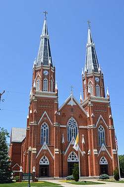
Immaculate Conception Catholic Church | |
| Motto: "One of Ohio's best-kept secrets!" | |
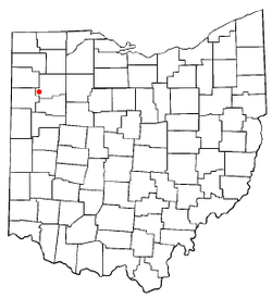 Location of Ottoville, Ohio | |
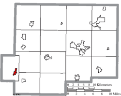 Location of Ottoville in Putnam County | |
| Coordinates: 40°55′54″N 84°20′16″W / 40.93167°N 84.33778°WCoordinates: 40°55′54″N 84°20′16″W / 40.93167°N 84.33778°W | |
| Country | United States |
| State | Ohio |
| County | Putnam |
| Government | |
| • Mayor | Ron Miller |
| Area[1] | |
| • Total | 0.81 sq mi (2.10 km2) |
| • Land | 0.80 sq mi (2.07 km2) |
| • Water | 0.01 sq mi (0.03 km2) |
| Elevation[2] | 738 ft (225 m) |
| Population (2010)[3] | |
| • Total | 976 |
| • Estimate (2012[4]) | 975 |
| • Density | 1,220.0/sq mi (471.0/km2) |
| Time zone | Eastern (EST) (UTC-5) |
| • Summer (DST) | EDT (UTC-4) |
| ZIP code | 45876 |
| Area code(s) | 419 |
| FIPS code | 39-59052[5] |
| GNIS feature ID | 1070885[2] |
| Website | http://www.villageofottoville.org/ |
Ottoville is a village in Putnam County, Ohio, in the United States. The population was 976 at the 2010 census.
History
The first plat at Ottoville was made in 1845 for John Otto Bredeick.[6] The effort at first proved unsuccessful, and the town site was platted again in 1873.[6] A post office called Otto was established in 1880, and the name was changed to Ottoville in 1881.[7] Ottoville was incorporated as a village in 1890.[8]
Geography
Ottoville is located at 40°55′54″N 84°20′16″W / 40.93167°N 84.33778°W (40.931676, -84.337723).[9]
According to the United States Census Bureau, the village has a total area of 0.81 square miles (2.10 km2), of which 0.80 square miles (2.07 km2) is land and 0.01 square miles (0.03 km2) is water.[1]
Demographics
| Historical population | |||
|---|---|---|---|
| Census | Pop. | %± | |
| 1900 | 369 | — | |
| 1910 | 477 | 29.3% | |
| 1920 | 435 | −8.8% | |
| 1930 | 443 | 1.8% | |
| 1940 | 467 | 5.4% | |
| 1950 | 543 | 16.3% | |
| 1960 | 793 | 46.0% | |
| 1970 | 914 | 15.3% | |
| 1980 | 833 | −8.9% | |
| 1990 | 842 | 1.1% | |
| 2000 | 873 | 3.7% | |
| 2010 | 976 | 11.8% | |
| Est. 2015 | 971 | [10] | −0.5% |
2010 census
As of the census[3] of 2010, there were 976 people, 392 households, and 279 families residing in the village. The population density was 1,220.0 inhabitants per square mile (471.0/km2). There were 411 housing units at an average density of 513.8 per square mile (198.4/km2). The racial makeup of the village was 97.5% White, 0.6% African American, 0.6% Asian, 0.9% from other races, and 0.3% from two or more races. Hispanic or Latino of any race were 1.7% of the population.
There were 392 households of which 33.7% had children under the age of 18 living with them, 60.7% were married couples living together, 6.9% had a female householder with no husband present, 3.6% had a male householder with no wife present, and 28.8% were non-families. 24.5% of all households were made up of individuals and 10.2% had someone living alone who was 65 years of age or older. The average household size was 2.49 and the average family size was 2.99.
The median age in the village was 38.7 years. 25.3% of residents were under the age of 18; 8.3% were between the ages of 18 and 24; 22.8% were from 25 to 44; 27.3% were from 45 to 64; and 16.2% were 65 years of age or older. The gender makeup of the village was 48.4% male and 51.6% female.
2000 census
As of the census[5] of 2000, there were 873 people, 348 households, and 244 families residing in the village. The population density was 1,252.2 people per square mile (481.5/km²). There were 360 housing units at an average density of 516.4 per square mile (198.6/km²). The racial makeup of the village was 99.08% White, 0.34% Asian, 0.11% from other races, and 0.46% from two or more races. Hispanic or Latino of any race were 0.46% of the population.
There were 348 households out of which 33.6% had children under the age of 18 living with them, 60.6% were married couples living together, 6.6% had a female householder with no husband present, and 29.6% were non-families. 28.2% of all households were made up of individuals and 14.4% had someone living alone who was 65 years of age or older. The average household size was 2.51 and the average family size was 3.09.
In the village the population was spread out with 28.4% under the age of 18, 6.6% from 18 to 24, 29.6% from 25 to 44, 19.7% from 45 to 64, and 15.7% who were 65 years of age or older. The median age was 37 years. For every 100 females there were 91.0 males. For every 100 females age 18 and over, there were 90.5 males.
The median income for a household in the village was $44,875, and the median income for a family was $55,104. Males had a median income of $37,589 versus $21,944 for females. The per capita income for the village was $19,909. About 2.5% of families and 2.1% of the population were below the poverty line, including 1.6% of those under age 18 and 7.1% of those age 65 or over.
References
- 1 2 "US Gazetteer files 2010". United States Census Bureau. Retrieved 2013-01-06.
- 1 2 "US Board on Geographic Names". United States Geological Survey. 2007-10-25. Retrieved 2008-01-31.
- 1 2 "American FactFinder". United States Census Bureau. Retrieved 2013-01-06.
- ↑ "Population Estimates". United States Census Bureau. Retrieved 2013-06-17.
- 1 2 "American FactFinder". United States Census Bureau. Retrieved 2008-01-31.
- 1 2 Kinder, George D. (1915). History of Putnam County, Ohio : its peoples, industries, and institutions. B.F. Bowen. p. 128.
- ↑ "Putnam County". Jim Forte Postal History. Retrieved 14 December 2015.
- ↑ Warren, Robert (May 31, 1953). "Blanchard River Brought Pioneers To Putnam". Toledo Blade. p. 3. Retrieved 30 April 2015.
- ↑ "US Gazetteer files: 2010, 2000, and 1990". United States Census Bureau. 2011-02-12. Retrieved 2011-04-23.
- ↑ "Annual Estimates of the Resident Population for Incorporated Places: April 1, 2010 to July 1, 2015". Retrieved July 2, 2016.
- ↑ "Census of Population and Housing". Census.gov. Retrieved June 4, 2015.
External links
Municipalities and communities of Putnam County, Ohio, United States | ||
|---|---|---|
| Villages | 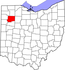 | |
| Townships | ||
| CDP | ||
| Unincorporated communities | ||
| Ghost towns | ||