Crucero, California
| Crucero | |
|---|---|
| Ghost town | |
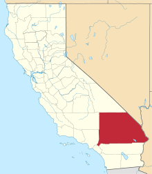
 Crucero Location within the state of California | |
| Coordinates: 35°02′50″N 116°09′56″W / 35.04722°N 116.16556°WCoordinates: 35°02′50″N 116°09′56″W / 35.04722°N 116.16556°W | |
| Country | United States |
| State | California |
| County | San Bernardino |
| Elevation[1] | 1,020 ft (311 m) |
| Time zone | Pacific (PST) (UTC-8) |
| • Summer (DST) | PDT (UTC-7) |
| ZIP codes | 92309 |
| Area codes | 442/760 |
| FIPS code | 06-38058 |
| GNIS feature ID | 252878 |
Crucero, California is a ghost town in San Bernardino County, California. It was located at the junction of the Union Pacific Railroad (originally the Los Angeles and Salt Lake Railroad) and the Tonopah and Tidewater Railroad. Originally named Epsom, it was renamed in 1910 for the Spanish word for crossing.[2] A post office existed at Crucero from 1911 to 1917 and from 1922 to 1943.[3] Following the abandonment of the T&T, the settlement was also abandoned.
References
- ↑ "Crucero". Geographic Names Information System. United States Geological Survey. Retrieved July 30, 2015.
- ↑ Gudde, Erwin (1960). California place names: the origin and etymology of current geographical names. Berkeley: University of California Press.
- ↑ Durham, David L. (1998). California's Geographic Names: A Gazetteer of Historic and Modern Names of the State. Clovis, Calif.: Word Dancer Press. p. 1410. ISBN 1-884995-14-4.
This article is issued from Wikipedia - version of the 9/27/2016. The text is available under the Creative Commons Attribution/Share Alike but additional terms may apply for the media files.