Mount Baldy, California
| Mt Baldy, California | |
|---|---|
| Unincorporated community | |
 Mt Baldy, California | |
| Coordinates: 34°14′10″N 117°39′36″W / 34.23611°N 117.66000°WCoordinates: 34°14′10″N 117°39′36″W / 34.23611°N 117.66000°W | |
| Country | United States |
| State | California |
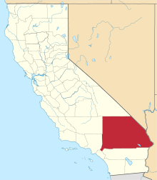
| County | San Bernardino |
| Elevation | 4,193 ft (1,278 m) |
| Time zone | Pacific (PST) (UTC-8) |
| • Summer (DST) | PDT (UTC-7) |
| ZIP code | 91759 |
| Area code(s) | 909 |
| GNIS feature ID | 1660300[1] |

Mount Baldy or Mt Baldy, formerly Camp Baynham and Camp Baldy, is an unincorporated community in the San Gabriel Mountains, in San Bernardino County near the eastern border of Los Angeles County, in southern California.
Geography
It is located below Mount San Antonio (Mt Baldy) in San Antonio Canyon. San Antonio Creek flows through the community. It is surrounded by Angeles National Forest. Mt Baldy is 12 miles (19 km) north of Ontario.
Buildings
Mt Baldy has a post office with ZIP code 91759.[2] The community was established as Camp Baynham in 1906; it changed its name to Camp Baldy in 1910 and became Mt Baldy in 1951. Its post office was established in 1913.[3]
The Mt Baldy School District operates the Mt Baldy School in town. The Mt Baldy Zen Center is located in the area.
The Mt Baldy Ski Lifts are above the town on the slopes of Mt Baldy.
Climate
Mt Baldy has relatively cold winters with mild snow. Temperatures often fall to 20 °F (−7 °C) at night. It is usually 35–45 °F (2–7 °C) during the day during the winter, and 20–25 °F at night. Annual snowfall is about 54 inches. Summer temperatures are mild to warm, and can get chilly at night. Daytime temperatures are 70–80 °F (21–27 °C), with lows of 45–55 °F (7–13 °C). Thunderstorms are not common, on occasion they brew in the mountains in and surrounding Mt Baldy. They usually occur in the afternoon, and clear up by late evening.
| Climate data for Mt. Baldy | |||||||||||||
|---|---|---|---|---|---|---|---|---|---|---|---|---|---|
| Month | Jan | Feb | Mar | Apr | May | Jun | Jul | Aug | Sep | Oct | Nov | Dec | Year |
| Average high °F (°C) | 39 (4) |
38 (3) |
38 (3) |
48 (9) |
58 (14) |
66 (19) |
76 (24) |
75 (24) |
68 (20) |
59 (15) |
47 (8) |
38 (3) |
54 (12) |
| Daily mean °F (°C) | 33 (1) |
32 (0) |
31 (−1) |
38 (3) |
47 (8) |
54 (12) |
64 (18) |
63 (17) |
56 (13) |
49 (9) |
38 (3) |
31 (−1) |
44.7 (6.8) |
| Average low °F (°C) | 26 (−3) |
25 (−4) |
23 (−5) |
28 (−2) |
36 (2) |
42 (6) |
52 (11) |
50 (10) |
44 (7) |
38 (3) |
29 (−2) |
24 (−4) |
35 (2) |
| Average precipitation inches (mm) | 4.20 (106.7) |
7.54 (191.5) |
3.08 (78.2) |
1.73 (43.9) |
1.00 (25.4) |
0.25 (6.4) |
0.10 (2.5) |
0.09 (2.3) |
0.01 (0.3) |
1.51 (38.4) |
3.41 (86.6) |
5.21 (132.3) |
40.83 (1,037.1) |
| Average snowfall inches (cm) | 15 (38) |
11 (28) |
8 (20) |
2 (5) |
0.2 (0.5) |
0.0 (0) |
0.0 (0) |
0.0 (0) |
0.0 (0) |
0.9 (2.3) |
3.3 (8.4) |
13.5 (34.3) |
41.9 (106.4) |
| Source: [4] | |||||||||||||
See also
- Winfred J. Sanborn, pioneer
- Angeles National Forest topics
- San Gabriel Mountains National Monument
References
- ↑ U.S. Geological Survey Geographic Names Information System: Mount Baldy, California
- ↑ ZIP Code Lookup
- ↑ Durham, David L. (1998). California's Geographic Names: A Gazetteer of Historic and Modern Names of the State. Quill Driver Books. p. 1447. ISBN 1-884995-14-4.
- ↑ "MOUNT BALDY NOTCH, CALIFORNIA (045901)". Intellicast. Retrieved 24 July 2012.
