Forest Falls, California
| Forest Falls, California | |
|---|---|
| Unincorporated community | |
 | |
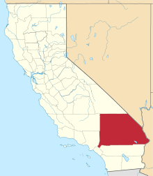
 Forest Falls, California Location within the state of California | |
| Coordinates: 34°05′18″N 116°55′13″W / 34.08833°N 116.92028°WCoordinates: 34°05′18″N 116°55′13″W / 34.08833°N 116.92028°W | |
| Country | United States |
| State | California |
| County | San Bernardino |
| Area | |
| • Total | 22.4 sq mi (58.1 km2) |
| Elevation[1] | 5,700 ft (1,700 m) |
| Population (2010)[2] | |
| • Total | 1,102 |
| • Density | 49/sq mi (19/km2) |
| Time zone | Pacific (PST) (UTC-8) |
| • Summer (DST) | PDT (UTC-7) |
| ZIP codes | 92339 |
| [3] | |
Forest Falls is an unincorporated community in San Bernardino County, California,[4] 75 miles (121 km) due east of Los Angeles. The community has a population of 1,102 and contains 712 houses.[5] Forest Falls is best known for the waterfalls on Vivian and Falls creeks and as a point of access for recreation in the San Bernardino National Forest, particularly the San Gorgonio Wilderness Area, which lies directly north of the community.
Geography
Forest Falls is situated in the San Bernardino Mountains of California, at elevations ranging from approximately 5,000 feet (1,500 m) to 6,000 feet (1,800 m) along the steep gradient of Mill Creek, a tributary of the Santa Ana River. It lies 75 miles (121 km) due east of the Los Angeles Civic Center, and 21 miles (34 km) from San Bernardino, the nearest large city and the county seat. The community stretches for approximately 5 miles (8.0 km) in a narrow band primarily along the south side of the linear canyon of Mill Creek, which trends slightly north of east. The highest portions of the San Bernardino Mountains, including southern California's highest point, San Gorgonio Mountain at 11,503 feet (3,506 m), lie directly north of Forest Falls in the San Gorgonio Wilderness Area. The falls for which the community is named descend from this high area over the northern edge of the canyon of Mill Creek.
Geology
The rocks immediately surrounding Forest Falls are basement rocks characteristic of the major part of the San Bernardino Mountains, that is, Paleoproterozoic gneiss, Neoproterozoic to Paleozoic marble and quartzite, and Late Cretaceous granitic rocks.[6][7] Marble and quartzite are present only in minor amounts in the immediate vicinity, although a small marble quarry up-canyon from the town was operated sporadically and uneconomically from 1908 into the 1940s.[8] The extremely linear canyon in which Forest Falls is located follows the trace of the Mill Creek Fault, a now-inactive strand of the San Andreas Fault system along which approximately 8 kilometres (5.0 mi) of right-lateral strike-slip displacement occurred during the period from 500,000 to 250,000 years ago. (Presently active strands of this fault system lie to the south.) [6][7] The canyon itself is the result of erosion by Mill Creek of the highly fractured rock along this linear fault zone. Because the San Bernardino Mountains are a young, steep and rapidly rising mountain range, erosion rates are extremely high and have been estimated to average as great as 1,560 millimetres (61 in) per 1,000 years in Mill Creek Canyon on hillside gradients as high as 36 degrees.[9]
Climate
Forest Falls, in common with the rest of California, enjoys a Mediterranean climate, receiving the majority of its precipitation during the winter months, frequently in the form of snow. Temperatures are temperate, reaching average highs in the 80's during the summer, and lows in the 20's during the winter. Precipitation is higher than in the adjacent valleys and averages more than 40 inches (1,000 mm) per year. Summer thunderstorms occasionally occur, particularly in the later part of the season. The amount of snow received during winter months largely depends on the area of Forest Falls under consideration, as the community extends over an elevation range of approximately 1,000 feet (300 m). Upper Canyon, as it is locally known, that is, the eastern higher-elevation end of the community, receives on average twice the amount of snow fall as Lower Canyon. Snowfall varies, but on occasion as much as six to seven feet has been recorded, the most on average however is around one to two feet sporadically throughout the winter.[10][11][12][13]
| Climate data for Forest Falls | |||||||||||||
|---|---|---|---|---|---|---|---|---|---|---|---|---|---|
| Month | Jan | Feb | Mar | Apr | May | Jun | Jul | Aug | Sep | Oct | Nov | Dec | Year |
| Record high °F (°C) | 69 (21) |
72 (22) |
77 (25) |
94 (34) |
93 (34) |
106 (41) |
100 (38) |
97 (36) |
98 (37) |
93 (34) |
78 (26) |
72 (22) |
106 (41) |
| Average high °F (°C) | 44 (7) |
47 (8) |
53 (12) |
60 (16) |
67 (19) |
76 (24) |
81 (27) |
81 (27) |
76 (24) |
64 (18) |
52 (11) |
45 (7) |
62.2 (16.7) |
| Average low °F (°C) | 29 (−2) |
30 (−1) |
32 (0) |
35 (2) |
41 (5) |
49 (9) |
55 (13) |
55 (13) |
50 (10) |
41 (5) |
34 (1) |
29 (−2) |
40 (4.4) |
| Record low °F (°C) | 6 (−14) |
5 (−15) |
11 (−12) |
17 (−8) |
25 (−4) |
30 (−1) |
40 (4) |
37 (3) |
30 (−1) |
18 (−8) |
10 (−12) |
6 (−14) |
5 (−15) |
| Average precipitation inches (mm) | 8.39 (213.1) |
8.99 (228.3) |
8.03 (204) |
2.53 (64.3) |
1.32 (33.5) |
.28 (7.1) |
.10 (2.5) |
.33 (8.4) |
1.07 (27.2) |
2.01 (51.1) |
3.45 (87.6) |
5.16 (131.1) |
41.66 (1,058.2) |
| Source: Weather Channel [14] | |||||||||||||
References
- ↑ U.S. Geological Survey Geographic Names Information System: Forest Falls, California. Retrieved on 2008-07-10.
- ↑ http://www.zip-codes.com/city/CA-FOREST-FALLS.asp
- ↑ "Forest Falls CA". ZIP Code Lookup. Retrieved 2008-07-10.
- ↑ http://california.hometownlocator.com/ca/san-bernardino/forest-falls.cfm All about Forest Falls on california hometownlocator
- ↑ http://www.uszip.com/zip/92339
- 1 2 Matti, J.C., Morton, D.M., and Cox, B.F. (1992). The San Andreas fault system in the vicinity of the central Transverse Ranges, southern California. U.S. Geological Survey Open-File Report 92-0354.
- 1 2 Matti, J.C., and Morton, D.M. (1993). Paleogeographic evolution of the San Andreas fault system in southern California: A reconstruction based on new cross-fault correlation in Powell, R.E., Weldon, R.E., II, and Matti, J.C., eds, The San Andreas fault system: Displacement, palinspastic reconstruction, and geological evolution: Geological Society of America Memoir 178.
- ↑ Robinson, John W. (1989). The San Bernardinos: the Mountain Country from Cajon Pass to Oak Glen, Two Centuries of Changing Use. Arcadia, CA: Big Santa Anita Historical Society.
- ↑ Binnie, Steven A., Phillips, William M., Summerfield, Michael A., and Fifield, L. Kevin (2007). Tectonic uplift, threshold hillslopes, and denudation rates in a developing mountain range. Geology, v. 35, no. 8, pp. 743-746.
- ↑ http://www.rssweather.com/wx/us/ca/forest%20falls/wx.php Weather Forecast for Forest Falls, California.
- ↑ http://www.wunderground.com/US/CA/Forest_Falls.html
- ↑ http://www.weatherforyou.com/weather/california/forest+falls.html
- ↑ http://weather.yahoo.com/united-states/california/forest-falls-2405075/ the weather for Forest Falls on yahoo
- ↑ Average weather for Forest Falls Weather Channel'.' Retrieved 2008-03-29.